Route Planner delivers a powerful, intuitive mapping experience designed for professionals, outdoor adventurers, and map enthusiasts. View maps in multiple styles, overlay MGRS grids, and explore with precision - all in a sleek, native app experience.
Whether you're navigating the backcountry, planning a mission, or analyzing spatial data, Route Planner gives you the tools you need right at your fingertips.
CORE FEATURES (Free):
- Live Location Data: See your coordinates, address, heading, speed, altitude, and more, clearly displayed in real time.
- Multiple Map Types: Choose the map that fits your mission.
- MGRS Grid Overlay: Toggle the Military Grid Reference System (MGRS) grid on or off with ease.
- Custom Pins & Navigation: Drop different types of pins and navigate directly to them.
- Altitude: Set pin altitude automatically or manually.
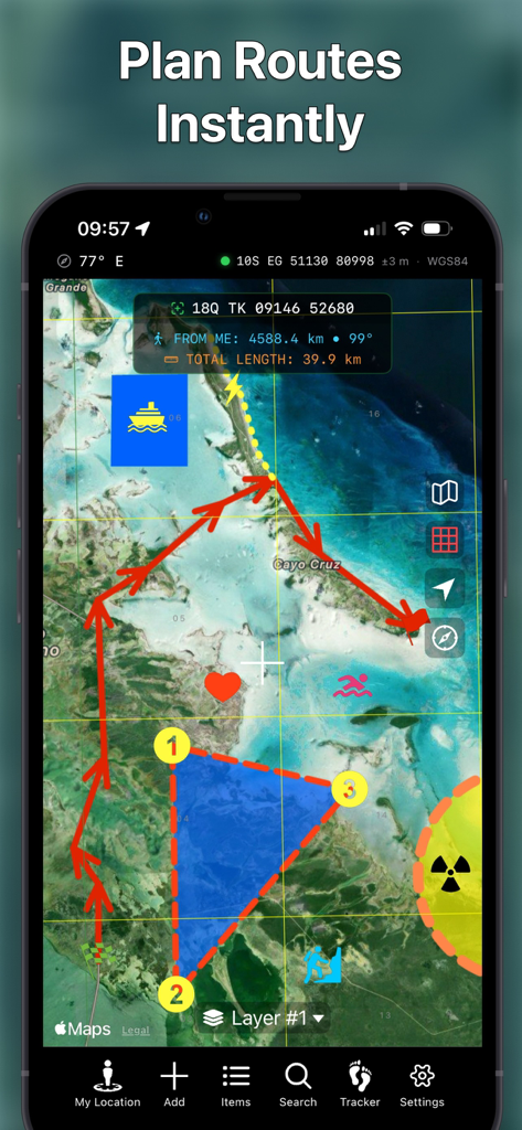
- Draw & Design: Add polylines (routes), polygons, and shapes.
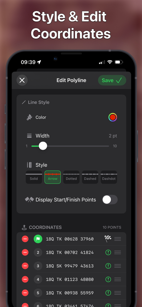
- Add/Edit Items via Form: Easily create or modify pins, shapes, and routes using a structured input form.
- Custom Pin and Overlay Styling: Customize colors, stroke widths, and dash patterns for pins, lines, shapes, and areas on your map.
- Layer Items List: View your layers in a clear, organized list.
- Search: Search by MGRS, UTM, Latitude/Longitude.
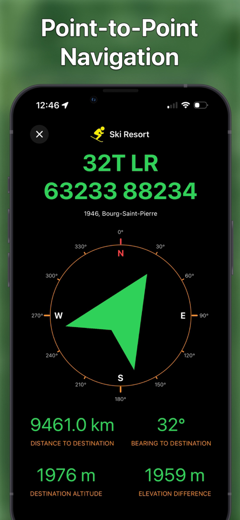
- Coordinate Projection: Move the map cursor based on a bearing and distance from your location or the map center.
- Flexible Data Formats: Customize your units for coordinates, distance, angles, altitude, and speed.
- File Import Support: Import map data from KML, GeoJSON, and GPX files with ease.
Note: free app version supports only limited number of pins and overlays.
PREMIUM FEATURES (Available via in-app purchase):
- Unlimited pins and polylines (routes).
- Car & Walking Directions: Get turn-by-turn navigation for both driving and walking routes.
- Hiking, Cycling & Ski Trails: Discover and explore nearby hiking, cycling and ski trails with detailed route and elevation data.
- Weather Forecast: View a 10-day forecast for any pinned location.
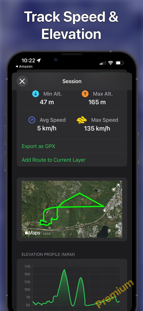
- Route Elevation Profile: View detailed elevation changes along your route, including ascents and descents.
- Peak Names and Altitudes: Identify surrounding peaks with their names and elevation clearly labeled.
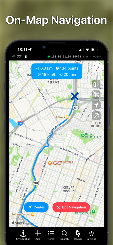
- Route Navigation: Navigate along your custom-drawn paths with real-time turn-by-turn guidance.
- Search by Address/Location: Quickly find places using standard addresses or points of interest.
- Tracker: Record your route, view it on the map along with its elevation profile (graph), and export it as a GPX file.
- Multiple Layers: Organize your data by adding multiple map layers for better structure and visibility.
- Layer Export & Import: Export or import your annotations, drawings, and overlays — or share them with others.
- Offline Map Caching: Save OpenStreetMap map locally to use them without an internet connection — perfect for remote areas.
- Additional Maps (OpenStreetMap & OpenTopoMap): Access detailed terrain and topographic map sources with full offline support for exploration anywhere.
Whether you're using it for tactical operations, field research, or hiking adventures, Route Planner is your go-to navigation companion.
More features coming soon – stay tuned!
If you have any questions, suggestions, or bug reports, do not hesitate to contact me at blayasoft@gmail.com.