このページはアプリまたはその開発者の公式ページではなく、情報提供および論評を目的として作成された独立した編集出版物です。明示的に別段の記載がない限り、アプリおよびその開発者は、MWM、Apple、Google Play、アプリのパブリッシャー、またはアプリの開発者と提携、承認、後援、認可、またはその他の公式的な関係はなく、このページのいかなる内容も、アプリがMWMのサービスを使用して開発されたことを意味するものではありません。すべての商標、ロゴ、スクリーンショット、その他のコンテンツはそれぞれの所有者の財産です。

ダウンロード
62K+ユーザー評価
評価数
1K+開発元
カテゴリ
Weather対応言語
2最新バージョン
3.9.8サイズ
76.7 MBリリース日
2017年6月28日計画から接地まで、フライトを完璧に。
No.1のパイロットコミュニティに参加して、3Dアプローチを可視化し、直感的な気象インサイトを入手し、次の「100ドルのハンバーガー」の目的地を見つけましょう。
3Dアプローチプレビュー
初めての空港への不安を、3Dでの仮想着陸で解消しましょう。距離とグライドパスを設定し、離陸前にあらゆるアプローチをマスターできます。
視覚的な航空気象
テキストの解読はやめて、空を視覚的に捉えましょう。視覚的なMETAR、FL150までの上空風、そして最適な滑走路選択のための計算された横風成分を入手できます。
以下のスクリーンショットと説明は、アプリの公式ストアリスティングから直接取得されたものであり、アプリ開発者の所有物です。
アプリストア
スクリーンショット
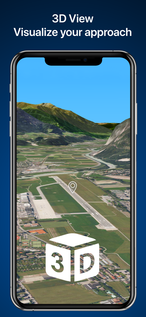
スマートフォンの画面に表示された空港滑走路の3Dアプローチ可視化
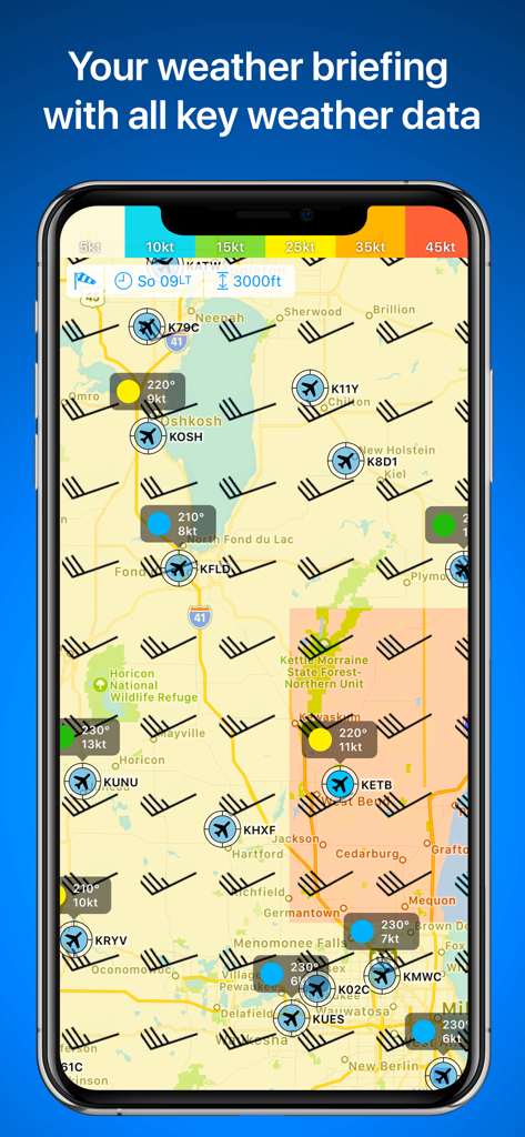
風向・風速記号と空港の飛行状態を表示するRunwayMapの航空気象マップ
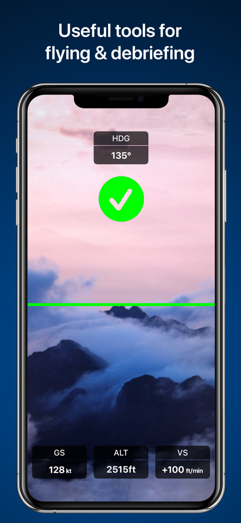
高度と速度データのオーバーレイを表示するRunwayMapのフライトツール画面

空港レストランの評価とパイロットのレビューを表示するRunwayMapアプリのインターフェース

空港にある軽飛行機を投稿したパイロットの、RunwayMapアプリ内のユーザープロフィールとソーシャルフィード
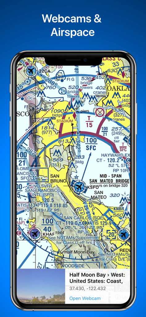
空域の詳細を含む航空用区分航空図とハーフムーンベイのライブ空港ウェブカメラプレビューを表示するRunwayMapアプリ
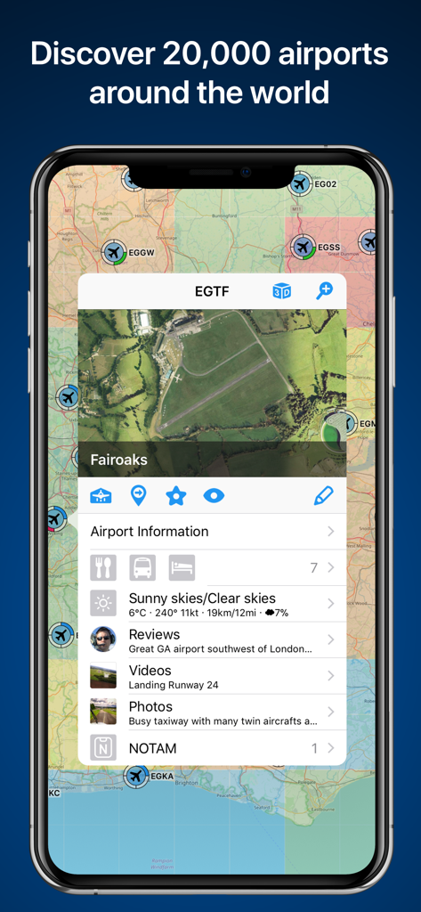
フェアオークス空港の詳細情報を伴う空港マップを表示するRunwayMapアプリ画面
説明
Download
類似アプリ
同じカテゴリのトップランクアプリ

墨迹天气-MojiWeather
Beijing MojiFengyun Technology Co.,Ltd.

The Weather Channel - Radar
The Weather Channel

Windy.com
Windyty, SE

天气预报-精准15日天气预报
Chongqing Caochen Technology Co., Ltd.

My Aurora Forecast & Alerts
JRustonApps B.V.

AccuWeather: Weather Forecast
AccuWeather International, Inc.

Weather & Radar - Storm radar
WetterOnline - Meteorologische Dienstleistungen GmbH

天气通
Weibo Internet Technology (China) Co.Ltd.

The Thermometer -Digital-
Vida Apps Incorporated
このページはアプリまたはその開発者の公式ページではなく、情報提供および論評を目的として作成された独立した編集出版物です。明示的に別段の記載がない限り、アプリおよびその開発者は、MWM、Apple、Google Play、アプリのパブリッシャー、またはアプリの開発者と提携、承認、後援、認可、またはその他の公式的な関係はなく、このページのいかなる内容も、アプリがMWMのサービスを使用して開発されたことを意味するものではありません。すべての商標、ロゴ、スクリーンショット、その他のコンテンツはそれぞれの所有者の財産です。