このページはアプリまたはその開発者の公式ページではなく、情報提供および論評を目的として作成された独立した編集出版物です。明示的に別段の記載がない限り、アプリおよびその開発者は、MWM、Apple、Google Play、アプリのパブリッシャー、またはアプリの開発者と提携、承認、後援、認可、またはその他の公式的な関係はなく、このページのいかなる内容も、アプリがMWMのサービスを使用して開発されたことを意味するものではありません。すべての商標、ロゴ、スクリーンショット、その他のコンテンツはそれぞれの所有者の財産です。
ダウンロード
25k+ユーザー評価
評価数
9開発元
カテゴリ
Navigation対応言語
1最新バージョン
1.0.2サイズ
85.9 MBリリース日
2026年1月30日地理分析と仮想探索のための包括的な評価
「三维山水全景地图」主要機能分析
リアルタイム3D地形表示と操作
ユーザーは、指先のスワイプ、回転、ズーム操作を通じて、直感的かつリアルタイムに3D視点で地形を観察できます。これにより、山脈の傾向、水系の分布、斜面や標高差を容易に把握することが可能です。
詳細な地理要素分析
この機能により、ユーザーは山脈の形成、水路のパターン、地形の勾配、および標高の変化といった詳細な地理的特徴を精密に分析できます。これにより、地形学、環境研究、都市計画など多岐にわたる分野での深い洞察が可能となります。
広範囲にわたる地理データの提供
膨大な量の地理データが利用可能であり、広範な地域に関する情報を提供します。これにより、ユーザーは教育、研究、計画、仮想探索など、さまざまな目的で詳細かつ包括的な地理データにアクセスできます。
多様な地図データソースの統合
複数の地図データソースが統合されており、ユーザーは異なる視点や詳細レベルで地理情報を参照できます。これにより、特定の分析ニーズに応じた柔軟なデータアクセスが実現します。
以下のスクリーンショットと説明は、アプリの公式ストアリスティングから直接取得されたものであり、アプリ開発者の所有物です。
アプリストア
スクリーンショット
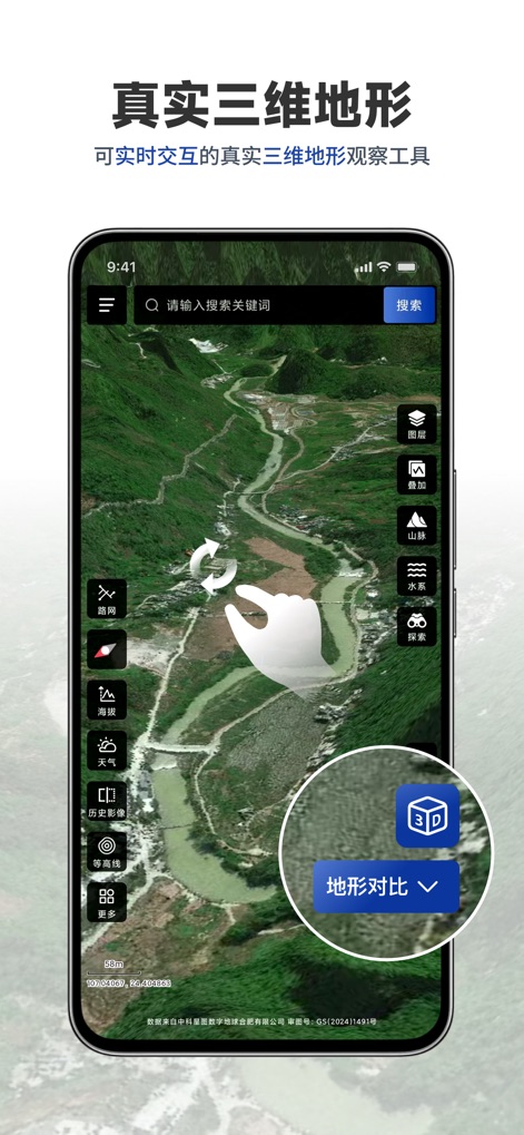
このアプリは、指先で操作するだけで、リアルタイムで**三次元の地形**を直感的に観察できます。また、**地形比較機能**により、山脈の連なりや水系の詳細な分布を簡単に把握することが可能です。
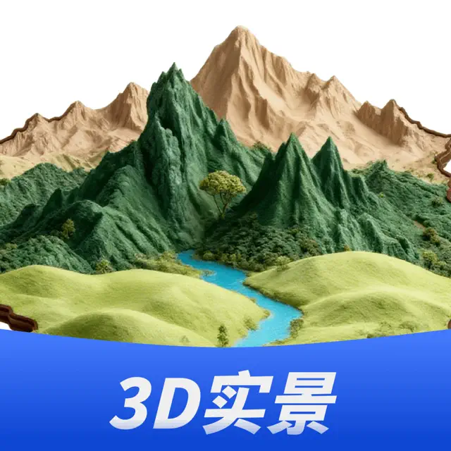
リアルな3D地形
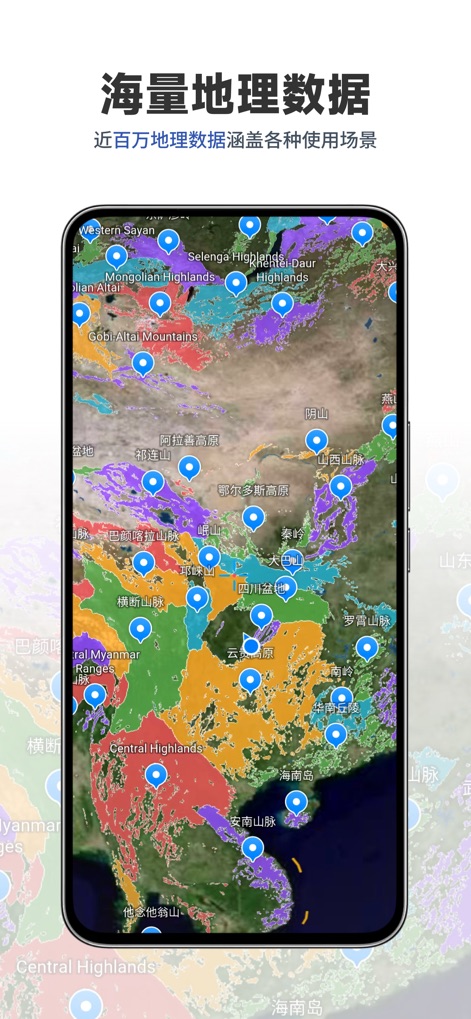
本ツールは、**近百万にも及ぶ膨大な地理データ**を搭載しており、多様な利用シーンに対応します。ユーザーは、**世界の主要な山脈や高原の分布**を一覧で確認し、詳細な地理情報を手軽に活用できます。
広大な地理データ
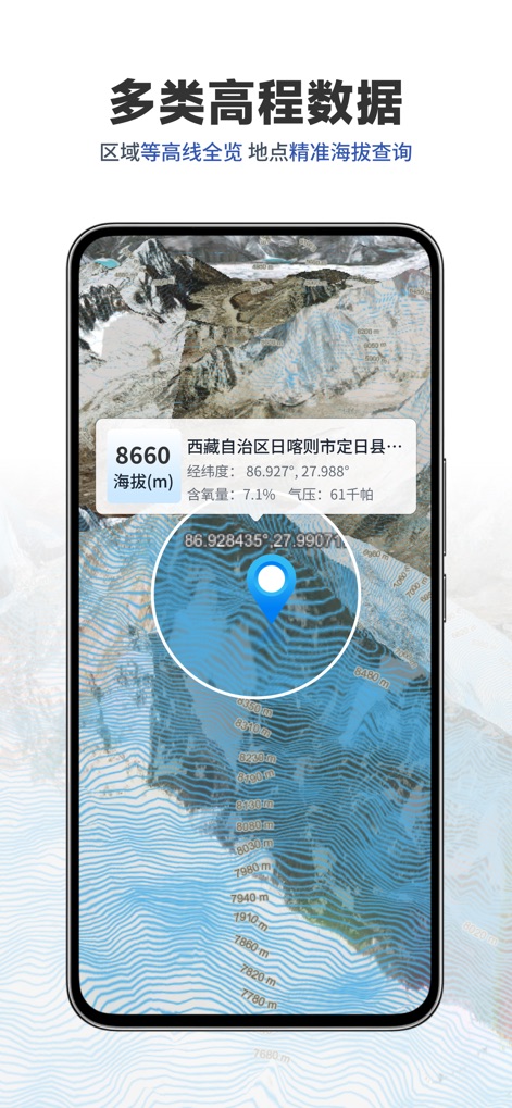
このアプリでは、特定の地点の**正確な標高情報**を瞬時に取得でき、**詳細な等高線**によって地形の全体像を把握できます。これにより、ユーザーは地理的特性を精密に分析することが可能です。
精密な標高分析
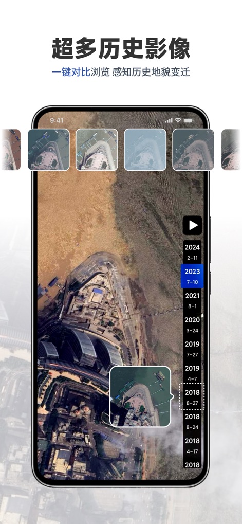
この機能を使うと、ユーザーは**豊富な年代の衛星画像**を時系列で比較し、**過去から現在への地形の変化**を視覚的に追跡できます。これにより、環境の変遷を深く理解することが可能です。
歴史的変遷を追跡
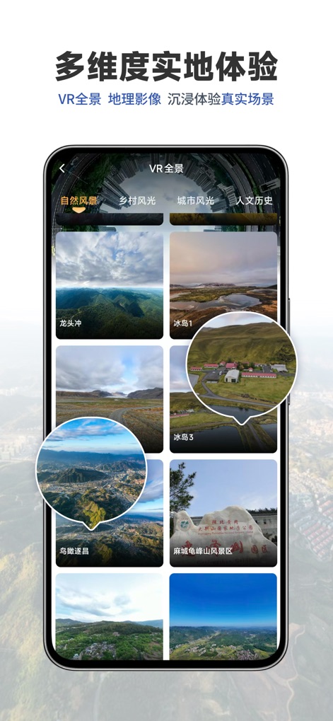
このアプリは、**VRパノラマビュー**を通じて、世界中の**多様な自然風景や都市の情景**を没入感あふれる形で体験できます。ユーザーは、自宅にいながらにして現地の雰囲気を味わうことが可能です。
没入型VR体験
説明
Download
類似アプリ
同じカテゴリのトップランクアプリ

Google Maps
Google LLC

AMap Global
AutoNavi Information Technology Co. Ltd.

Waze Navigation & Live Traffic
waze

百度地图-路线规划,出行必备
Beijing Baidu Netcom Science & Technology Co.,Ltd

Moovit: Bus & Transit Tracker
Moovit App Global LTD

Transit • Subway & Bus Times
9280-0366 Quebec inc.

ParkMobile: Park. Pay. Go.
Parkmobile USA, Inc

腾讯地图-路线规划,导航地铁打车出行
Shenzhen Tencent Computer Systems Company Limited

MapXplorer: Map Radar Navigate
GOLDLAB APPLICATIONS YAZILIM VE BILISIM ANONIM SIRKETI
このページはアプリまたはその開発者の公式ページではなく、情報提供および論評を目的として作成された独立した編集出版物です。明示的に別段の記載がない限り、アプリおよびその開発者は、MWM、Apple、Google Play、アプリのパブリッシャー、またはアプリの開発者と提携、承認、後援、認可、またはその他の公式的な関係はなく、このページのいかなる内容も、アプリがMWMのサービスを使用して開発されたことを意味するものではありません。すべての商標、ロゴ、スクリーンショット、その他のコンテンツはそれぞれの所有者の財産です。