このページはアプリまたはその開発者の公式ページではなく、情報提供および論評を目的として作成された独立した編集出版物です。明示的に別段の記載がない限り、アプリおよびその開発者は、MWM、Apple、Google Play、アプリのパブリッシャー、またはアプリの開発者と提携、承認、後援、認可、またはその他の公式的な関係はなく、このページのいかなる内容も、アプリがMWMのサービスを使用して開発されたことを意味するものではありません。すべての商標、ロゴ、スクリーンショット、その他のコンテンツはそれぞれの所有者の財産です。

Ship Tracker - Marine Radar
ライブ船舶位置を監視し、航路を分析し、詳細な船舶データにプログレードのレーダービジュアルでアクセスしましょう。世界中どこでも、オフラインでも利用可能です。
ダウンロード
400ユーザー評価
評価数
0開発元
カテゴリ
Travel対応言語
19最新バージョン
1.0サイズ
103.7 MBリリース日
2025年8月13日プログレードの追跡機能で海をマスターしよう
ライブAISデータと高度なレーダービジュアルで、iOSデバイスを強力な海事コマンドセンターに変えましょう。海上のあらゆる船舶に対応します。
リアルタイムグローバルAIS追跡
ライブアップデートと高コントラストのレーダービジュアルで世界中の何千もの船舶を監視し、あらゆる港や航路で比類のない状況認識を実現します。
オフライン海図情報
キャッシュされた海図と衛星ビューを使用して、セルラー信号が届かない場所でも重要なデータを提供し、自信を持って航海しましょう。
以下のスクリーンショットと説明は、アプリの公式ストアリスティングから直接取得されたものであり、アプリ開発者の所有物です。
アプリストア
スクリーンショット
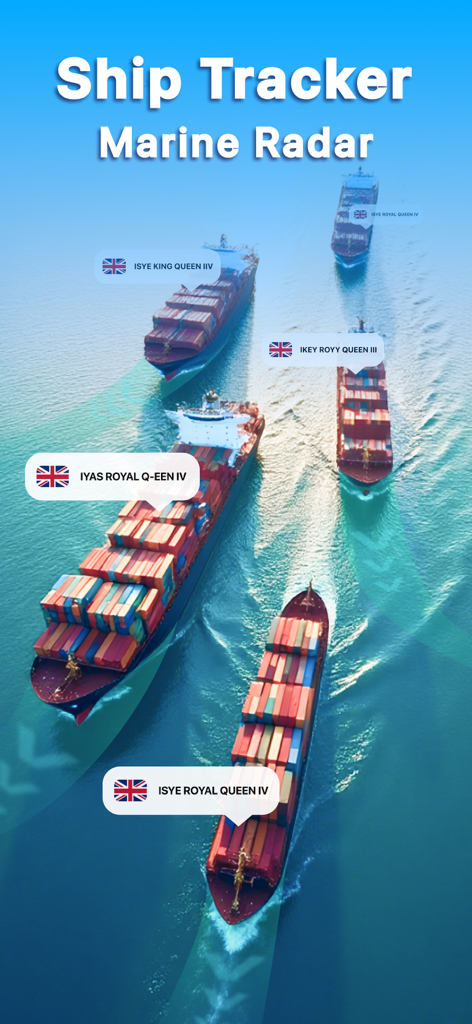
ライブ追跡ラベルと船舶レーダービジュアルを備えたコンテナ船の航空写真
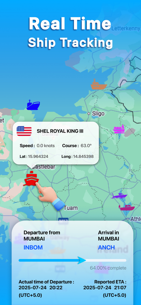
船舶の詳細と航海進捗状況を示す地図上のリアルタイム船舶追跡を示すモバイルアプリ画面
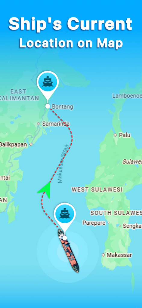
Ship Trackerアプリが地図上にライブ船舶位置とナビゲーションパスを示す
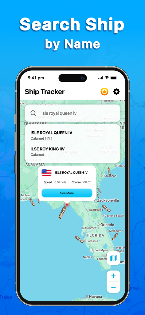
Ship Trackerアプリインターフェースが海図上で船舶名による船舶検索を示す
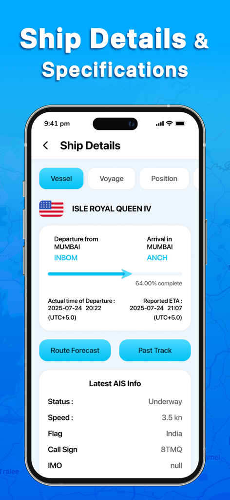
船舶の仕様、航海進捗状況、船舶のリアルタイムAISデータを示すモバイルアプリ画面
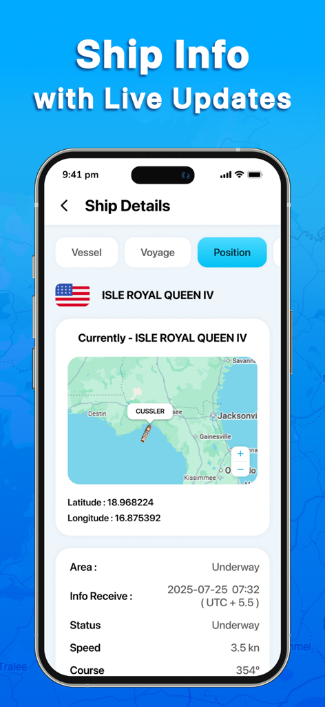
地図上のライブ船舶位置の詳細とナビゲーションデータを示すモバイル画面
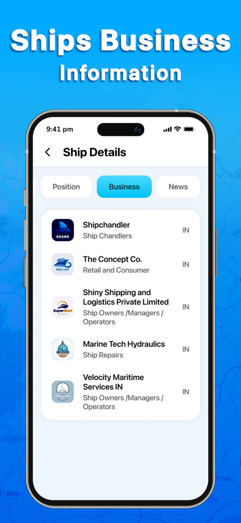
Ship Trackerアプリの事業情報画面に、海事サービスプロバイダーと所有者がリストされている
説明
Download
類似アプリ
同じカテゴリのトップランクアプリ

Uber - Request a ride
Uber Technologies, Inc.

Airbnb
Airbnb, Inc.

铁路12306
ACADEMY OF RAILWAY SCIENCES CO., ltd.

Booking.com: Hotels & Travel
Booking.com B.V.

Grab: Taxi Ride, Food Delivery
GRABTAXI HOLDINGS PTE. LTD.

Trip.com: Book Flights, Hotels
Trip.com Travel Singapore Pte. Ltd.

DiDi China: Ride Hailing
Didi Chuxing (Beijing) Network Platform Technology Co., Ltd

去哪儿旅行-订酒店机票火车票
Beijing Qunar Information Technology Company Limit

Bolt: Request a Ride
BOLT TECHNOLOGY OU
このページはアプリまたはその開発者の公式ページではなく、情報提供および論評を目的として作成された独立した編集出版物です。明示的に別段の記載がない限り、アプリおよびその開発者は、MWM、Apple、Google Play、アプリのパブリッシャー、またはアプリの開発者と提携、承認、後援、認可、またはその他の公式的な関係はなく、このページのいかなる内容も、アプリがMWMのサービスを使用して開発されたことを意味するものではありません。すべての商標、ロゴ、スクリーンショット、その他のコンテンツはそれぞれの所有者の財産です。