このページはアプリまたはその開発者の公式ページではなく、情報提供および論評を目的として作成された独立した編集出版物です。明示的に別段の記載がない限り、アプリおよびその開発者は、MWM、Apple、Google Play、アプリのパブリッシャー、またはアプリの開発者と提携、承認、後援、認可、またはその他の公式的な関係はなく、このページのいかなる内容も、アプリがMWMのサービスを使用して開発されたことを意味するものではありません。すべての商標、ロゴ、スクリーンショット、その他のコンテンツはそれぞれの所有者の財産です。

ダウンロード
368K+ユーザー評価
評価数
500開発元
カテゴリ
Photo & Video対応言語
11最新バージョン
3.5.5サイズ
27.6 MBリリース日
2019年5月8日指先でできる精密な太陽光計画
完璧な光のコントロールのために設計された高精度ARビジュアライゼーションと影のシミュレーションで、プロフェッショナルなプロジェクトやアウトドアの趣味を強化しましょう。
拡張現実(AR)軌道
カメラビューに重ねて表示される太陽の正確な軌道を可視化し、推測なしにいつでも太陽光がどこに当たるかを確認できます。
3D影シミュレーター
地図上に仮想の木や建物を配置し、1年を通して影がどのように変化するかを正確に予測できます。
以下のスクリーンショットと説明は、アプリの公式ストアリスティングから直接取得されたものであり、アプリ開発者の所有物です。
アプリストア
スクリーンショット
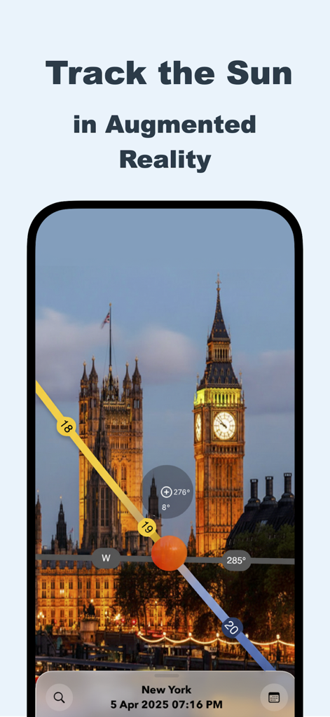
Sun Tracker ARでビッグ・ベンに重なる太陽軌道の拡張現実(AR)ビュー
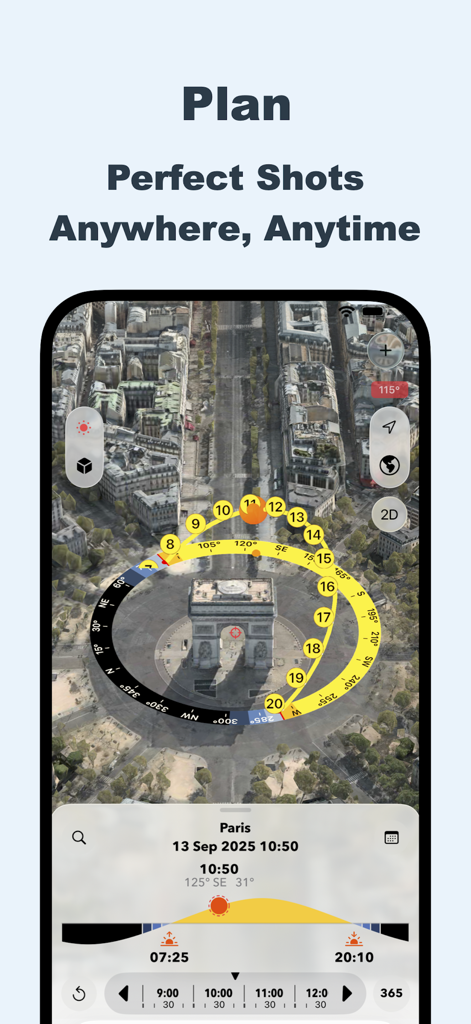
写真計画のため、都市地図上の3D太陽軌道ビジュアライゼーションを示すSun Tracker ARアプリのインターフェース
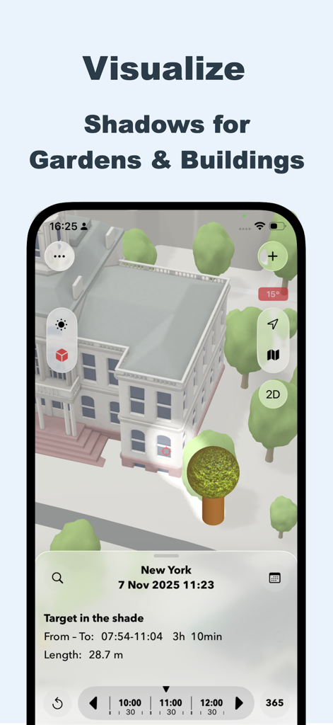
Sun Tracker ARアプリのインターフェースにおける建物や庭の3D影シミュレーション
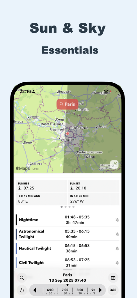
パリの太陽軌道マップと詳細な薄明時刻表を表示するSun Tracker ARアプリのインターフェース
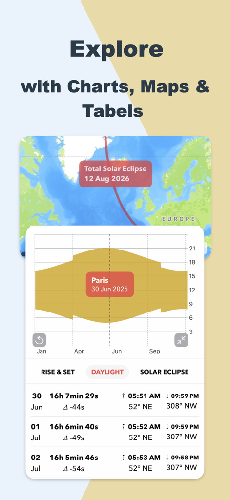
日食マップ、日の出日の入りチャート、日の出日の入りデータテーブルを表示するSun Tracker ARモバイルアプリのインターフェース

日食や日の出通知などの太陽イベントのカレンダー連携を示すSun Tracker ARのインターフェース
説明
Download
類似アプリ
似た機能とユーザー体験を持つアプリ

Moon Phases and Lunar Calendar
Business City s.r.o.

My Moon Phase - Lunar Calendar
JRustonApps B.V.

The Moon: Calendar Moon Phases
Vitalii Gryniuk

Moonlitt: Moon Phase Tracker
Flipping Hues Srls

Sunrise Sunset Times
Fascinating Projects Pty Ltd

PhotoPills
PhotoPills S.L.

AuroraReach
HuskyCodes Oy

Sun Seeker - Sunlight Tracker
Ajnaware Pty Ltd

Sundial Solar & Lunar Time
Tier 9 Digital LLC
このページはアプリまたはその開発者の公式ページではなく、情報提供および論評を目的として作成された独立した編集出版物です。明示的に別段の記載がない限り、アプリおよびその開発者は、MWM、Apple、Google Play、アプリのパブリッシャー、またはアプリの開発者と提携、承認、後援、認可、またはその他の公式的な関係はなく、このページのいかなる内容も、アプリがMWMのサービスを使用して開発されたことを意味するものではありません。すべての商標、ロゴ、スクリーンショット、その他のコンテンツはそれぞれの所有者の財産です。