このページはアプリまたはその開発者の公式ページではなく、情報提供および論評を目的として作成された独立した編集出版物です。明示的に別段の記載がない限り、アプリおよびその開発者は、MWM、Apple、Google Play、アプリのパブリッシャー、またはアプリの開発者と提携、承認、後援、認可、またはその他の公式的な関係はなく、このページのいかなる内容も、アプリがMWMのサービスを使用して開発されたことを意味するものではありません。すべての商標、ロゴ、スクリーンショット、その他のコンテンツはそれぞれの所有者の財産です。

The Athenian Long Walls
iPhoneまたはiPadを洗練されたフィールドガイドに変えましょう。ペリクレスと黄金時代の隠された遺産を、厳選された考古学の旅を通じて生き生きとさせる、没入型の地図ベースのストーリーテリングを体験してください。
ダウンロード
0ユーザー評価
評価数
0開発元
カテゴリ
Travel対応言語
1最新バージョン
1.0.4サイズ
44.0 MBリリース日
2025年4月28日帝国の隠された生命線を発見する
デバイスを洗練されたフィールドガイドに変え、アテネの黄金時代を形作った巨大な古代の城壁を視覚化しましょう。
インタラクティブな遺跡発見
地図ベースのストーリーテリングを使用して、アテネとピレウスの現代の通りの下に隠された考古学的な遺跡を見つけ、視覚化してください。
厳選された物語の旅
ペリクレスとテミストクレスの足跡をたどり、都市の台頭の背後にある軍事戦略を説明する没入型の章を体験してください。
以下のスクリーンショットと説明は、アプリの公式ストアリスティングから直接取得されたものであり、アプリ開発者の所有物です。
アプリストア
スクリーンショット
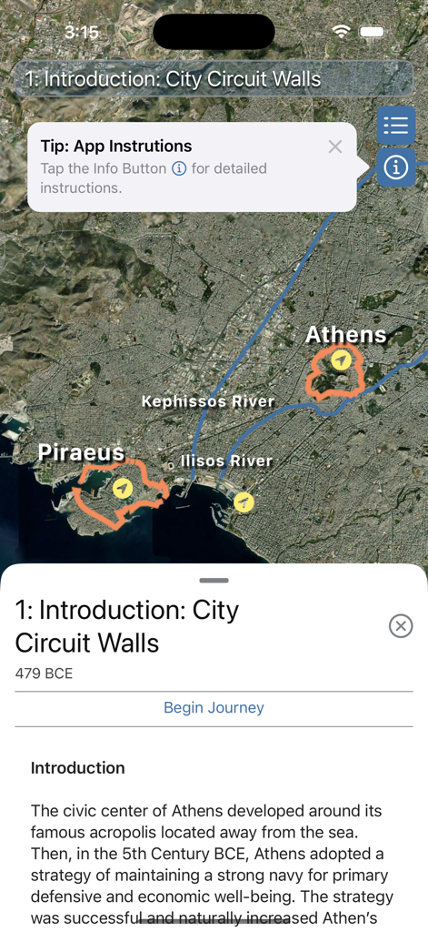
アテネの長壁アプリで、アテネとピレウスを結ぶ歴史的な城壁を示す衛星地図。
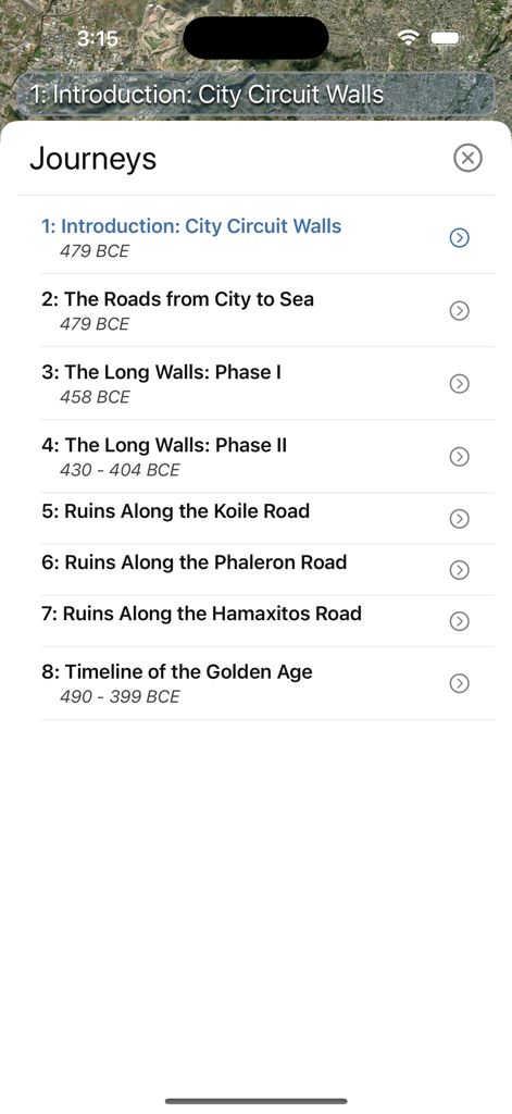
都市周回路や黄金時代のタイムラインなど、歴史的な旅のリストを表示するモバイルアプリの画面。
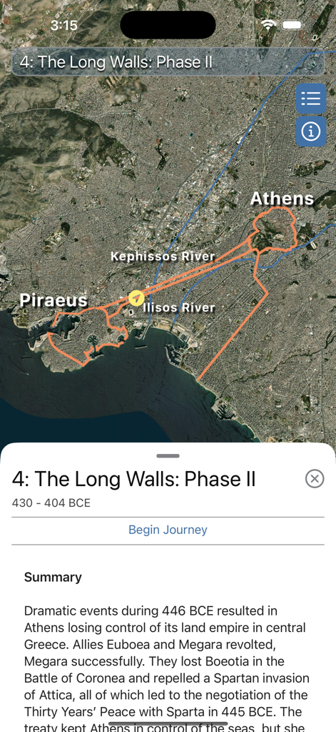
アテネの長壁アプリで、アテネとピレウスの歴史的な城壁の経路を示す衛星地図。
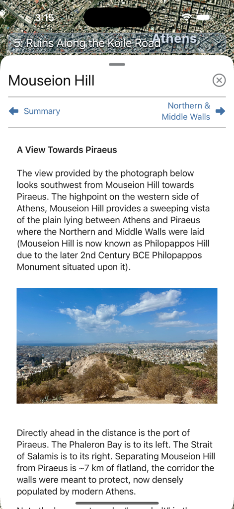
アテネの長壁モバイル旅行ガイド内のマウスイオンの丘からのピレウスのパノラマビュー。
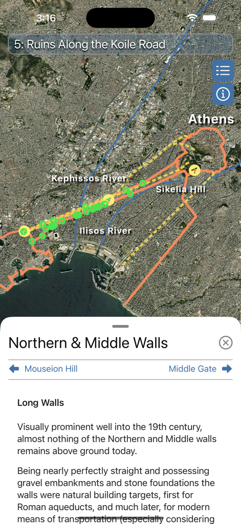
古代の長壁の経路と歴史的なランドマークのオーバーレイを示す、アテネの衛星地図ビュー。
説明
Download
類似アプリ
同じカテゴリのトップランクアプリ

Uber - Request a ride
Uber Technologies, Inc.

Airbnb
Airbnb, Inc.

铁路12306
ACADEMY OF RAILWAY SCIENCES CO., ltd.

Booking.com: Hotels & Travel
Booking.com B.V.

Grab: Taxi Ride, Food Delivery
GRABTAXI HOLDINGS PTE. LTD.

DiDi China: Ride Hailing
Didi Chuxing (Beijing) Network Platform Technology Co., Ltd

Bolt: Request a Ride
BOLT TECHNOLOGY OU

Trip.com: Book Flights, Hotels
Trip.com Travel Singapore Pte. Ltd.

去哪儿旅行-订酒店机票火车票
Beijing Qunar Information Technology Company Limit
このページはアプリまたはその開発者の公式ページではなく、情報提供および論評を目的として作成された独立した編集出版物です。明示的に別段の記載がない限り、アプリおよびその開発者は、MWM、Apple、Google Play、アプリのパブリッシャー、またはアプリの開発者と提携、承認、後援、認可、またはその他の公式的な関係はなく、このページのいかなる内容も、アプリがMWMのサービスを使用して開発されたことを意味するものではありません。すべての商標、ロゴ、スクリーンショット、その他のコンテンツはそれぞれの所有者の財産です。