このページはアプリまたはその開発者の公式ページではなく、情報提供および論評を目的として作成された独立した編集出版物です。明示的に別段の記載がない限り、アプリおよびその開発者は、MWM、Apple、Google Play、アプリのパブリッシャー、またはアプリの開発者と提携、承認、後援、認可、またはその他の公式的な関係はなく、このページのいかなる内容も、アプリがMWMのサービスを使用して開発されたことを意味するものではありません。すべての商標、ロゴ、スクリーンショット、その他のコンテンツはそれぞれの所有者の財産です。

Tracks4Africa Guide
アフリカの最も人里離れた風景を自信を持ってナビゲートしましょう。綿密で自立した冒険家のために設計された、実地調査済みのオフラインマップ、プログレードのPOI、専門家の旅行データにアクセスできます。
ダウンロード
92K+ユーザー評価
評価数
200開発元
カテゴリ
Reference対応言語
1最新バージョン
2.4.8サイズ
297.0 MBリリース日
2015年3月26日荒野を自信を持ってナビゲート
セルフドライブサファリに最適なプログレードのコンパニオン。現代のオーバーランダーのために、精密なオフラインマップと専門家が検証したデータを提供します。
完全なオフライン独立性
携帯電波を気にすることなく、アフリカの最も遠い場所を探索できます。すべてのマップとデータはローカルに保存されるため、100%オフラインで信頼できます。
実地調査による正確さ
標準的なナビゲーションを超えましょう。最大限の安全のために、実際の旅行者によって綿密にマッピングされ、検証された頑丈なトラックと裏道にアクセスできます。
以下のスクリーンショットと説明は、アプリの公式ストアリスティングから直接取得されたものであり、アプリ開発者の所有物です。
アプリストア
スクリーンショット
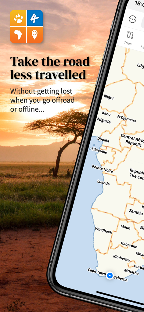
Tracks4Africa Guideアプリに、アフリカのオフラインマップと景色の良い夕焼けの風景が表示されています
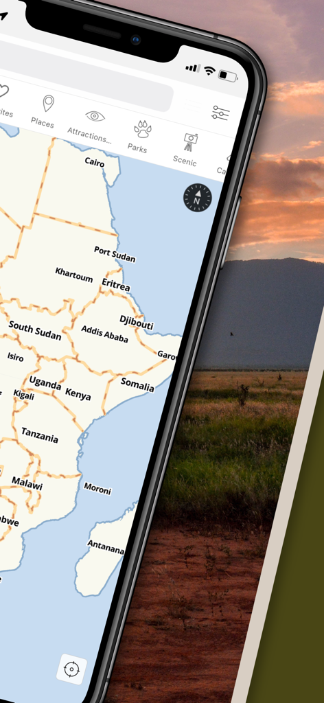
Tracks4Africa Guideアプリがアフリカのオフラインマップと旅行カテゴリを表示しているスマートフォンの画面
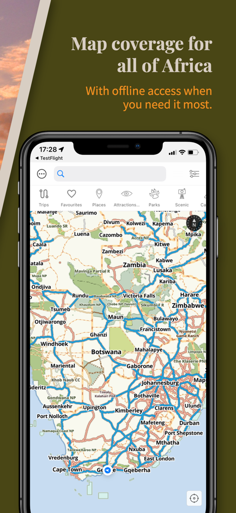
Tracks4Africa Guideアプリに、南アフリカの詳細なオフラインマップが表示されています
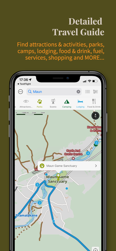
Tracks4Africa Guideアプリのインターフェースに、アフリカのオーバーランディングのためのPOIの詳細な旅行マップが表示されています
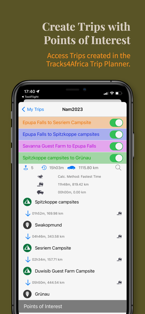
Tracks4Africa Guideアプリのスクリーンショット。サファリ旅行の旅行時間と距離を含む詳細な旅行旅程が表示されています
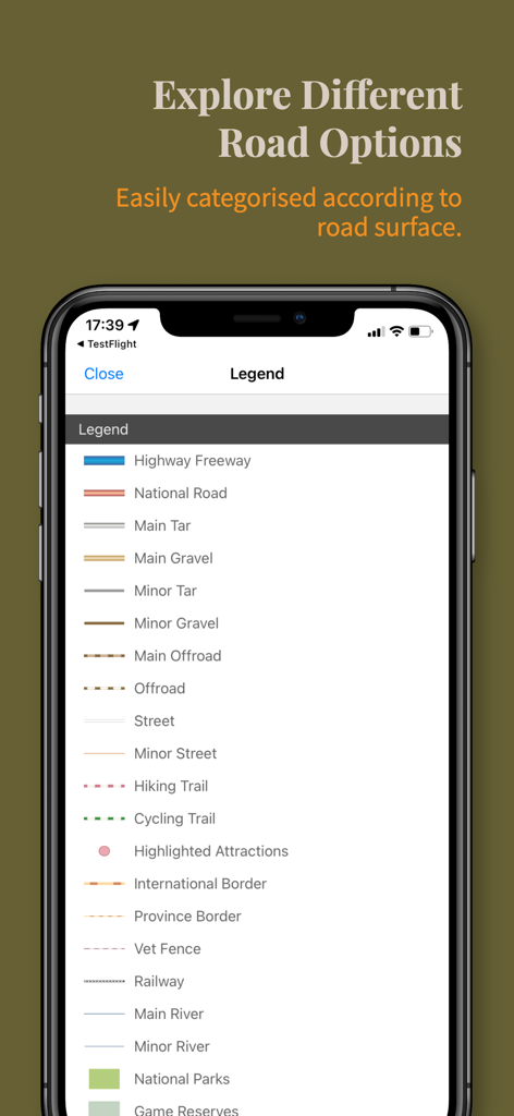
Tracks4Africaのマップ凡例。さまざまな路面やハイキングコースのカテゴリが表示されています
説明
Download
類似アプリ
似た機能とユーザー体験を持つアプリ

Detecht - Motorcycle App & GPS
Detecht Technologies AB

REVER - Motorcycle GPS & Rides
Rever, LLC

NYSSA Snowmobile Trails
Mapgears Inc.

Scenic Motorcycle Navigation
Applified Life Ltd.

Trails Offroad: Offline Maps
TRAILS OFFROAD LLC

Overland Bound One: Maps & GPS
Overland Bound Inc

Stegra.io - Motorcycle GPS
Stegraio AB

GoSnowmobiling NB
Mapgears Inc.

Lost Riders
Lost Riders, LLC
このページはアプリまたはその開発者の公式ページではなく、情報提供および論評を目的として作成された独立した編集出版物です。明示的に別段の記載がない限り、アプリおよびその開発者は、MWM、Apple、Google Play、アプリのパブリッシャー、またはアプリの開発者と提携、承認、後援、認可、またはその他の公式的な関係はなく、このページのいかなる内容も、アプリがMWMのサービスを使用して開発されたことを意味するものではありません。すべての商標、ロゴ、スクリーンショット、その他のコンテンツはそれぞれの所有者の財産です。