このページはアプリまたはその開発者の公式ページではなく、情報提供および論評を目的として作成された独立した編集出版物です。明示的に別段の記載がない限り、アプリおよびその開発者は、MWM、Apple、Google Play、アプリのパブリッシャー、またはアプリの開発者と提携、承認、後援、認可、またはその他の公式的な関係はなく、このページのいかなる内容も、アプリがMWMのサービスを使用して開発されたことを意味するものではありません。すべての商標、ロゴ、スクリーンショット、その他のコンテンツはそれぞれの所有者の財産です。

TrailWatch: Your Hiking Guide
高度なGPS追跡、リアルタイムのグループ安全機能、市民報告を利用して、私たちのトレイルの美しさを保つ、環境意識の高い探検家のコミュニティに参加しましょう。
ダウンロード
98K+ユーザー評価
評価数
3K+開発元
カテゴリ
Travel対応言語
1最新バージョン
3.9.2サイズ
32.8 MBリリース日
2014年1月29日より高い目的を持って自然を体験しましょう
高度なGPS追跡と環境保全を組み合わせましょう。TrailWatchは、あなたが愛するトレイルを探索、共有、保護することを可能にします。
市民主導の保全
トレイルの損傷や異常なインシデントをリアルタイムで報告し、重要なカントリーパークの環境を保全および保護するのに役立ちます。
スマートグループセーフティ
ライブGPS位置追跡と自動写真共有で、ハイキングクルーを接続したままにしましょう。
以下のスクリーンショットと説明は、アプリの公式ストアリスティングから直接取得されたものであり、アプリ開発者の所有物です。
アプリストア
スクリーンショット
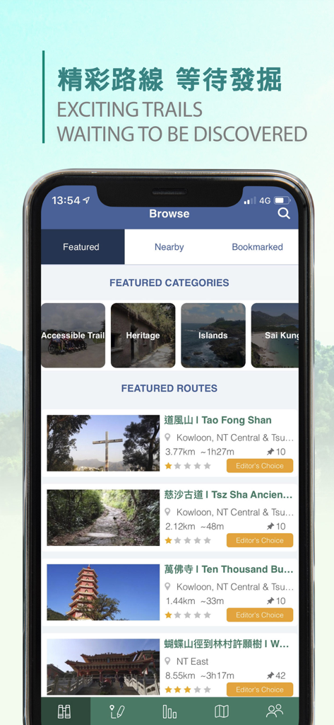
TrailWatchアプリのインターフェース。香港の注目のハイキングコースとカテゴリを表示。
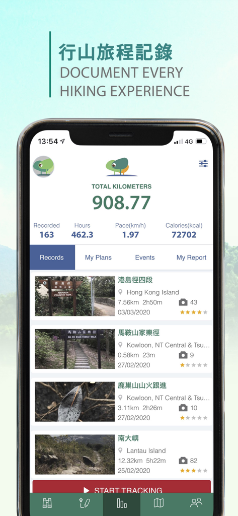
TrailWatchアプリのインターフェース。総ハイキングキロメートル、カロリー、記録されたトレイルのリストを表示。
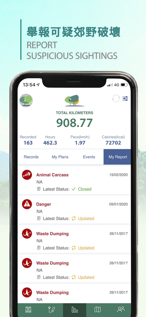
TrailWatchアプリのインターフェース。ユーザーのハイキング統計と、ゴミの投棄や危険などの報告された環境インシデントのリストを表示。
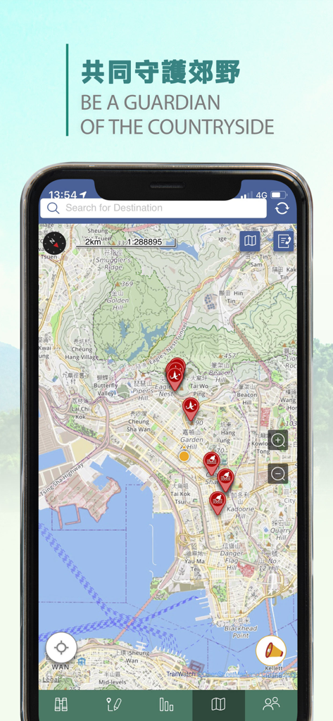
スマートフォンの画面。TrailWatchアプリのマップに、香港のハイキングトレイル上のインシデントを示す赤いマーカーが表示されています。
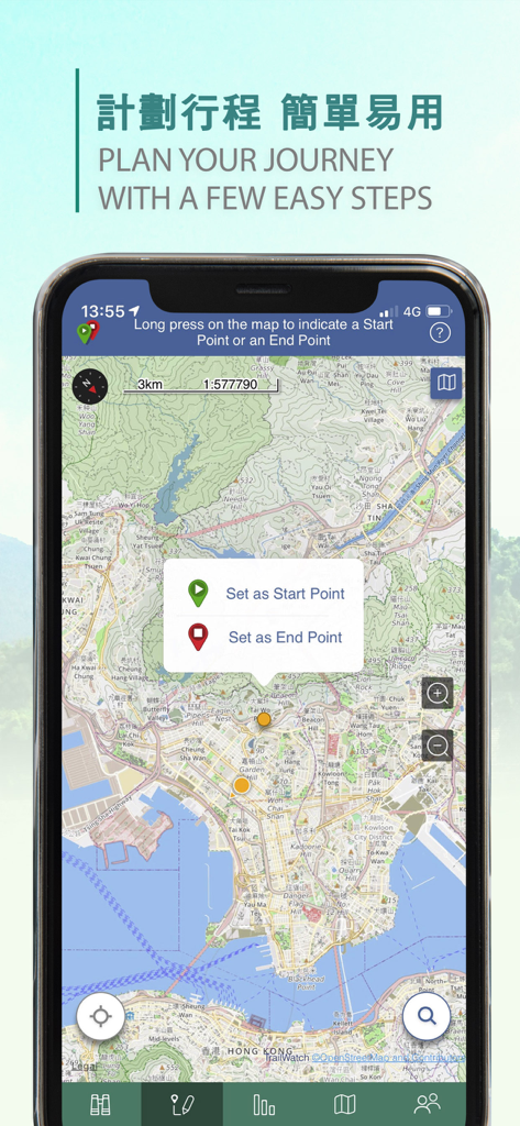
TrailWatchモバイルアプリ。開始点と終了点を設定してハイキングジャーニーを計画するためのマップインターフェースを表示。
説明
Download
類似アプリ
同じカテゴリのトップランクアプリ

Uber - Request a ride
Uber Technologies, Inc.

Airbnb
Airbnb, Inc.

铁路12306
ACADEMY OF RAILWAY SCIENCES CO., ltd.

Booking.com: Hotels & Travel
Booking.com B.V.

Grab: Taxi Ride, Food Delivery
GRABTAXI HOLDINGS PTE. LTD.

Trip.com: Book Flights, Hotels
Trip.com Travel Singapore Pte. Ltd.

DiDi China: Ride Hailing
Didi Chuxing (Beijing) Network Platform Technology Co., Ltd

去哪儿旅行-订酒店机票火车票
Beijing Qunar Information Technology Company Limit

Bolt: Request a Ride
BOLT TECHNOLOGY OU
このページはアプリまたはその開発者の公式ページではなく、情報提供および論評を目的として作成された独立した編集出版物です。明示的に別段の記載がない限り、アプリおよびその開発者は、MWM、Apple、Google Play、アプリのパブリッシャー、またはアプリの開発者と提携、承認、後援、認可、またはその他の公式的な関係はなく、このページのいかなる内容も、アプリがMWMのサービスを使用して開発されたことを意味するものではありません。すべての商標、ロゴ、スクリーンショット、その他のコンテンツはそれぞれの所有者の財産です。