このページはアプリまたはその開発者の公式ページではなく、情報提供および論評を目的として作成された独立した編集出版物です。明示的に別段の記載がない限り、アプリおよびその開発者は、MWM、Apple、Google Play、アプリのパブリッシャー、またはアプリの開発者と提携、承認、後援、認可、またはその他の公式的な関係はなく、このページのいかなる内容も、アプリがMWMのサービスを使用して開発されたことを意味するものではありません。すべての商標、ロゴ、スクリーンショット、その他のコンテンツはそれぞれの所有者の財産です。

TrueNorth: Compass, Altimeter
3重ソースの高度精度、リアルタイムの気圧監視、高精度のコンパスツールを使用して、絶対的な自信を持ってナビゲートします。オフラインの信頼性と、世界で最も過酷な環境での完全なプライバシーを要求するプロフェッショナルやアウトドア愛好家のために構築されています。
ダウンロード
600ユーザー評価
評価数
0開発元
カテゴリ
Navigation対応言語
1最新バージョン
1.0.4サイズ
17.9 MBリリース日
2025年5月30日バックカントリーのためのプロフェッショナルグレードのナビゲーション
完全にオフグリッドにいるときに、最高のパフォーマンスを発揮するように設計された信頼性の高いフィールドインストゥルメントにiPhoneを変換します。
3重ソースの高度精度
GPS、気圧センサー、標高データベースを組み合わせて、あらゆる地形で最も正確な高度測定値を取得します。
オフライン信頼性のための構築
セル信号がありませんか?問題ありません。インターネット接続を必要とせずに、プロフェッショナルコンパスとGPS座標にアクセスします。
以下のスクリーンショットと説明は、アプリの公式ストアリスティングから直接取得されたものであり、アプリ開発者の所有物です。
アプリストア
スクリーンショット
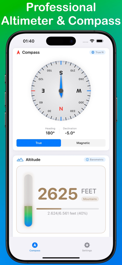
TrueNorthアプリインターフェースは、180度のヘディングと2625フィートを示すデジタル高度計を備えたプロフェッショナルなコンパスローズを表示しています
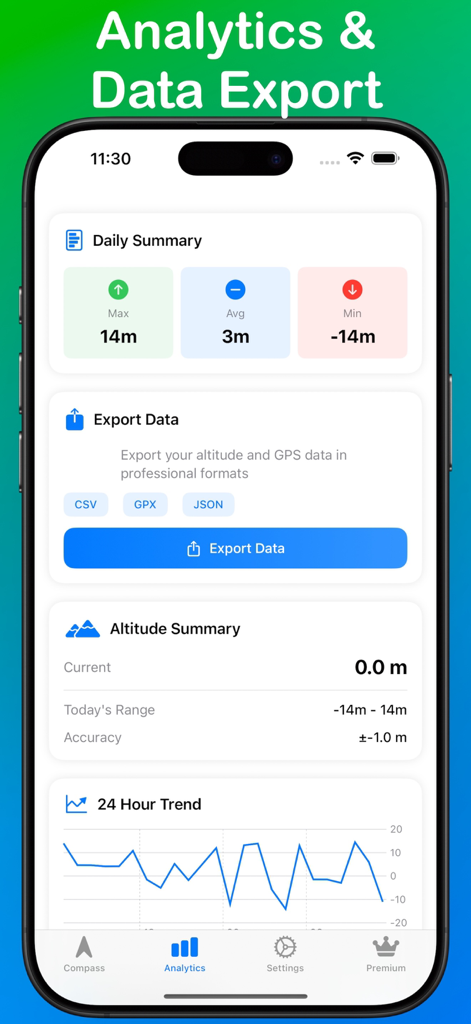
TrueNorthアプリ分析ダッシュボードは、高度の概要とデータエクスポートオプションを表示しています
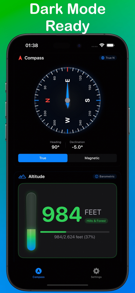
TrueNorthアプリインターフェースは、ダークモードでプロフェッショナルコンパスとデジタル高度計を表示しています
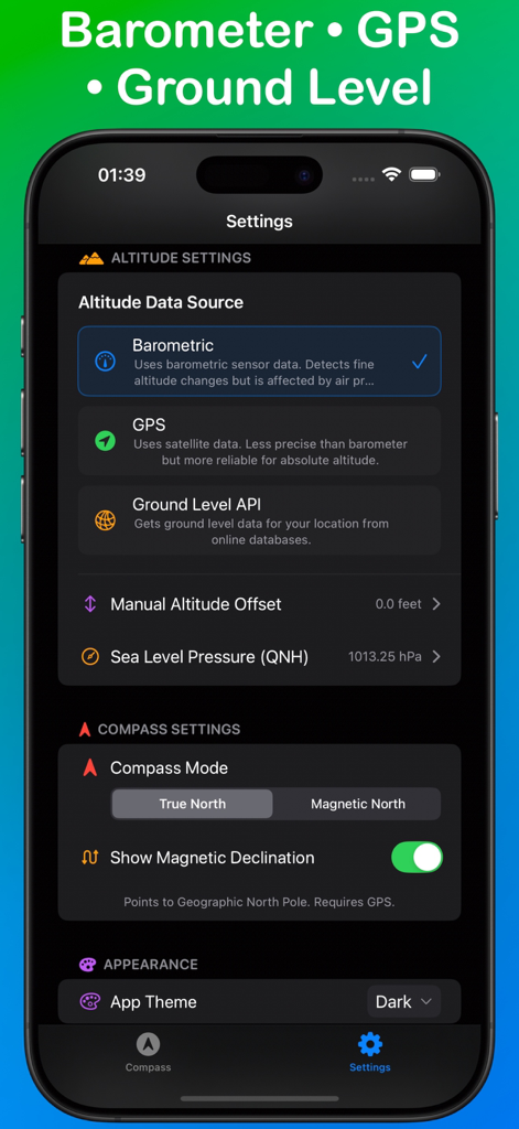
TrueNorthアプリ設定画面は、高度ソースオプションとコンパスナビゲーションモードを表示しています
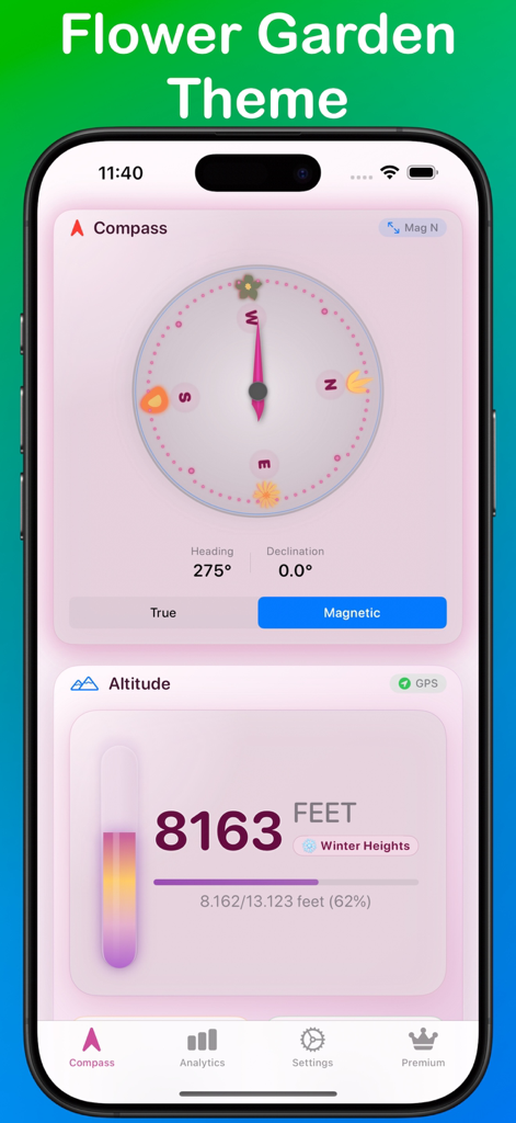
TrueNorthナビゲーションアプリは、ピンクの花の庭のテーマでコンパスと高度計を表示しています
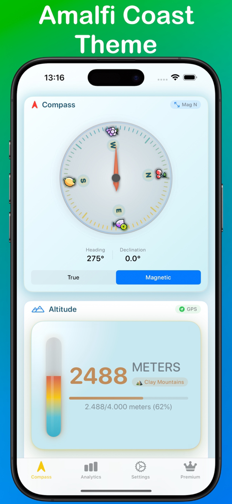
TrueNorthアプリインターフェースは、コンパスと高度測定値とともにアマルフィ海岸のテーマを表示しています
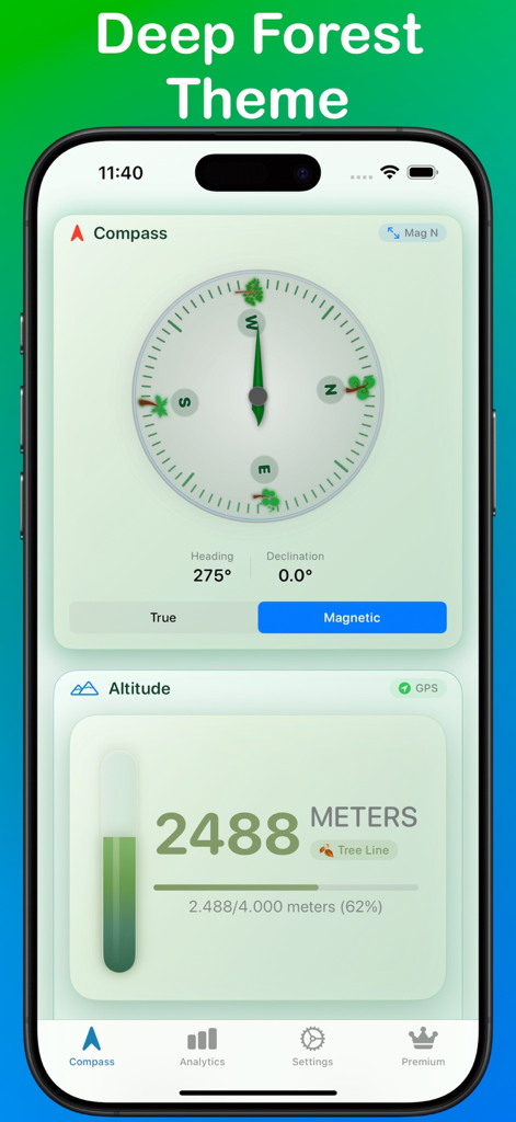
TrueNorthナビゲーションアプリは、ディープフォレストの緑のテーマで磁気コンパスと高度計を表示しています
説明
Download
類似アプリ
同じカテゴリのトップランクアプリ

Google Maps
Google LLC

Waze Navigation & Live Traffic
waze

AMap Global
AutoNavi Information Technology Co. Ltd.

百度地图-路线规划,出行必备
Beijing Baidu Netcom Science & Technology Co.,Ltd

Moovit: Bus & Transit Tracker
Moovit App Global LTD

Transit • Subway & Bus Times
9280-0366 Quebec inc.

ParkMobile: Park. Pay. Go.
Parkmobile USA, Inc

腾讯地图-路线规划,导航地铁打车出行
Shenzhen Tencent Computer Systems Company Limited

Île-de-France Mobilités
Ile de France Mobilites
このページはアプリまたはその開発者の公式ページではなく、情報提供および論評を目的として作成された独立した編集出版物です。明示的に別段の記載がない限り、アプリおよびその開発者は、MWM、Apple、Google Play、アプリのパブリッシャー、またはアプリの開発者と提携、承認、後援、認可、またはその他の公式的な関係はなく、このページのいかなる内容も、アプリがMWMのサービスを使用して開発されたことを意味するものではありません。すべての商標、ロゴ、スクリーンショット、その他のコンテンツはそれぞれの所有者の財産です。