このページはアプリまたはその開発者の公式ページではなく、情報提供および論評を目的として作成された独立した編集出版物です。明示的に別段の記載がない限り、アプリおよびその開発者は、MWM、Apple、Google Play、アプリのパブリッシャー、またはアプリの開発者と提携、承認、後援、認可、またはその他の公式的な関係はなく、このページのいかなる内容も、アプリがMWMのサービスを使用して開発されたことを意味するものではありません。すべての商標、ロゴ、スクリーンショット、その他のコンテンツはそれぞれの所有者の財産です。

ダウンロード
3K+ユーザー評価
評価数
0開発元
カテゴリ
Weather対応言語
1最新バージョン
2.61サイズ
265.4 MBリリース日
2024年1月2日専門的な洪水リスクと水位情報
英国の主要な公式環境機関から直接提供される、包括的で広告なしのデータで環境変化の先を行きましょう。
ライブ公式機関データ
イングランド、スコットランド、ウェールズ全域の900以上のステーションからのリアルタイムの降雨、河川、潮汐レベルに広告なしでアクセスできます。
高度なリスク準備
詳細な5日間の洪水予報とアクティブな警告を監視し、財産、土地、資産を積極的に保護します。
以下のスクリーンショットと説明は、アプリの公式ストアリスティングから直接取得されたものであり、アプリ開発者の所有物です。
アプリストア
スクリーンショット
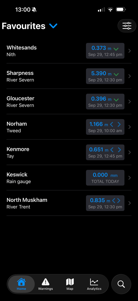
UkFloodProアプリのお気に入りの河川および降雨監視ステーションのリストで、ライブデータレベルが表示されています。
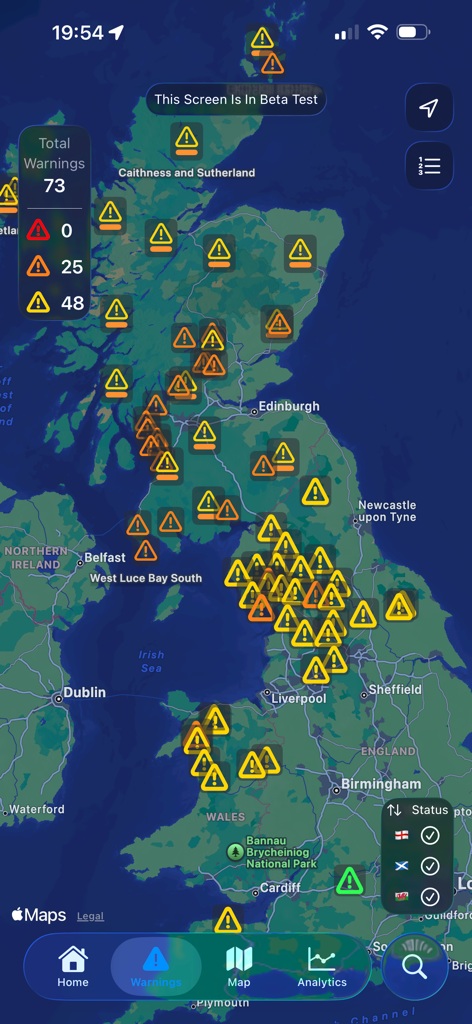
英国の地図に複数の洪水警報アイコンとアラート概要が表示されています。
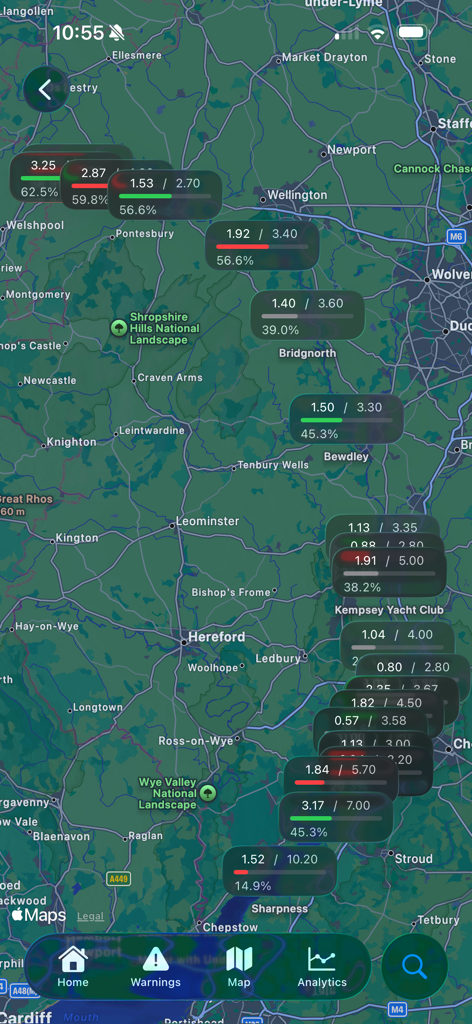
UkFloodProアプリの英国地図にライブ河川水位データと洪水ステーションのステータスが表示されています。
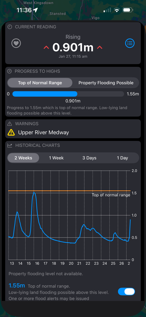
UkFloodProアプリのUpper River Medwayの詳細な河川水位測定値と履歴グラフ。
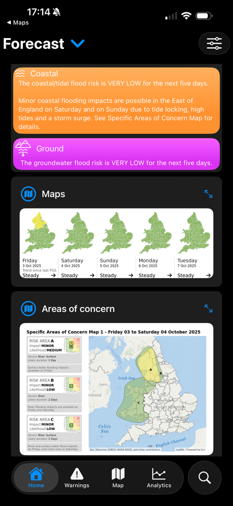
英国の地域リスクマップを示す5日間の洪水予報ダッシュボード。
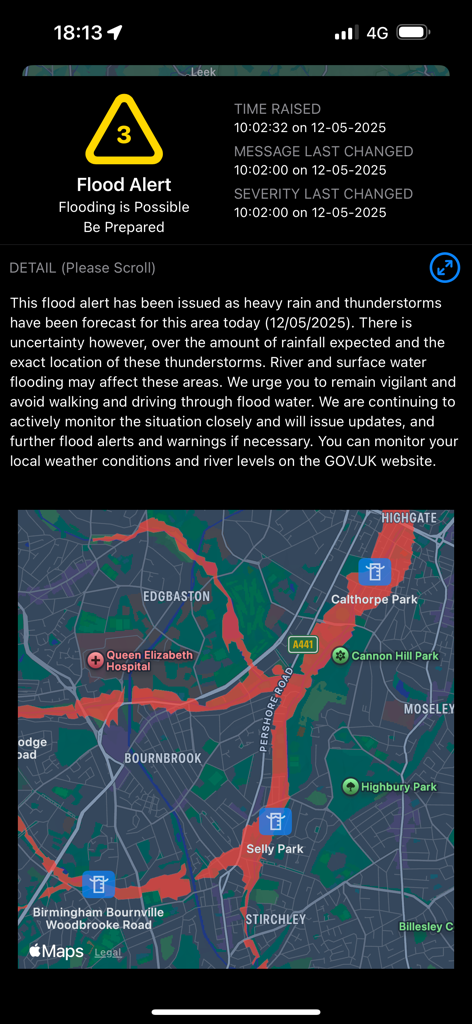
バーミンガムの洪水ゾーンを示すリスクマップ付きの詳細な洪水アラート画面。
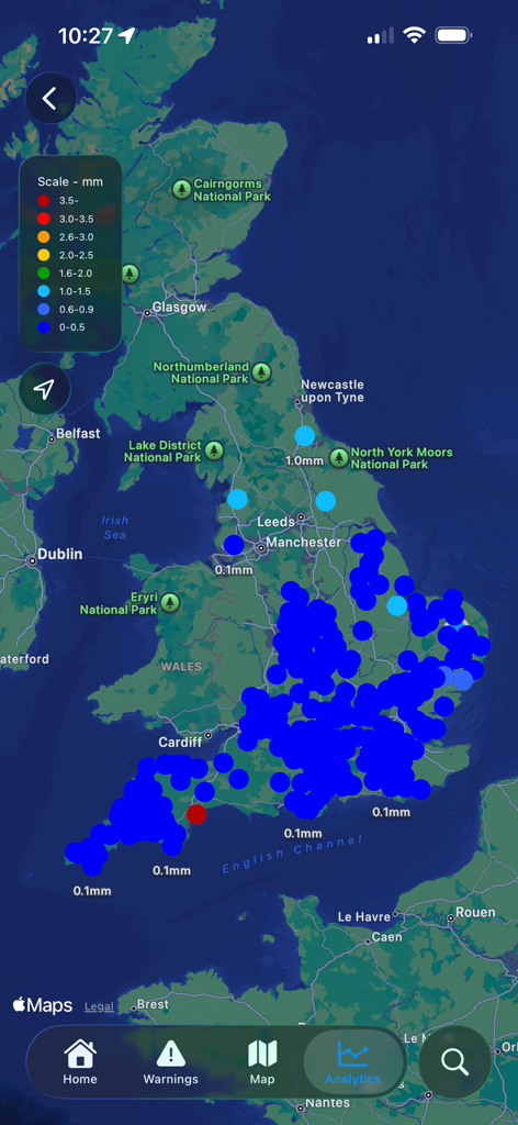
UkFloodProアプリの地図表示で、英国全土のライブ降雨データが表示されています。
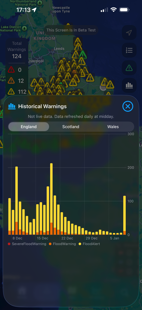
地図ビュー上に表示されたイングランドの履歴洪水警報とアラートを示す棒グラフ。
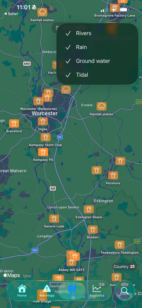
UkFloodProアプリの地図表示で、気象観測所とデータフィルターが表示されています。
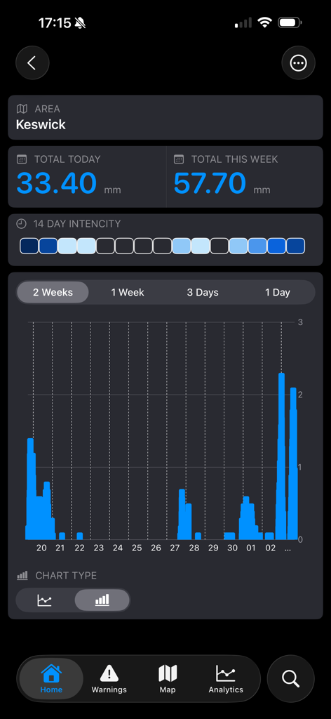
UkFloodProアプリの画面に、ケズウィックの降雨データとグラフが表示されています。
説明
Download
類似アプリ
同じカテゴリのトップランクアプリ

墨迹天气-MojiWeather
Beijing MojiFengyun Technology Co.,Ltd.

The Weather Channel - Radar
The Weather Channel

Windy.com
Windyty, SE

天气预报-精准15日天气预报
Chongqing Caochen Technology Co., Ltd.

My Aurora Forecast & Alerts
JRustonApps B.V.

AccuWeather: Weather Forecast
AccuWeather International, Inc.

Weather & Radar - Storm radar
WetterOnline - Meteorologische Dienstleistungen GmbH

天气通
Weibo Internet Technology (China) Co.Ltd.

The Thermometer -Digital-
Vida Apps Incorporated
このページはアプリまたはその開発者の公式ページではなく、情報提供および論評を目的として作成された独立した編集出版物です。明示的に別段の記載がない限り、アプリおよびその開発者は、MWM、Apple、Google Play、アプリのパブリッシャー、またはアプリの開発者と提携、承認、後援、認可、またはその他の公式的な関係はなく、このページのいかなる内容も、アプリがMWMのサービスを使用して開発されたことを意味するものではありません。すべての商標、ロゴ、スクリーンショット、その他のコンテンツはそれぞれの所有者の財産です。