このページはアプリまたはその開発者の公式ページではなく、情報提供および論評を目的として作成された独立した編集出版物です。明示的に別段の記載がない限り、アプリおよびその開発者は、MWM、Apple、Google Play、アプリのパブリッシャー、またはアプリの開発者と提携、承認、後援、認可、またはその他の公式的な関係はなく、このページのいかなる内容も、アプリがMWMのサービスを使用して開発されたことを意味するものではありません。すべての商標、ロゴ、スクリーンショット、その他のコンテンツはそれぞれの所有者の財産です。

Watch Wayfinder
手首で正確なナビゲーション。オフラインのNOAAチャート、リアルタイムのVMGデータ、およびテクニカルなアウトドアのプロシューマー向けに設計されたカスタムGPX統合で、水上とトレイルをマスターしましょう。
ダウンロード
14K+ユーザー評価
評価数
0開発元
カテゴリ
Navigation対応言語
1最新バージョン
1.7.5サイズ
5.8 MBリリース日
2023年8月10日手首でプロ仕様のナビゲーション
かさばるチャートプロッターを、洗練されたデータ駆動型のツールに置き換えましょう。プロ仕様のマリンチャート、リアルタイムのパフォーマンスメトリクス、オフラインマップにアクセスし、テクニカルなアウトドアのプロシューマー向けに設計されています。
オフラインマリン&トレイルマップ
NOAAチャートとOpenStreetMapデータで安全かつコースを維持しましょう。携帯電話サービスがない遠隔地での信頼性を確保するために、外出前に詳細なマップエリアを手動でダウンロードしてください。
リアルタイムパフォーマンス分析
テクニカルメトリクスでラインを最適化しましょう。VMG(目標向上速度)、最高速度、正確な方位を一目で監視できます。ウィンドサーフィン、カイトボーディング、競技セーリングに最適です。
以下のスクリーンショットと説明は、アプリの公式ストアリスティングから直接取得されたものであり、アプリ開発者の所有物です。
アプリストア
スクリーンショット
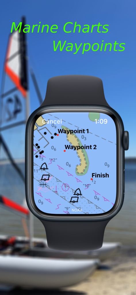
Watch WayfinderアプリがApple Watch上で詳細なマリンチャートとナビゲーションウェイポイントを表示している様子
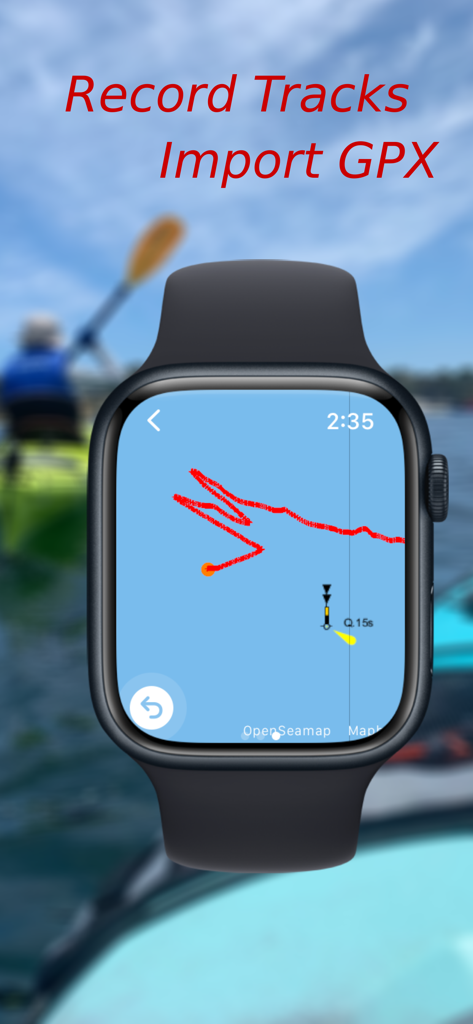
Apple WatchがWatch Wayfinderアプリを表示し、マリンマップ上でナビゲーショントラックを記録している様子
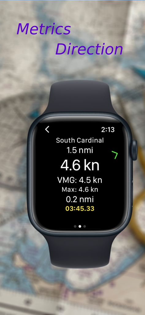
Apple Watch画面に、速度、VMG、南カーディナルウェイポイントまでの距離を含むナビゲーションデータが表示されている様子
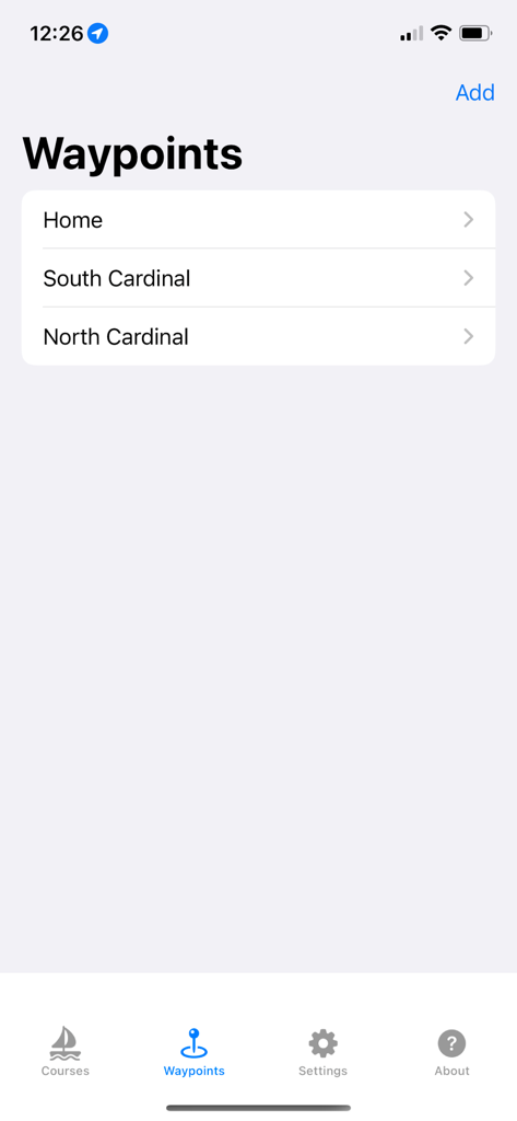
Watch Wayfinder iPhoneアプリのインターフェースに、保存されたナビゲーションウェイポイントのリストが表示されている様子
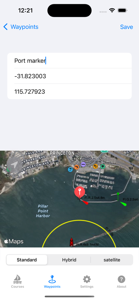
Watch WayfinderアプリのiPhoneインターフェースに、GPS座標と衛星マップを使用したウェイポイント作成画面が表示されている様子
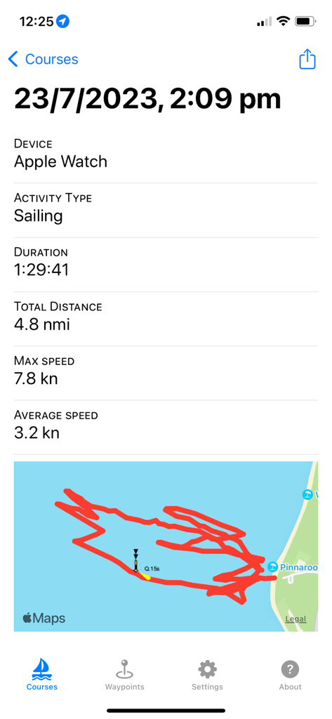
iPhone画面に、Apple WatchからのGPSトラックマップとマリン統計を含むセーリングアクティビティの概要が表示されている様子
説明
Download
類似アプリ
同じカテゴリのトップランクアプリ

Google Maps
Google LLC

Waze Navigation & Live Traffic
waze

AMap Global
AutoNavi Information Technology Co. Ltd.

百度地图-路线规划,出行必备
Beijing Baidu Netcom Science & Technology Co.,Ltd

Moovit: Bus & Transit Tracker
Moovit App Global LTD

Transit • Subway & Bus Times
9280-0366 Quebec inc.

ParkMobile: Park. Pay. Go.
Parkmobile USA, Inc

腾讯地图-路线规划,导航地铁打车出行
Shenzhen Tencent Computer Systems Company Limited

Île-de-France Mobilités
Ile de France Mobilites
このページはアプリまたはその開発者の公式ページではなく、情報提供および論評を目的として作成された独立した編集出版物です。明示的に別段の記載がない限り、アプリおよびその開発者は、MWM、Apple、Google Play、アプリのパブリッシャー、またはアプリの開発者と提携、承認、後援、認可、またはその他の公式的な関係はなく、このページのいかなる内容も、アプリがMWMのサービスを使用して開発されたことを意味するものではありません。すべての商標、ロゴ、スクリーンショット、その他のコンテンツはそれぞれの所有者の財産です。