このページはアプリまたはその開発者の公式ページではなく、情報提供および論評を目的として作成された独立した編集出版物です。明示的に別段の記載がない限り、アプリおよびその開発者は、MWM、Apple、Google Play、アプリのパブリッシャー、またはアプリの開発者と提携、承認、後援、認可、またはその他の公式的な関係はなく、このページのいかなる内容も、アプリがMWMのサービスを使用して開発されたことを意味するものではありません。すべての商標、ロゴ、スクリーンショット、その他のコンテンツはそれぞれの所有者の財産です。

WinGPS Marine Plus
真剣な船乗り、沿岸クルーザー、グレートループ冒険者向けに、専門家のルートプランニング、リアルタイムAIS追跡、詳細な水路データで自信を持って航海しましょう。
ダウンロード
12K+ユーザー評価
評価数
0開発元
カテゴリ
Navigation対応言語
3最新バージョン
1.39サイズ
59.6 MBリリース日
2020年12月11日現代の船長のためのプロフェッショナルグレードナビゲーション
外洋航海から複雑な内陸水路まで、WinGPS Marine Plusは専門的な船舶管理に必要な精度、安全機能、リアルタイムデータを提供します。
リアルタイムAIS認識
高解像度の海図上に近くのAISオブジェクトを直接プロットして、混雑した沿岸水路や船舶航路を安全に航行しましょう。
船舶別ルーティング
橋の高さ、閘門のスケジュール、内陸水路データを考慮して、船の寸法に合わせて最適化された航路を生成します。
以下のスクリーンショットと説明は、アプリの公式ストアリスティングから直接取得されたものであり、アプリ開発者の所有物です。
アプリストア
スクリーンショット
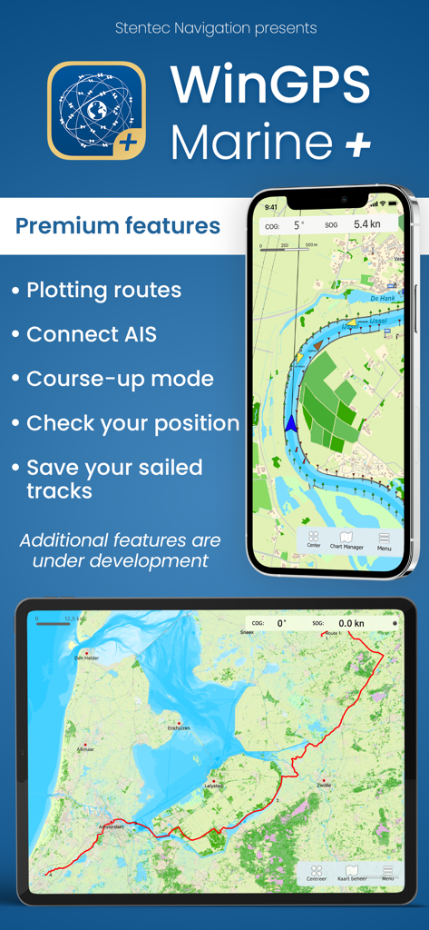
WinGPS Marine Plusアプリのインターフェース。モバイルデバイス上の海図とナビゲーション機能を表示。
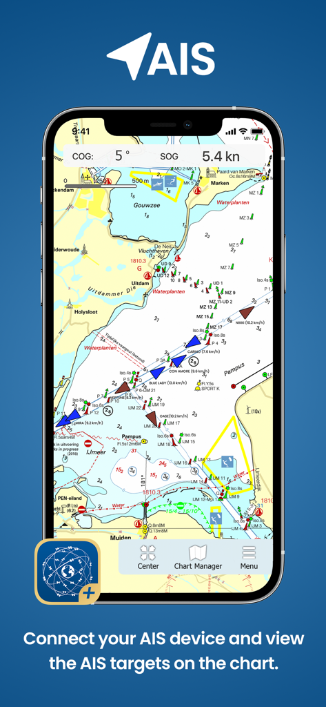
WinGPS Marine Plusアプリ。海図上のAIS船舶追跡を表示。
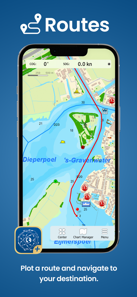
スマートフォン画面。WinGPS Marine Plusアプリが海図上に航海ルートをプロットしている様子を表示。
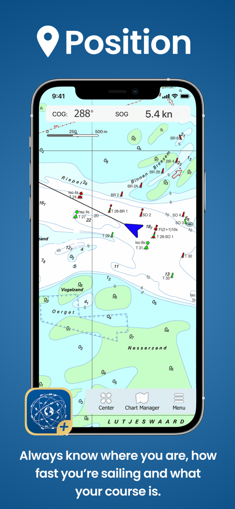
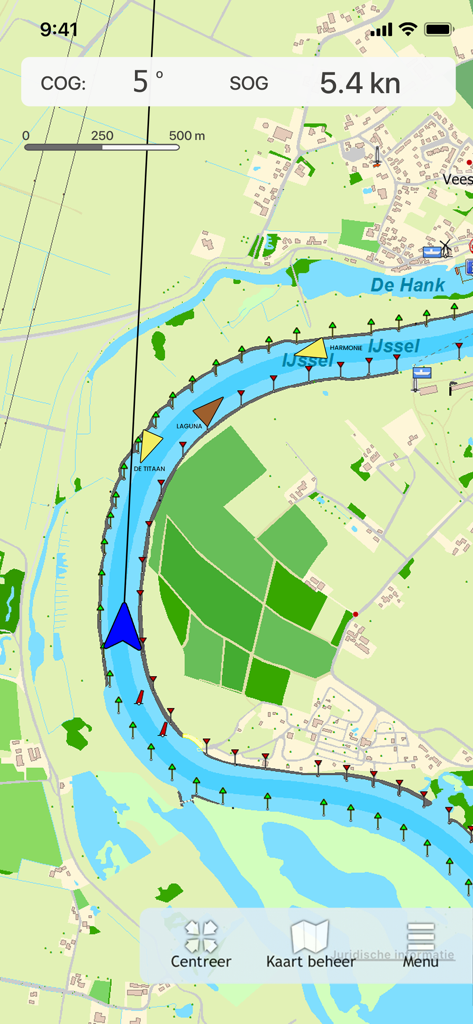
WinGPS Marine Plusアプリのインターフェース。現在の船の位置と速度を示す海図を表示。
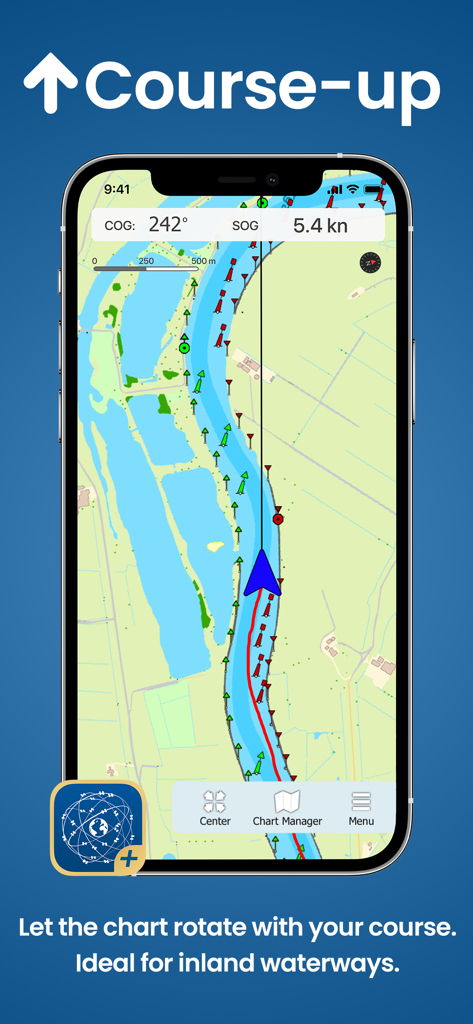
WinGPS Marine Plusアプリ。内陸ナビゲーションのためのコースアップチャート回転を表示。
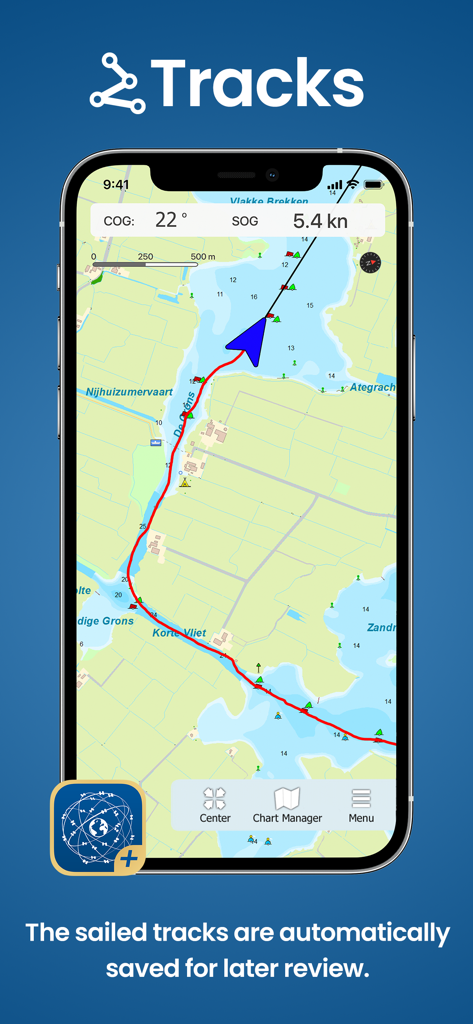
WinGPS Marine Plusアプリのインターフェース。海図上に保存された航海トラックを表示。
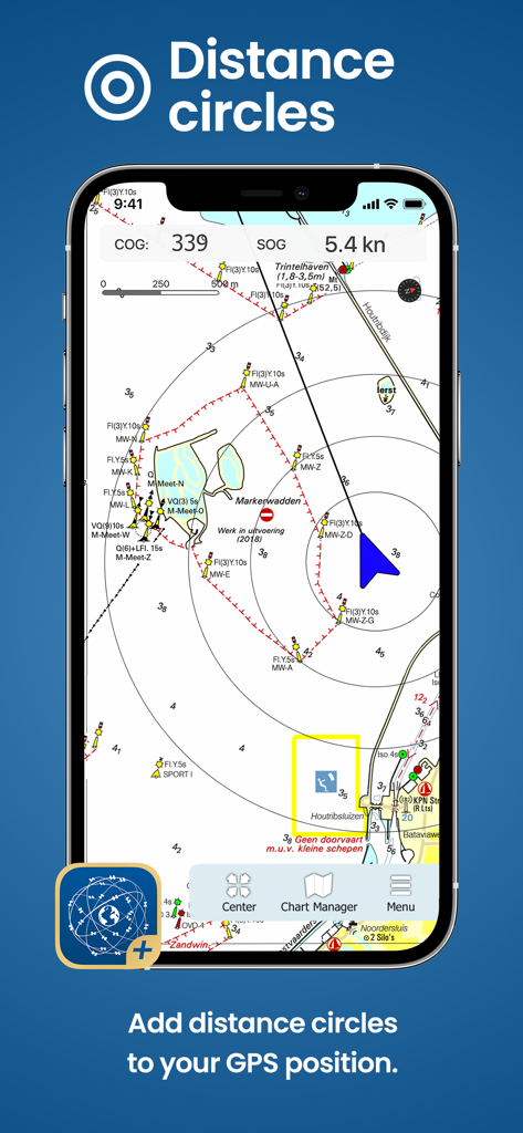
WinGPS Marine Plusアプリ。デジタル海図上の船の位置を中心とした距離円を表示。
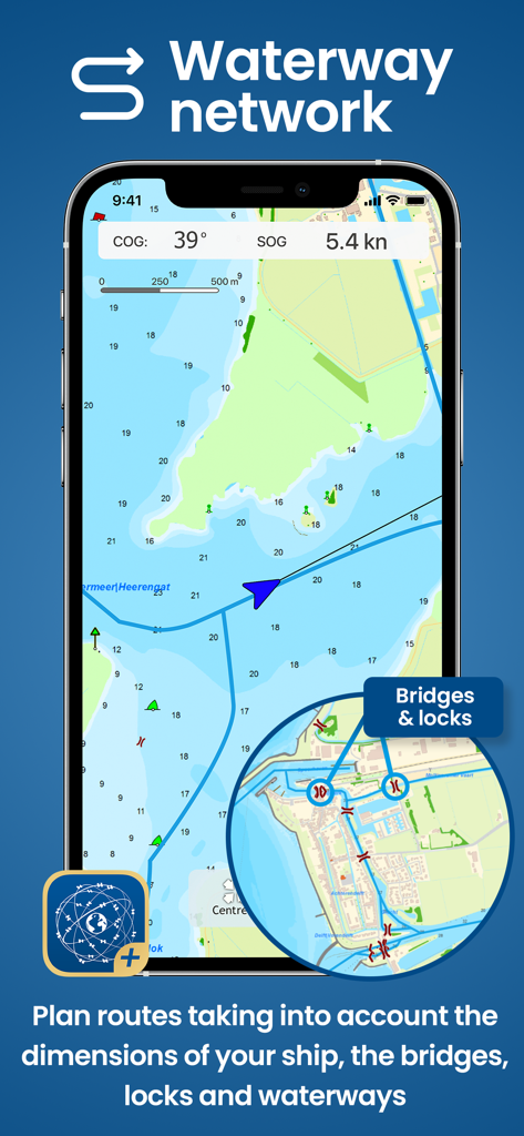
スマートフォン。WinGPS Marine Plusアプリに海図と水路ネットワークの詳細を表示。
WinGPS Marine Plusナビゲーションマップ。AIS船舶追跡と航海マーカーを川に表示。
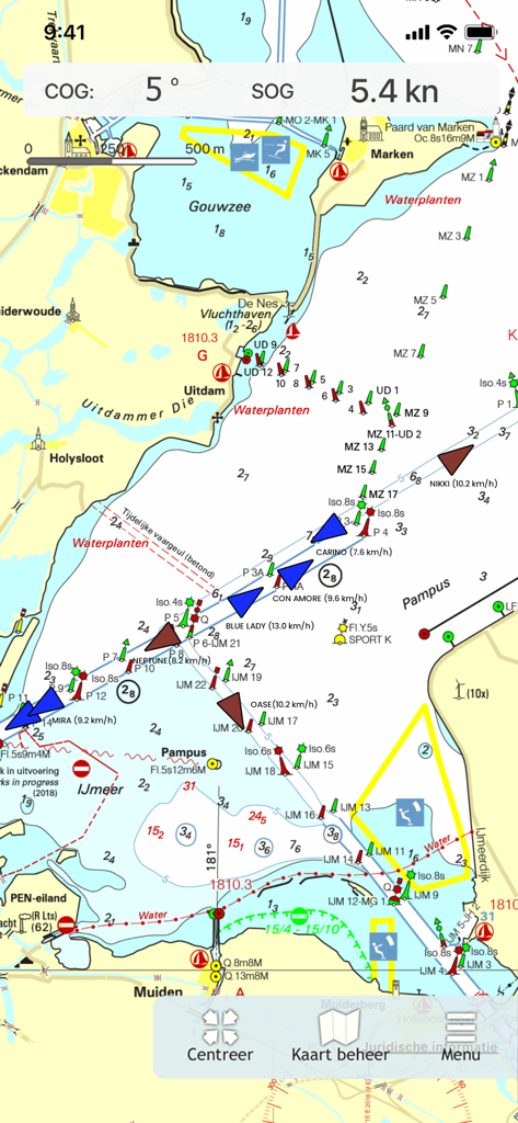
WinGPS Marine Plusアプリ。リアルタイムAIS船舶追跡と航海データを含む海事ナビゲーションチャートを表示。
説明
Download
類似アプリ
同じカテゴリのトップランクアプリ

Google Maps
Google LLC

Waze Navigation & Live Traffic
waze

AMap Global
AutoNavi Information Technology Co. Ltd.

百度地图-路线规划,出行必备
Beijing Baidu Netcom Science & Technology Co.,Ltd

Moovit: Bus & Transit Tracker
Moovit App Global LTD

Transit • Subway & Bus Times
9280-0366 Quebec inc.

ParkMobile: Park. Pay. Go.
Parkmobile USA, Inc

腾讯地图-路线规划,导航地铁打车出行
Shenzhen Tencent Computer Systems Company Limited

Île-de-France Mobilités
Ile de France Mobilites
このページはアプリまたはその開発者の公式ページではなく、情報提供および論評を目的として作成された独立した編集出版物です。明示的に別段の記載がない限り、アプリおよびその開発者は、MWM、Apple、Google Play、アプリのパブリッシャー、またはアプリの開発者と提携、承認、後援、認可、またはその他の公式的な関係はなく、このページのいかなる内容も、アプリがMWMのサービスを使用して開発されたことを意味するものではありません。すべての商標、ロゴ、スクリーンショット、その他のコンテンツはそれぞれの所有者の財産です。