이 페이지는 앱이나 개발자의 공식 페이지가 아니며, 정보 제공 및 논평을 목적으로 작성된 독립 편집 간행물입니다. 명시적으로 달리 언급되지 않는 한, 해당 앱이나 개발자는 MWM, Apple, Google Play, 앱 퍼블리셔 또는 앱 개발자와 제휴, 보증, 후원, 승인 또는 공식적으로 연결되어 있지 않으며, 이 페이지의 어떤 내용도 해당 앱이 MWM의 서비스를 사용하여 개발되었음을 의미하지 않습니다. 모든 상표, 로고, 스크린샷 및 기타 콘텐츠는 해당 소유자의 자산입니다.

Airports Plus
전 세계 수천 개의 공항에 대한 상세한 활주로 배치, 무선 주파수 및 실시간 METAR/TAF 데이터에 액세스하세요. iPad에 최적화되어 있으며 인터넷 연결 없이도 완벽하게 작동합니다.
다운로드
211K+사용자 평점
총 평가 수
100개발사
카테고리
Travel지원 언어
26최신 버전
5.2크기
148.8 MB출시일
2012년 1월 24일모든 비행을 위한 필수 정보
조종사 및 항공 애호가를 위해 설계된 전 세계 공항 기술 사양, 무선 주파수 및 실시간 날씨 데이터에 대한 포괄적인 오프라인 데이터베이스에 액세스하세요.
고속 오프라인 데이터베이스
최대 기내 중복성을 위해 셀룰러 연결 없이도 10,000피트 상공에서 수천 개의 상세한 공항 프로필에 즉시 액세스하세요.
중요 무선 및 활주로 데이터
ATIS, 타워 및 지상 주파수와 상세한 활주로 치수, 방향, 표면 및 조명 사양에 즉시 액세스하세요.
다음 스크린샷과 설명은 앱의 공식 스토어 목록에서 직접 가져온 것이며 앱 개발자의 자산입니다.
앱 스토어
스크린샷
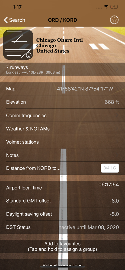
시카고 오헤어 국제공항의 상세한 항공 데이터 (활주로, 고도, 현지 시간 포함)
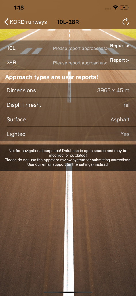
Airports Plus 앱의 시카고 오헤어 국제공항 기술 활주로 사양
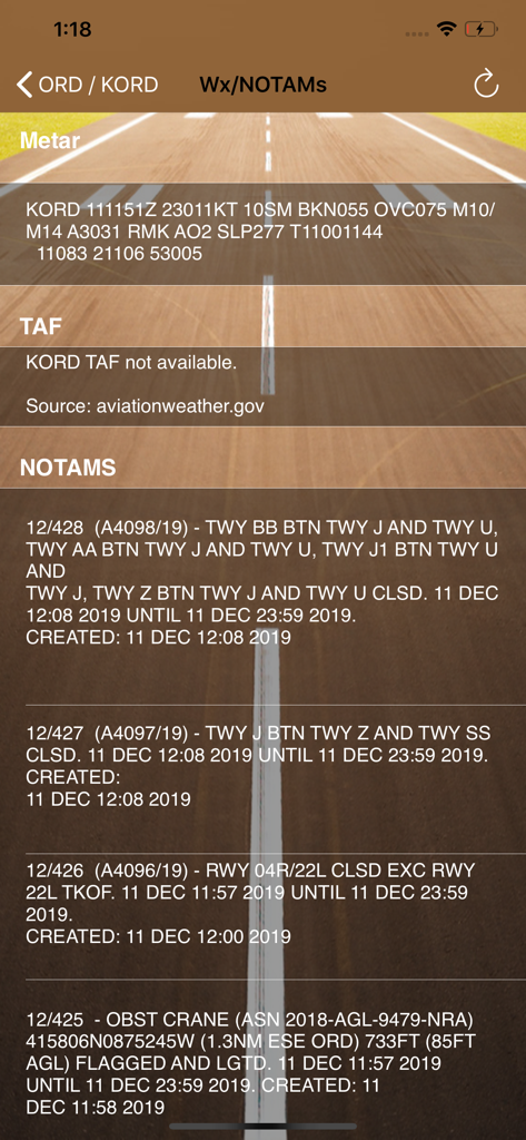
Airports Plus 앱에 표시되는 KORD 공항의 항공 날씨 METAR 및 NOTAM 안전 공지
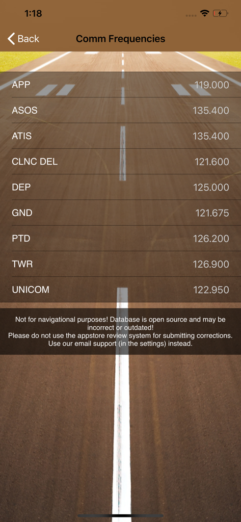
Airports Plus 앱 화면에 표시되는 타워 및 지상과 같은 공항 통신 주파수.
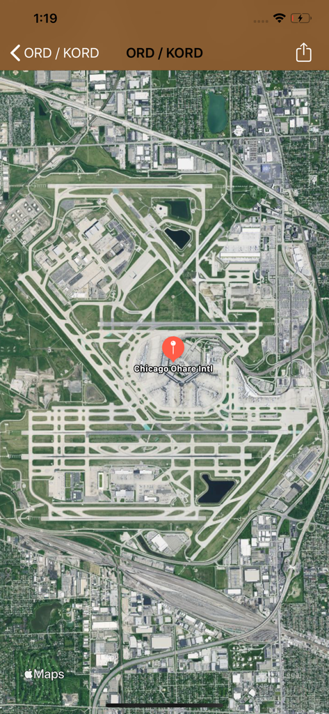
Airports Plus 앱의 시카고 오헤어 국제공항 위성 지도 보기
설명
Download
비슷한 앱
같은 카테고리의 상위 앱

Uber - Request a ride
Uber Technologies, Inc.

Airbnb
Airbnb, Inc.

铁路12306
ACADEMY OF RAILWAY SCIENCES CO., ltd.

Booking.com: Hotels & Travel
Booking.com B.V.

Grab: Taxi Ride, Food Delivery
GRABTAXI HOLDINGS PTE. LTD.

Trip.com: Book Flights, Hotels
Trip.com Travel Singapore Pte. Ltd.

DiDi China: Ride Hailing
Didi Chuxing (Beijing) Network Platform Technology Co., Ltd

去哪儿旅行-订酒店机票火车票
Beijing Qunar Information Technology Company Limit

Bolt: Request a Ride
BOLT TECHNOLOGY OU
이 페이지는 앱이나 개발자의 공식 페이지가 아니며, 정보 제공 및 논평을 목적으로 작성된 독립 편집 간행물입니다. 명시적으로 달리 언급되지 않는 한, 해당 앱이나 개발자는 MWM, Apple, Google Play, 앱 퍼블리셔 또는 앱 개발자와 제휴, 보증, 후원, 승인 또는 공식적으로 연결되어 있지 않으며, 이 페이지의 어떤 내용도 해당 앱이 MWM의 서비스를 사용하여 개발되었음을 의미하지 않습니다. 모든 상표, 로고, 스크린샷 및 기타 콘텐츠는 해당 소유자의 자산입니다.