이 페이지는 앱이나 개발자의 공식 페이지가 아니며, 정보 제공 및 논평을 목적으로 작성된 독립 편집 간행물입니다. 명시적으로 달리 언급되지 않는 한, 해당 앱이나 개발자는 MWM, Apple, Google Play, 앱 퍼블리셔 또는 앱 개발자와 제휴, 보증, 후원, 승인 또는 공식적으로 연결되어 있지 않으며, 이 페이지의 어떤 내용도 해당 앱이 MWM의 서비스를 사용하여 개발되었음을 의미하지 않습니다. 모든 상표, 로고, 스크린샷 및 기타 콘텐츠는 해당 소유자의 자산입니다.

Alaska State Roads
마지막 개척지를 자신 있게 탐색하세요. 390개의 실시간 고속도로 카메라와 즉각적인 사고 알림을 통해 모든 여정에서 안전하고 정보를 얻으십시오.
다운로드
3K+사용자 평점
총 평가 수
0개발사
카테고리
Travel지원 언어
1최신 버전
1.2크기
4.5 MB출시일
2020년 9월 14일마지막 개척지의 도로를 마스터하세요
주 교통국(DOT)의 실시간 시각적 증거와 공인된 데이터를 통해 알래스카의 독특한 운전 과제를 탐색하세요.
390개 이상의 실시간 카메라 피드
추측은 그만. 엔진을 시작하기 전에 주 전역의 실시간 적설량, 결빙 및 가시성 수준을 확인하세요.
공식 사고 알림
사고 및 위험에 대한 색상 코드로 구분된 심각도 보고서에 액세스하여 생존 및 안전을 위한 가장 신뢰할 수 있는 데이터를 확보하십시오.
다음 스크린샷과 설명은 앱의 공식 스토어 목록에서 직접 가져온 것이며 앱 개발자의 자산입니다.
앱 스토어
스크린샷
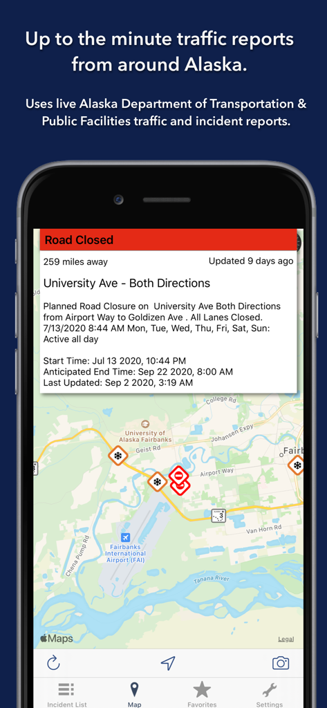
알래스카 주 도로 앱의 페어뱅크스 지도 스크린샷, 도로 폐쇄 알림 및 실시간 교통 사고 아이콘 표시.
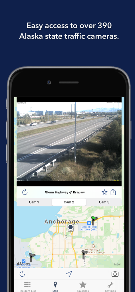
알래스카 주 도로 앱, 앵커리지 지도 상단의 글렌 하이웨이 실시간 교통 카메라 피드 표시
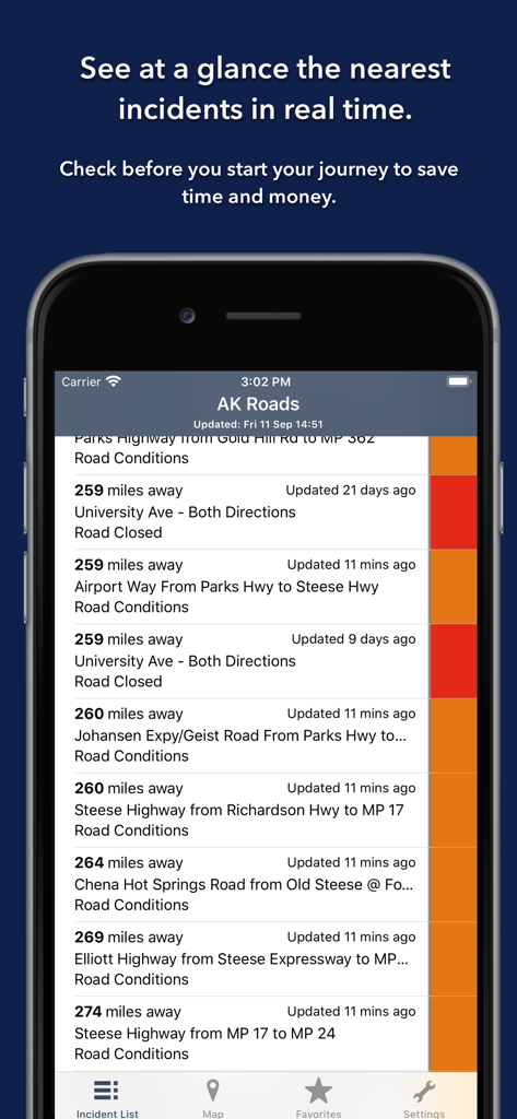
알래스카 주 도로 앱의 실시간 도로 사고 및 폐쇄 목록, 색상 코드로 구분된 심각도 표시기 포함
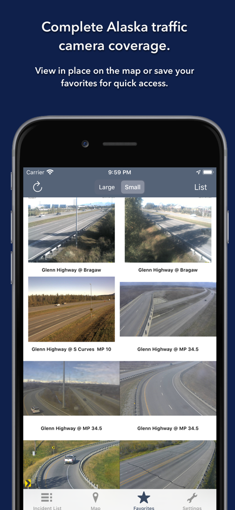
알래스카 주 도로 앱, 글렌 하이웨이 실시간 교통 카메라 피드 표시
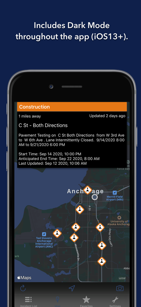
알래스카 주 도로 앱 인터페이스, 앵커리지 지도에 공사 알림 표시된 다크 모드.
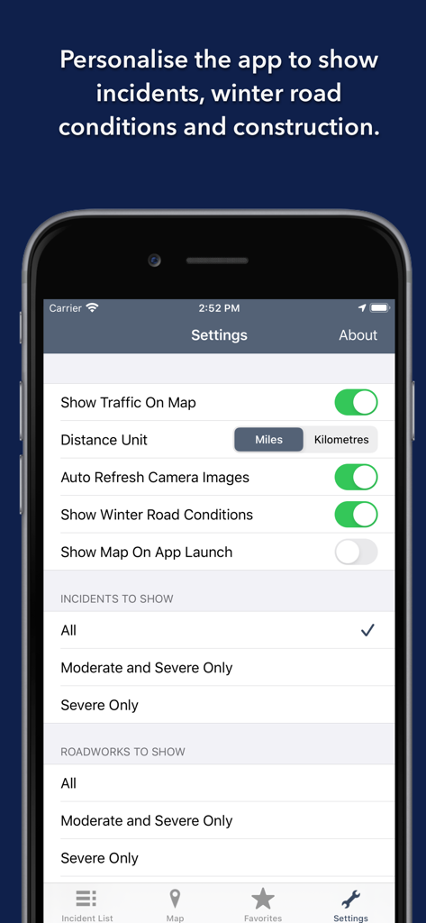
교통 사고 및 겨울철 도로 상황에 대한 알래스카 주 도로 앱의 개인 설정
설명
Download
비슷한 앱
같은 카테고리의 상위 앱

Uber - Request a ride
Uber Technologies, Inc.

Airbnb
Airbnb, Inc.

铁路12306
ACADEMY OF RAILWAY SCIENCES CO., ltd.

Booking.com: Hotels & Travel
Booking.com B.V.

Grab: Taxi Ride, Food Delivery
GRABTAXI HOLDINGS PTE. LTD.

Trip.com: Book Flights, Hotels
Trip.com Travel Singapore Pte. Ltd.

DiDi China: Ride Hailing
Didi Chuxing (Beijing) Network Platform Technology Co., Ltd

去哪儿旅行-订酒店机票火车票
Beijing Qunar Information Technology Company Limit

Bolt: Request a Ride
BOLT TECHNOLOGY OU
이 페이지는 앱이나 개발자의 공식 페이지가 아니며, 정보 제공 및 논평을 목적으로 작성된 독립 편집 간행물입니다. 명시적으로 달리 언급되지 않는 한, 해당 앱이나 개발자는 MWM, Apple, Google Play, 앱 퍼블리셔 또는 앱 개발자와 제휴, 보증, 후원, 승인 또는 공식적으로 연결되어 있지 않으며, 이 페이지의 어떤 내용도 해당 앱이 MWM의 서비스를 사용하여 개발되었음을 의미하지 않습니다. 모든 상표, 로고, 스크린샷 및 기타 콘텐츠는 해당 소유자의 자산입니다.