이 페이지는 앱이나 개발자의 공식 페이지가 아니며, 정보 제공 및 논평을 목적으로 작성된 독립 편집 간행물입니다. 명시적으로 달리 언급되지 않는 한, 해당 앱이나 개발자는 MWM, Apple, Google Play, 앱 퍼블리셔 또는 앱 개발자와 제휴, 보증, 후원, 승인 또는 공식적으로 연결되어 있지 않으며, 이 페이지의 어떤 내용도 해당 앱이 MWM의 서비스를 사용하여 개발되었음을 의미하지 않습니다. 모든 상표, 로고, 스크린샷 및 기타 콘텐츠는 해당 소유자의 자산입니다.

Avalanche Inclinometer
가시성이 뛰어난 경사, 고도, 방위각 수치로 눈사태 위험을 파악하세요. 큰 폰트, 음성 피드백, 즉각적인 안전 색상 코딩을 통해 백컨트리의 험난한 환경에 맞게 설계되었습니다.
다운로드
88K+사용자 평점
총 평가 수
0개발사
카테고리
Sports지원 언어
1최신 버전
1.0.1크기
53.7 MB출시일
2016년 10월 12일지형을 자신 있게 파악하세요
백컨트리 스키어와 라이더를 위해 설계되어, 눈사태 지형을 안전하고 효율적으로 탐색하는 데 필요한 중요 데이터를 제공합니다.
고가시성 인터페이스
고글을 착용한 상태에서도 눈부신 태양 아래나 심한 폭풍우 속에서도 잘 보이도록 설계된 거대한 폰트와 고대비 디스플레이입니다.
시선이 자유로운 경사 분석
색상으로 구분된 위험 다이얼과 측정 시 경사도를 소리 내어 읽어주는 음성 측정을 통해 즉각적인 피드백을 받으세요.
다음 스크린샷과 설명은 앱의 공식 스토어 목록에서 직접 가져온 것이며 앱 개발자의 자산입니다.
앱 스토어
스크린샷
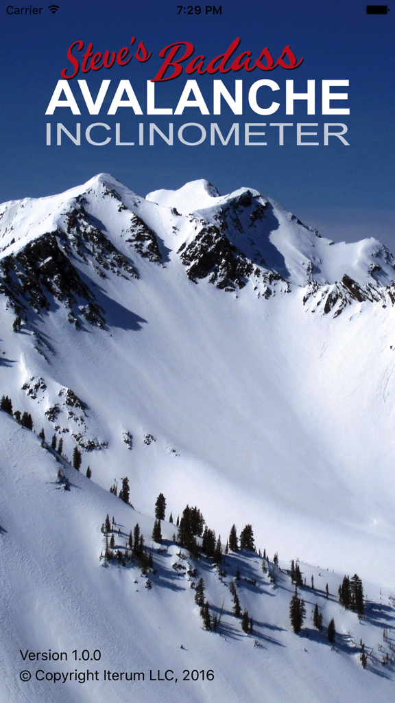
눈 덮인 산맥이 특징인 스티브의 멋진 눈사태 경사계 앱 홈 화면
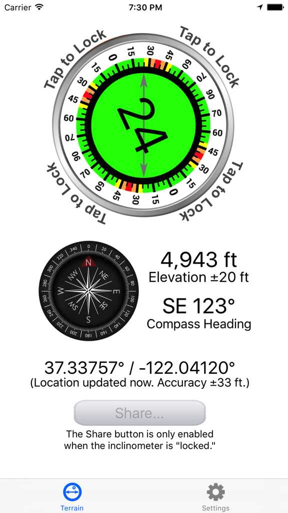
24도 경사각, 4943피트 고도 및 나침반 방향을 표시하는 눈사태 경사계 앱 화면
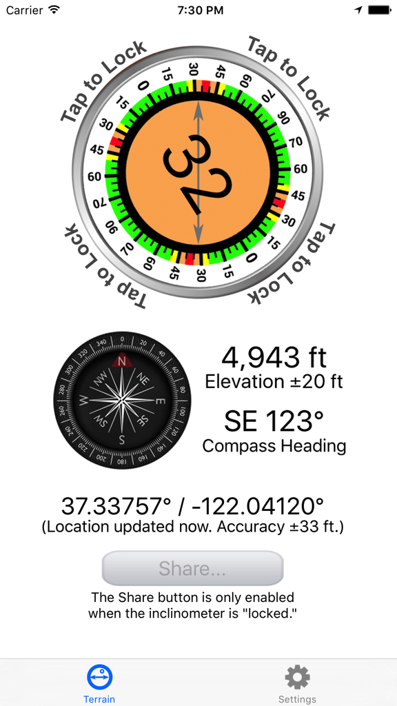
32도 경사 측정값, 나침반 방향, 고도 및 GPS 좌표를 표시하는 눈사태 경사계 앱 인터페이스
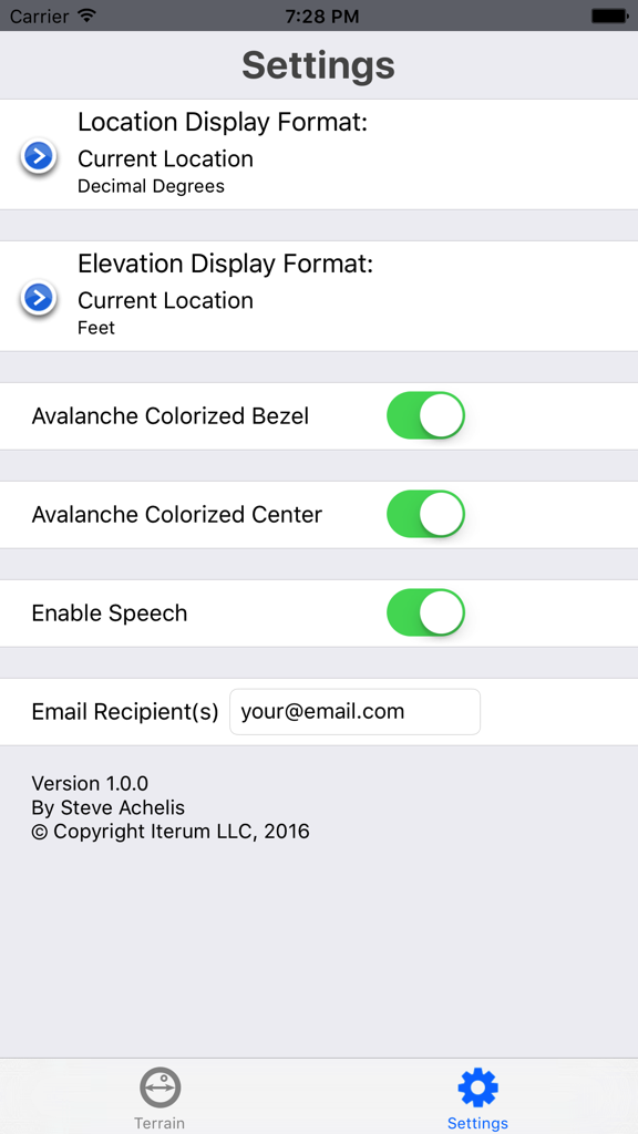
위치 형식, 색상화된 시각 보조 도구 및 음성 피드백 옵션이 있는 눈사태 경사계 앱의 설정 화면
설명
Download
비슷한 앱
같은 카테고리의 상위 앱

得物 - 得到美好事物
Shanghai Dewu Information Group Co., Ltd.

懂球帝 - 足球篮球体坛数据
Hainan Football-Loving Girl Network Technology Co., Ltd.

Underdog Sports
Underdog Sports, Inc.

虎扑-评分篮球足球游戏影视
Shanghai Kuanghui Network Technology Co., LTD

ESPN: Live Sports & Scores
Disney Electronic Content, Inc.

Flashscore: Live Scores & News
Livesport s.r.o.

Polymarket
Blockratize Inc

DAZN: Stream Live Sports
DAZN Limited

DraftKings Sportsbook & Casino
DRAFTKINGS LLC.
이 페이지는 앱이나 개발자의 공식 페이지가 아니며, 정보 제공 및 논평을 목적으로 작성된 독립 편집 간행물입니다. 명시적으로 달리 언급되지 않는 한, 해당 앱이나 개발자는 MWM, Apple, Google Play, 앱 퍼블리셔 또는 앱 개발자와 제휴, 보증, 후원, 승인 또는 공식적으로 연결되어 있지 않으며, 이 페이지의 어떤 내용도 해당 앱이 MWM의 서비스를 사용하여 개발되었음을 의미하지 않습니다. 모든 상표, 로고, 스크린샷 및 기타 콘텐츠는 해당 소유자의 자산입니다.