이 페이지는 앱이나 개발자의 공식 페이지가 아니며, 정보 제공 및 논평을 목적으로 작성된 독립 편집 간행물입니다. 명시적으로 달리 언급되지 않는 한, 해당 앱이나 개발자는 MWM, Apple, Google Play, 앱 퍼블리셔 또는 앱 개발자와 제휴, 보증, 후원, 승인 또는 공식적으로 연결되어 있지 않으며, 이 페이지의 어떤 내용도 해당 앱이 MWM의 서비스를 사용하여 개발되었음을 의미하지 않습니다. 모든 상표, 로고, 스크린샷 및 기타 콘텐츠는 해당 소유자의 자산입니다.

California Fire Cams
라이브 메가픽셀 카메라 피드, 대화형 산불 지도, 지역별 일기 예보로 연기보다 앞서나가세요. 매 순간이 중요할 때 가족과 집을 보호할 수 있는 실제 상황 정보를 얻으세요.
다운로드
2K+사용자 평점
총 평가 수
0개발사
카테고리
Travel지원 언어
1최신 버전
3.4.3크기
10.5 MB출시일
2018년 3월 4일실시간 시각 정보로 집을 보호하세요
산불 시즌 동안 안심하세요. 저희 앱은 고해상도 시각적 확인과 실시간 데이터를 제공하여 위협보다 앞서나가 가족을 보호하는 데 도움을 드립니다.
라이브 메가픽셀 카메라
수백 대의 카메라에서 제공되는 고해상도 시각적 피드로 "실제 상황"을 확인하고 수평선상의 연기 및 산불 활동을 모니터링하세요.
정밀 산불 추적
실시간 날씨 및 산불 예측과 결합된 대화형 지도에서 활성 산불 위치를 추적하여 정확히 위험이 어디에 있는지 파악하세요.
다음 스크린샷과 설명은 앱의 공식 스토어 목록에서 직접 가져온 것이며 앱 개발자의 자산입니다.
앱 스토어
스크린샷
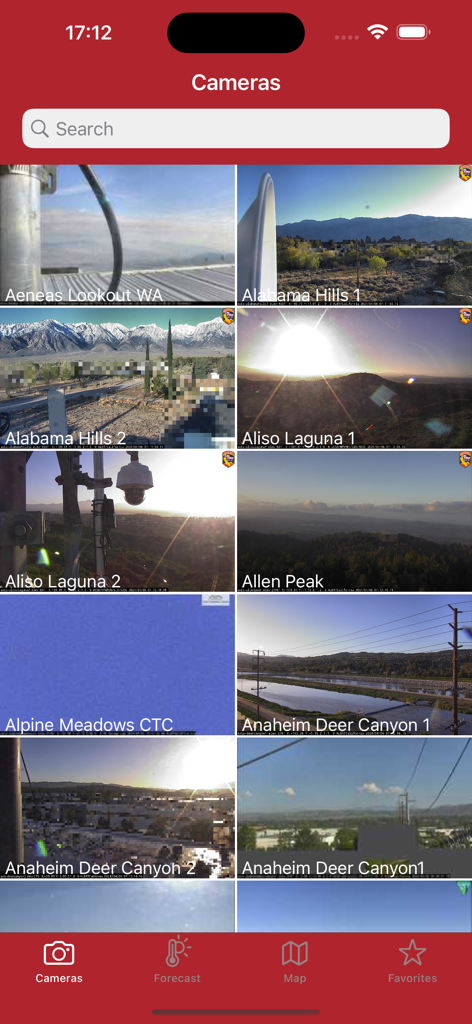
다양한 감시 지점의 실시간 피드를 표시하는 캘리포니아 산불 카메라 앱의 카메라 보기
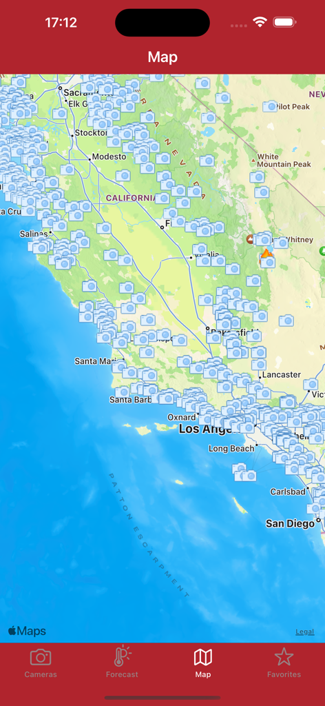
앱에서 수많은 산불 카메라 아이콘과 활성 산불 표시기를 표시하는 캘리포니아 지도 보기
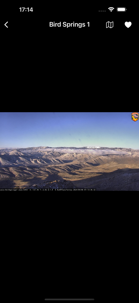
캘리포니아 버드 스프링스 1의 산악 풍경을 보여주는 실시간 산불 모니터링 카메라 보기
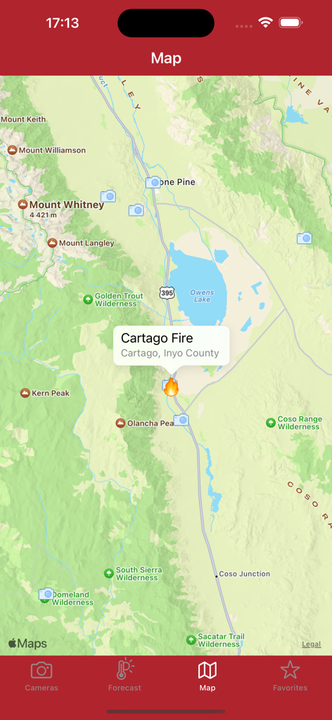
캘리포니아 산불 카메라 앱의 지도 인터페이스에 Cartago 산불에 대한 산불 경고 및 지역 모니터링 카메라 표시
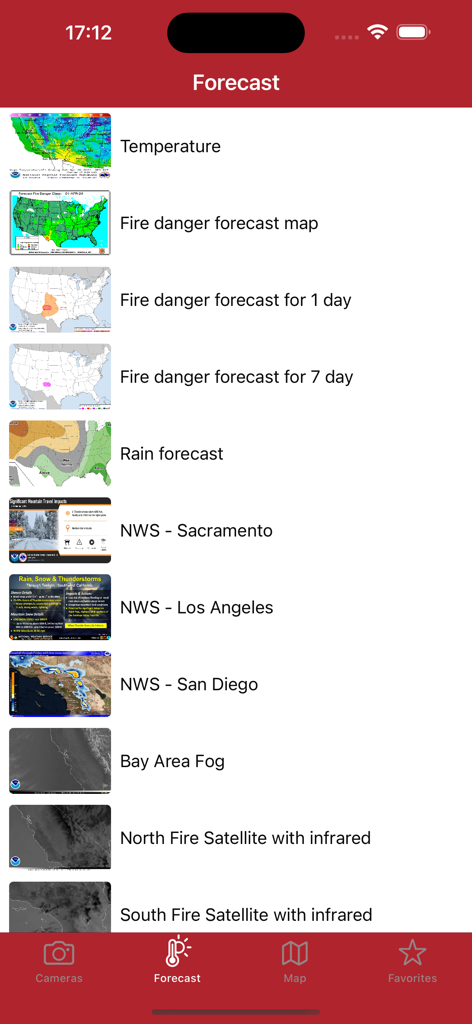
캘리포니아 산불 카메라 앱의 예측 화면에 산불 위험 및 일기 예보 지도 목록 표시
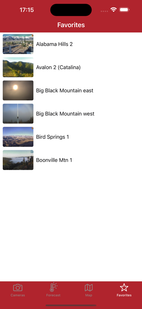
캘리포니아 산불 카메라 앱 즐겨찾기 화면에 위치 이름과 썸네일 이미지가 있는 실시간 산불 모니터링 카메라 피드 목록 표시
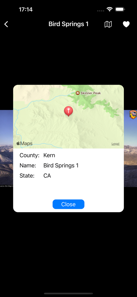
캘리포니아 컨 카운티의 버드 스프링스 1 산불 카메라 위치를 보여주는 지도 인터페이스
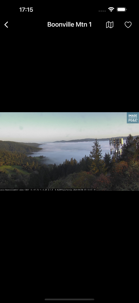
안개가 낀 계곡과 숲 지역을 보여주는 분빌 산의 라이브 메가픽셀 카메라 피드.
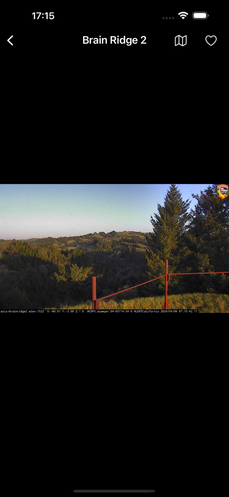
캘리포니아의 브레인 릿지 실시간 카메라 피드로 산불 모니터링
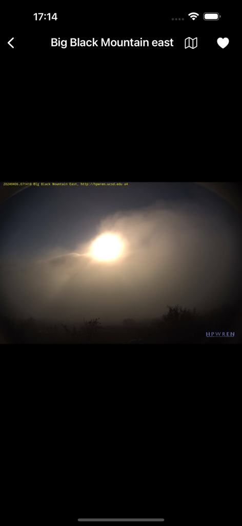
캘리포니아의 연기 또는 안개를 통과하는 태양을 보여주는 빅 블랙 마운틴 동쪽의 실시간 카메라 피드
설명
Download
비슷한 앱
같은 카테고리의 상위 앱

Uber - Request a ride
Uber Technologies, Inc.

Airbnb
Airbnb, Inc.

铁路12306
ACADEMY OF RAILWAY SCIENCES CO., ltd.

Booking.com: Hotels & Travel
Booking.com B.V.

Grab: Taxi Ride, Food Delivery
GRABTAXI HOLDINGS PTE. LTD.

DiDi China: Ride Hailing
Didi Chuxing (Beijing) Network Platform Technology Co., Ltd

Bolt: Request a Ride
BOLT TECHNOLOGY OU

去哪儿旅行-订酒店机票火车票
Beijing Qunar Information Technology Company Limit

Trip.com: Book Flights, Hotels
Trip.com Travel Singapore Pte. Ltd.
이 페이지는 앱이나 개발자의 공식 페이지가 아니며, 정보 제공 및 논평을 목적으로 작성된 독립 편집 간행물입니다. 명시적으로 달리 언급되지 않는 한, 해당 앱이나 개발자는 MWM, Apple, Google Play, 앱 퍼블리셔 또는 앱 개발자와 제휴, 보증, 후원, 승인 또는 공식적으로 연결되어 있지 않으며, 이 페이지의 어떤 내용도 해당 앱이 MWM의 서비스를 사용하여 개발되었음을 의미하지 않습니다. 모든 상표, 로고, 스크린샷 및 기타 콘텐츠는 해당 소유자의 자산입니다.