이 페이지는 앱이나 개발자의 공식 페이지가 아니며, 정보 제공 및 논평을 목적으로 작성된 독립 편집 간행물입니다. 명시적으로 달리 언급되지 않는 한, 해당 앱이나 개발자는 MWM, Apple, Google Play, 앱 퍼블리셔 또는 앱 개발자와 제휴, 보증, 후원, 승인 또는 공식적으로 연결되어 있지 않으며, 이 페이지의 어떤 내용도 해당 앱이 MWM의 서비스를 사용하여 개발되었음을 의미하지 않습니다. 모든 상표, 로고, 스크린샷 및 기타 콘텐츠는 해당 소유자의 자산입니다.

Fires: Wildfire News and Atlas
수백만 명이 신뢰하는 전문가급 도구로 집과 가족을 보호하세요. 실시간 3D 항공기 추적, 공식 대피 경보, 고해상도 오프라인 지도로 활성 화재를 모니터링하세요.
다운로드
349K+사용자 평점
총 평가 수
100개발사
카테고리
News지원 언어
1최신 버전
4.7.0크기
54.6 MB출시일
2016년 9월 8일당신의 안전을 위한 전문가급 정보
세계에서 가장 신뢰받는 산불 추적기를 통해 응급 구조대원이 사용하는 것과 동일한 실시간 데이터에 액세스하여 집, 가족 및 야외 활동을 보호하세요.
실시간 3D 항공기 추적
3D 비행 경로를 통해 소방 항공기와 헬리콥터를 실시간으로 모니터링하여 진압 노력이 어디에 집중되고 있는지 정확히 확인하세요.
전문가용 오프라인 지도
통신 서비스가 없는 곳에서도 작동하는 80개 이상의 고해상도 국유림 및 BLM 지도를 사용하여 오지에서도 안전하게 탐색하세요.
다음 스크린샷과 설명은 앱의 공식 스토어 목록에서 직접 가져온 것이며 앱 개발자의 자산입니다.
앱 스토어
스크린샷
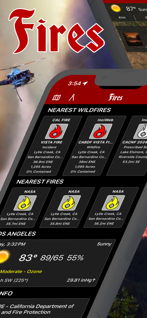
실시간 산불 추적 및 지역 기상 데이터를 보여주는 Fires 앱의 인터페이스
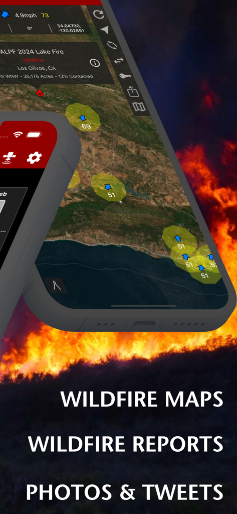
화염 배경 위로 산불 지도와 사건 보고서를 보여주는 Fires 앱 인터페이스
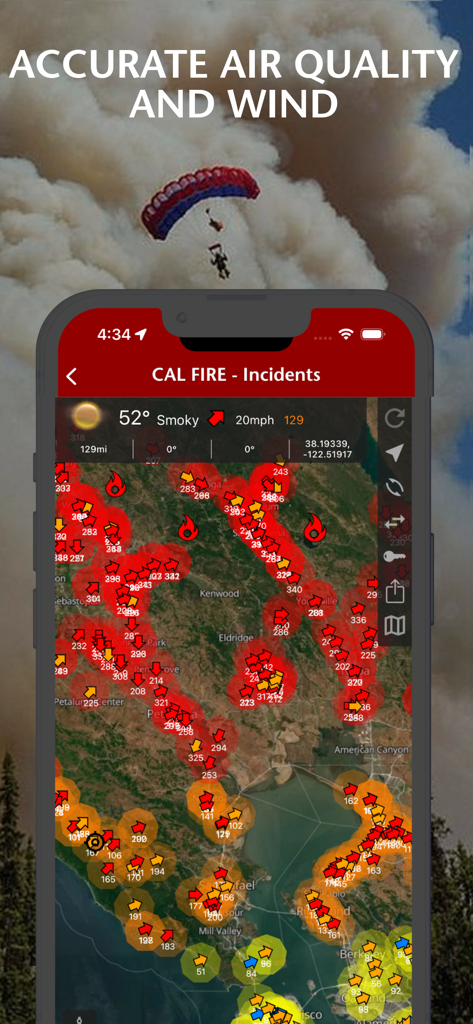
대화형 사건 지도에 공기질과 풍향 조건을 표시하는 산불 뉴스 앱
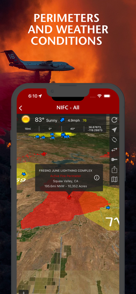
Fires 앱의 지도에 산불 경계와 기상 조건을 표시하는 스마트폰 화면

지도 경계와 2024년 레이크 화재 사진을 포함한 산불 사건 상세 정보를 표시하는 모바일 앱 인터페이스
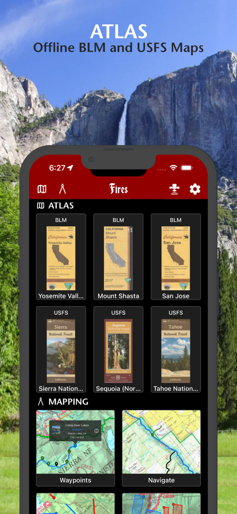
국유림 및 공원을 위한 오프라인 BLM 및 USFS 지도를 보여주는 Fires 앱 인터페이스
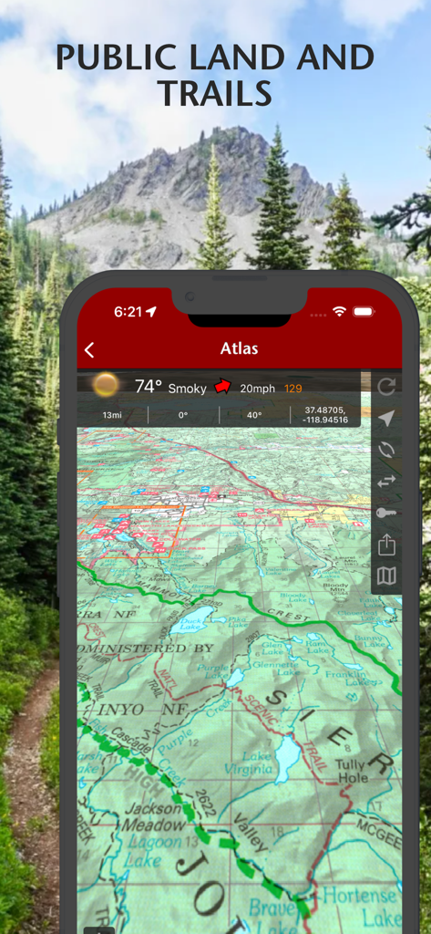
Fires 앱에서 기상 데이터와 함께 공유지 및 하이킹 트레일을 보여주는 지형도 보기
설명
Download
비슷한 앱
같은 카테고리의 상위 앱

X
X Corp.

REDDIT, INC.

Substack
Substack Inc.

NYTimes: US and Global News
The New York Times Company

Nextdoor: Neighborhood Network
Nextdoor.com, Inc.

CrimeRadar Dispatch Audio
Scoopz Inc.

NewsBreak: Local News & Alerts
Particle Media Inc.

Ground News
Snapwise Inc.

Google News
Google LLC
이 페이지는 앱이나 개발자의 공식 페이지가 아니며, 정보 제공 및 논평을 목적으로 작성된 독립 편집 간행물입니다. 명시적으로 달리 언급되지 않는 한, 해당 앱이나 개발자는 MWM, Apple, Google Play, 앱 퍼블리셔 또는 앱 개발자와 제휴, 보증, 후원, 승인 또는 공식적으로 연결되어 있지 않으며, 이 페이지의 어떤 내용도 해당 앱이 MWM의 서비스를 사용하여 개발되었음을 의미하지 않습니다. 모든 상표, 로고, 스크린샷 및 기타 콘텐츠는 해당 소유자의 자산입니다.