이 페이지는 앱이나 개발자의 공식 페이지가 아니며, 정보 제공 및 논평을 목적으로 작성된 독립 편집 간행물입니다. 명시적으로 달리 언급되지 않는 한, 해당 앱이나 개발자는 MWM, Apple, Google Play, 앱 퍼블리셔 또는 앱 개발자와 제휴, 보증, 후원, 승인 또는 공식적으로 연결되어 있지 않으며, 이 페이지의 어떤 내용도 해당 앱이 MWM의 서비스를 사용하여 개발되었음을 의미하지 않습니다. 모든 상표, 로고, 스크린샷 및 기타 콘텐츠는 해당 소유자의 자산입니다.

GPS Altitude&Height tracker
하이커와 등산가를 위한 필수 오프라인 툴킷. 어디에서나 고도, 기압, 정확한 위치를 추적한 다음, 통계 스탬프가 찍힌 워터마크 카메라로 정상의 영광을 공유하세요.
다운로드
80K+사용자 평점
총 평가 수
1K+개발사
카테고리
Travel지원 언어
2최신 버전
2.0.1크기
16.8 MB출시일
2024년 12월 10일모든 산을 정복하세요
하이커와 탐험가가 고도를 추적하고, 안전을 유지하며, 정상 성과를 공유할 수 있는 필수 정밀 도구입니다.
오프라인 고도 추적
휴대폰 서비스가 없는 외딴 지역에서도 어디에서나 실시간 고도 및 GPS 데이터를 얻으세요.
정상 워터마크 카메라
즉각적인 소셜 증명을 위해 자동 고도 및 위치 스탬프가 찍힌 최고의 순간을 캡처하세요.
다음 스크린샷과 설명은 앱의 공식 스토어 목록에서 직접 가져온 것이며 앱 개발자의 자산입니다.
앱 스토어
스크린샷
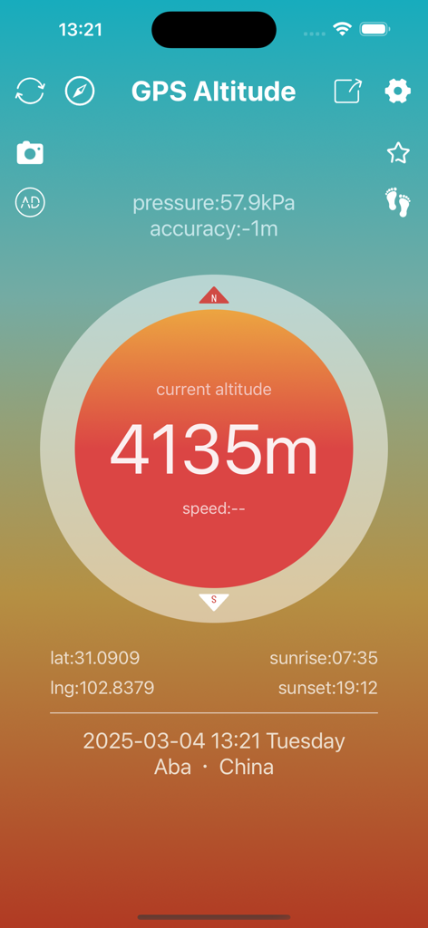
4135미터의 현재 고도와 기압 및 위치 데이터가 표시되는 GPS 고도 앱 인터페이스
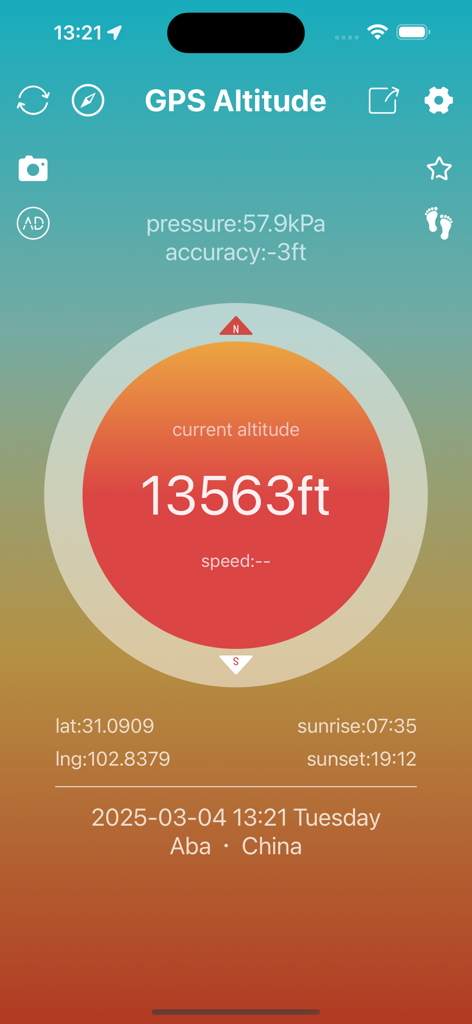
13563피트의 현재 고도와 기압 및 좌표가 표시되는 GPS 고도 앱 인터페이스

4135미터의 현재 높이와 지형도상의 위치가 표시되는 GPS 고도 추적기 앱의 모바일 인터페이스
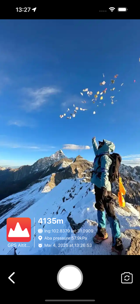
4135미터의 고도와 위치 좌표가 표시되는 GPS 워터마크가 있는 눈 덮인 산 정상의 등산객
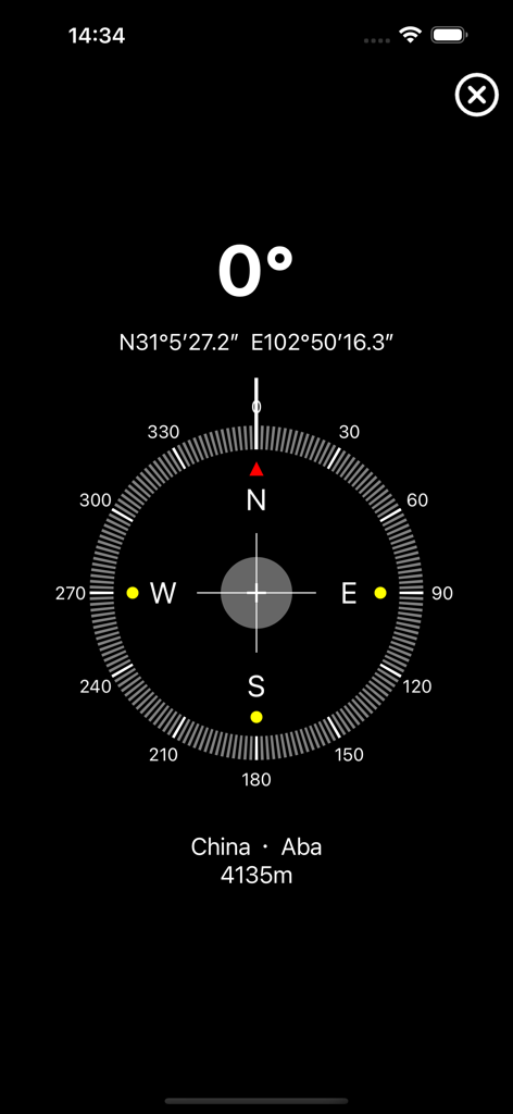
북쪽 0도를 표시하는 디지털 나침반 인터페이스와 4135미터의 GPS 좌표 및 고도
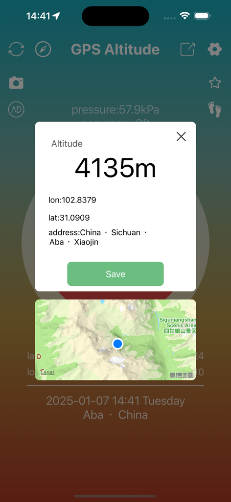
4135미터의 고도와 위도 경도 좌표 및 지도 위치가 표시되는 GPS 고도 앱 인터페이스
설명
Download
비슷한 앱
같은 카테고리의 상위 앱

Uber - Request a ride
Uber Technologies, Inc.

Airbnb
Airbnb, Inc.

铁路12306
ACADEMY OF RAILWAY SCIENCES CO., ltd.

Booking.com: Hotels & Travel
Booking.com B.V.

Grab: Taxi Ride, Food Delivery
GRABTAXI HOLDINGS PTE. LTD.

Trip.com: Book Flights, Hotels
Trip.com Travel Singapore Pte. Ltd.

DiDi China: Ride Hailing
Didi Chuxing (Beijing) Network Platform Technology Co., Ltd

去哪儿旅行-订酒店机票火车票
Beijing Qunar Information Technology Company Limit

Bolt: Request a Ride
BOLT TECHNOLOGY OU
이 페이지는 앱이나 개발자의 공식 페이지가 아니며, 정보 제공 및 논평을 목적으로 작성된 독립 편집 간행물입니다. 명시적으로 달리 언급되지 않는 한, 해당 앱이나 개발자는 MWM, Apple, Google Play, 앱 퍼블리셔 또는 앱 개발자와 제휴, 보증, 후원, 승인 또는 공식적으로 연결되어 있지 않으며, 이 페이지의 어떤 내용도 해당 앱이 MWM의 서비스를 사용하여 개발되었음을 의미하지 않습니다. 모든 상표, 로고, 스크린샷 및 기타 콘텐츠는 해당 소유자의 자산입니다.