이 페이지는 앱이나 개발자의 공식 페이지가 아니며, 정보 제공 및 논평을 목적으로 작성된 독립 편집 간행물입니다. 명시적으로 달리 언급되지 않는 한, 해당 앱이나 개발자는 MWM, Apple, Google Play, 앱 퍼블리셔 또는 앱 개발자와 제휴, 보증, 후원, 승인 또는 공식적으로 연결되어 있지 않으며, 이 페이지의 어떤 내용도 해당 앱이 MWM의 서비스를 사용하여 개발되었음을 의미하지 않습니다. 모든 상표, 로고, 스크린샷 및 기타 콘텐츠는 해당 소유자의 자산입니다.

Hunterra: map&book your hunts
실시간 참가자 및 사냥개 추적, 오프라인 GPS 지도, 안전과 성공을 위해 설계된 완벽한 토지 관리 시스템으로 사냥터를 마스터하세요.
다운로드
12K+사용자 평점
총 평가 수
100개발사
카테고리
Sports지원 언어
16최신 버전
2.5.17크기
149.2 MB출시일
2020년 8월 31일정밀하게 사냥터를 관리하세요
상세한 토지 관리부터 전문가 수준의 그룹 조정까지, Hunterra는 모든 현대 사냥꾼에게 필요한 전술적 우위를 제공합니다.
실시간 그룹 조정
합동 사냥 중 모든 참가자와 사냥개의 실시간 움직임을 추적하여 최대의 안전을 보장합니다. Garmin 및 Dogtrace를 완벽하게 지원합니다.
스마트 임대 관리
사냥 거치대 디지털 예약 시스템과 사냥 클럽 및 개인 토지 관리자를 위한 방문자 기록부로 추측을 없애세요.
다음 스크린샷과 설명은 앱의 공식 스토어 목록에서 직접 가져온 것이며 앱 개발자의 자산입니다.
앱 스토어
스크린샷
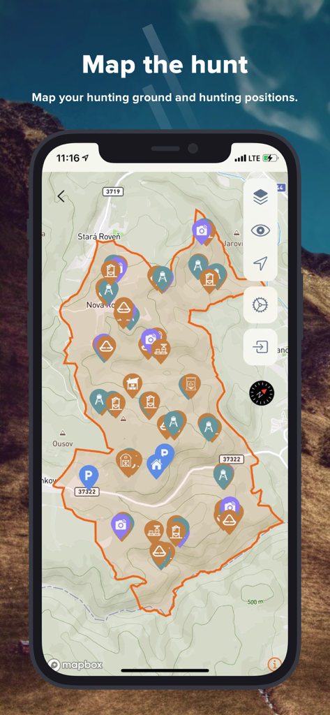
Hunterra 앱 인터페이스를 보여주는 스마트폰. 사냥터 경계선과 거치대 및 트레일 카메라 마커가 표시된 지형도.
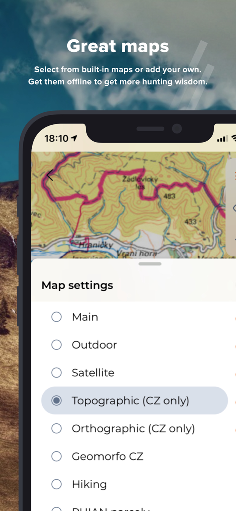
사냥을 위한 다양한 지형 및 위성 지도 설정을 보여주는 Hunterra 앱 인터페이스
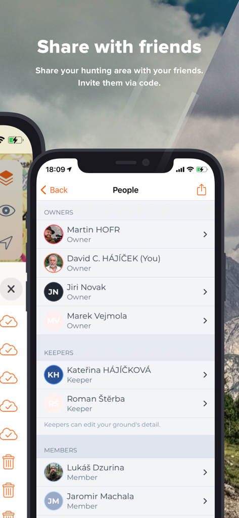
사냥터의 소유자, 관리자, 회원으로 분류된 사람들의 목록을 보여주는 Hunterra의 모바일 앱 화면
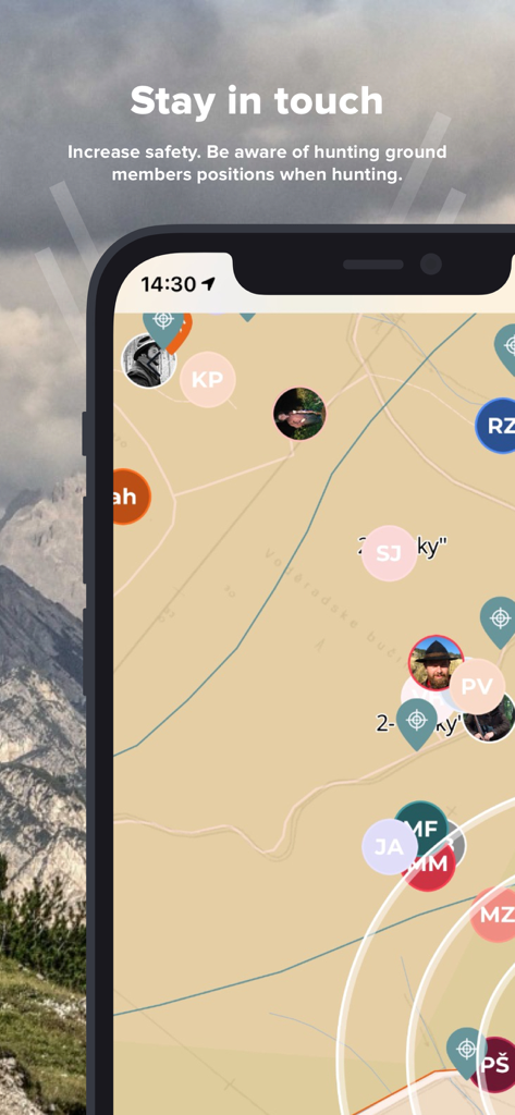
지도에서 사냥 팀원들의 실시간 위치 추적을 보여주는 Hunterra 앱 화면
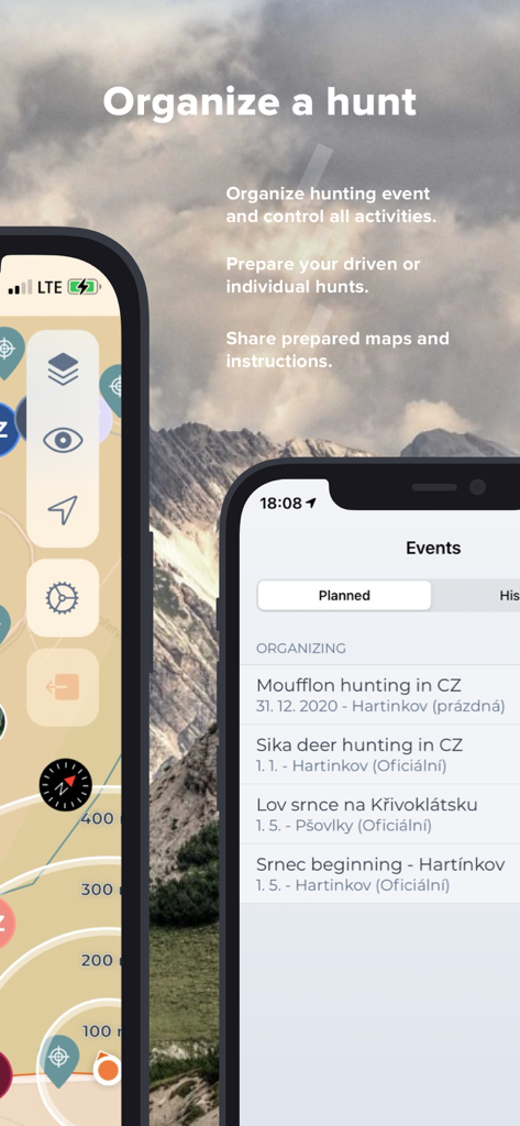
산 배경에 대해 사냥 이벤트를 구성하고 지도를 계획하는 Hunterra 앱을 보여주는 두 개의 스마트폰
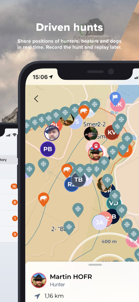
합동 사냥 중 사냥꾼과 사냥개의 실시간 위치를 보여주는 Hunterra 앱의 실시간 지도
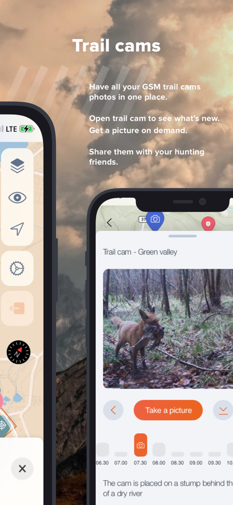
사냥을 위한 통합 트레일 카메라 사진 및 원격 관리 도구를 보여주는 Hunterra 앱 화면
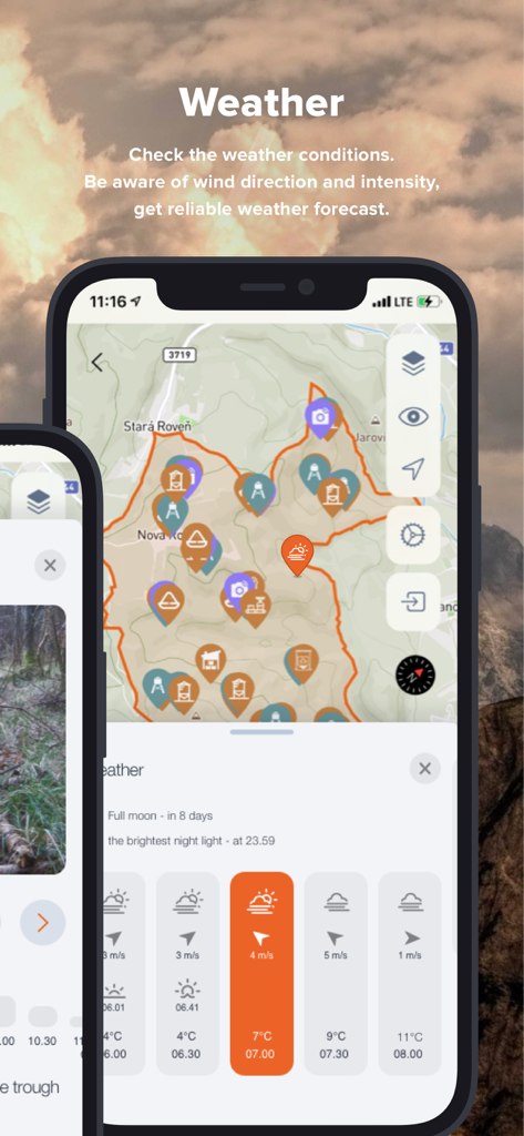
지형도에 사냥 날씨 조건과 풍향을 표시하는 Hunterra 앱 인터페이스
설명
Download
비슷한 앱
같은 카테고리의 상위 앱

得物 - 得到美好事物
Shanghai Dewu Information Group Co., Ltd.

懂球帝 - 足球篮球体坛数据
Hainan Football-Loving Girl Network Technology Co., Ltd.

Underdog Sports
Underdog Sports, Inc.

虎扑-评分篮球足球游戏影视
Shanghai Kuanghui Network Technology Co., LTD

ESPN: Live Sports & Scores
Disney Electronic Content, Inc.

Flashscore: Live Scores & News
Livesport s.r.o.

Polymarket
Blockratize Inc

DAZN: Stream Live Sports
DAZN Limited

DraftKings Sportsbook & Casino
DRAFTKINGS LLC.
이 페이지는 앱이나 개발자의 공식 페이지가 아니며, 정보 제공 및 논평을 목적으로 작성된 독립 편집 간행물입니다. 명시적으로 달리 언급되지 않는 한, 해당 앱이나 개발자는 MWM, Apple, Google Play, 앱 퍼블리셔 또는 앱 개발자와 제휴, 보증, 후원, 승인 또는 공식적으로 연결되어 있지 않으며, 이 페이지의 어떤 내용도 해당 앱이 MWM의 서비스를 사용하여 개발되었음을 의미하지 않습니다. 모든 상표, 로고, 스크린샷 및 기타 콘텐츠는 해당 소유자의 자산입니다.