이 페이지는 앱이나 개발자의 공식 페이지가 아니며, 정보 제공 및 논평을 목적으로 작성된 독립 편집 간행물입니다. 명시적으로 달리 언급되지 않는 한, 해당 앱이나 개발자는 MWM, Apple, Google Play, 앱 퍼블리셔 또는 앱 개발자와 제휴, 보증, 후원, 승인 또는 공식적으로 연결되어 있지 않으며, 이 페이지의 어떤 내용도 해당 앱이 MWM의 서비스를 사용하여 개발되었음을 의미하지 않습니다. 모든 상표, 로고, 스크린샷 및 기타 콘텐츠는 해당 소유자의 자산입니다.

Hurricane Track- Storm Tracker
미디어의 과장된 보도를 건너뛰고 실시간 NEXRAD 레이더, GOES-19 위성 이미지, 정확한 5일 폭풍 경로에 액세스하세요. 가장 중요한 순간에 정보에 입각한 안전 결정을 내리는 데 필요한 고급 기상 도구를 모두 무료로 이용하세요.
다운로드
530K+사용자 평점
총 평가 수
100개발사
카테고리
Weather지원 언어
1최신 버전
3.5.0크기
25.6 MB출시일
2011년 5월 22일집을 위한 전문가 수준의 폭풍 정보
전문 기상학자들이 사용하는 것과 동일한 고해상도 데이터에 액세스하여 위협을 모니터링하고 위험을 평가하며 자신 있게 재산을 보호하세요.
NEXRAD 지역 레이더
특정 우편번호에 대한 정밀 기술로 초지역 위험 및 토네이도 경보를 모니터링하세요.
5일 예측 경로
GOES-19 위성 이미지를 사용하여 향후 열대성 저기압의 궤적을 추적하여 영향 며칠 전에 대비하세요.
자주 묻는 질문
에 대해 알아야 할 모든 것 Hurricane Track- Storm Tracker
허리케인 트랙-스톰 트래커는 무료인가요?
네, 허리케인 트랙-스톰 트래커는 무료 애플리케이션입니다. 앱 설명에 "허리케인 트랙은 무료입니다!"라고 명시되어 있습니다.
허리케인 트랙 3.0에는 어떤 레이더 기술이 사용되나요?
허리케인 트랙 3.0은 GOES-19 위성과 사용자 정의 가능한 NEXRAD 기술 기반 로컬 레이더를 포함한 18개의 월드 레이더를 사용합니다. 또한 혁신적인 낙뢰 강도 레이더도 제공합니다.
허리케인 트랙-스톰 트래커는 특정 지역에 대한 로컬 레이더를 제공하나요?
허리케인 트랙-스톰 트래커는 예상되는 열대 폭풍 경로를 보여줄 수 있나요?
네, 허리케인 트랙-스톰 트래커는 향후 예상되는 열대 저기압 경로를 표시합니다. 향후 5일간의 예측을 제공합니다.
허리케인 트랙-스톰 트래커는 어떤 위험 경고를 제공하나요?
허리케인 트랙-스톰 트래커는 토네이도 워치, 홍수 경보, 만조 등 다양한 이벤트에 대한 상세한 예보 및 위험 경고를 제공합니다. 이 기능은 미국 전용이며 매시간 업데이트됩니다.
허리케인 트랙 3.0에는 3D 지구 시각화 기능이 포함되어 있나요?
네, 허리케인 트랙 3.0은 인터랙티브 3D 지구 기능을 제공합니다. 이 시각화는 실시간 구름, 열대 폭풍 및 지진을 표시합니다.
허리케인 트랙-스톰 트래커는 해수면 온도 데이터를 제공하나요?
네, 허리케인 트랙-스톰 트래커는 해수면 온도 데이터를 제공합니다. 이 데이터는 지난 두 달간의 기록을 바탕으로 제공됩니다.
다음 스크린샷과 설명은 앱의 공식 스토어 목록에서 직접 가져온 것이며 앱 개발자의 자산입니다.
앱 스토어
스크린샷
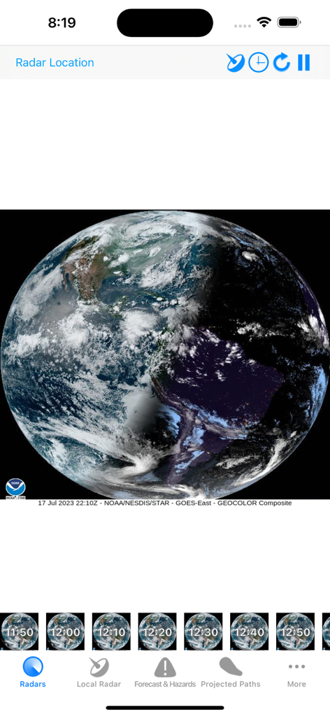
허리케인 추적기 모바일 앱에서 실시간 구름 범위를 보여주는 지구 위성 보기
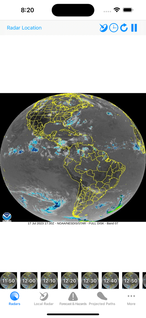
허리케인 추적기 앱에서 아메리카 대륙의 전 세계 위성 레이더 보기
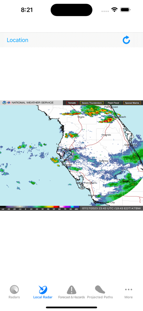
허리케인 추적기 앱에서 날씨 강도를 표시하는 플로리다 지역 NEXRAD 레이더 지도
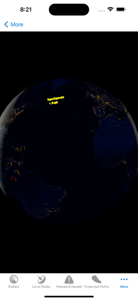
허리케인 추적기 앱에서 열대성 저기압을 보여주는 대화형 3D 지구 보기
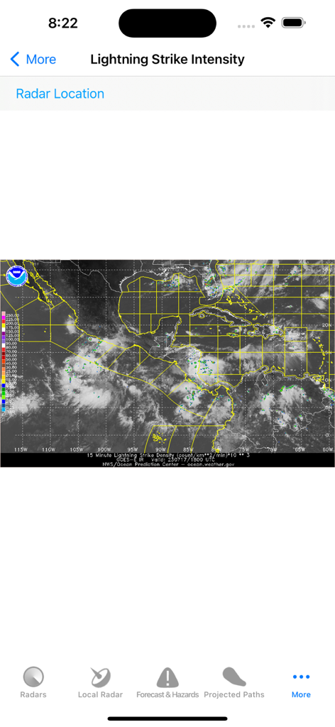
허리케인 추적기 앱의 번개 강도 지도
설명
Download
비슷한 앱
유사한 기능과 사용자 경험을 가진 앱

Watch Duty: Wildfire Maps
Sherwood Forestry Service, Inc.

My Hurricane Tracker & Alerts
JRustonApps B.V.

Air Quality & Pollen - AirCare
AirCare Data, Inc.

My Hurricane Tracker Pro
JRustonApps B.V.

เช็คน้ำ
Geo-Informatics and Space Technology Development Agency

SharkSmart
NSW Trade & Investment, Regional Infrastructure & Services

Dorsal Shark Reports
Bluebottle Digital Pty. Ltd.

global storms
Kelly Technology Inc.

My AQI Air Quality & Pollution
Jean Baptiste Stevenard
이 페이지는 앱이나 개발자의 공식 페이지가 아니며, 정보 제공 및 논평을 목적으로 작성된 독립 편집 간행물입니다. 명시적으로 달리 언급되지 않는 한, 해당 앱이나 개발자는 MWM, Apple, Google Play, 앱 퍼블리셔 또는 앱 개발자와 제휴, 보증, 후원, 승인 또는 공식적으로 연결되어 있지 않으며, 이 페이지의 어떤 내용도 해당 앱이 MWM의 서비스를 사용하여 개발되었음을 의미하지 않습니다. 모든 상표, 로고, 스크린샷 및 기타 콘텐츠는 해당 소유자의 자산입니다.