이 페이지는 앱이나 개발자의 공식 페이지가 아니며, 정보 제공 및 논평을 목적으로 작성된 독립 편집 간행물입니다. 명시적으로 달리 언급되지 않는 한, 해당 앱이나 개발자는 MWM, Apple, Google Play, 앱 퍼블리셔 또는 앱 개발자와 제휴, 보증, 후원, 승인 또는 공식적으로 연결되어 있지 않으며, 이 페이지의 어떤 내용도 해당 앱이 MWM의 서비스를 사용하여 개발되었음을 의미하지 않습니다. 모든 상표, 로고, 스크린샷 및 기타 콘텐츠는 해당 소유자의 자산입니다.

다운로드
107K+사용자 평점
총 평가 수
100개발사
카테고리
Travel지원 언어
31최신 버전
5.11크기
75.1 MB출시일
2014년 6월 29일영원한 도시로 시간 여행
1748년 Nolli 지도를 사용하여 학자처럼 정확하고 18세기 여행자처럼 경이롭게 로마를 탐험하세요. 이 지도는 현대 GPS와 완벽하게 동기화됩니다.
실시간 역사 탐색
걸으면서 3세기 도시 역사를 원활하게 연결하며 원본 1748년 지도에서 실시간 위치를 추적하세요.
1,400개 이상의 지리 참조 장소
Giambattista Nolli의 원본 색인을 사용하여 현대 지도에서 놓치는 숨겨진 안뜰, 역사적인 포털 및 랜드마크를 발견하세요.
다음 스크린샷과 설명은 앱의 공식 스토어 목록에서 직접 가져온 것이며 앱 개발자의 자산입니다.
앱 스토어
스크린샷
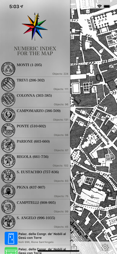
숫자 색인과 1748년 로마 지도 섹션이 표시된 모바일 화면
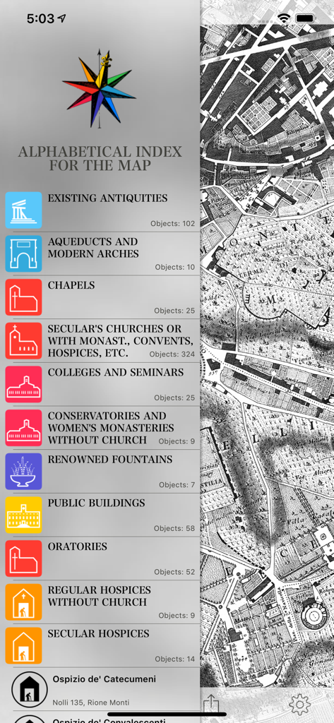
Nolli 1748년 로마 지도의 알파벳순 랜드마크 및 장소 색인
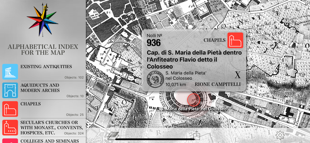
1748년 로마의 알파벳순 색인 및 역사 지도 탐색 (콜로세움 지역 표시)
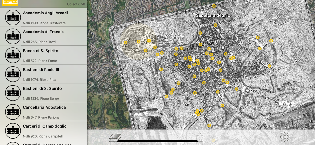
위치 핀과 측면 색인 목록이 있는 1748년 로마 역사 지도 표시 Nolli 앱 인터페이스
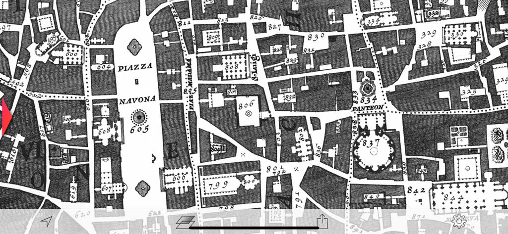
나보나 광장과 판테온을 보여주는 1748년 로마 상세 역사 지도
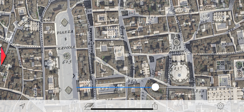
나보나 광장과 판테온을 보여주는 1748년 로마 상세 역사 지도
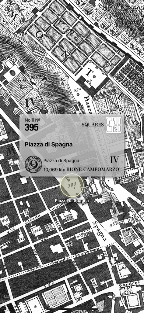
1748년 로마의 스페인 광장을 보여주는 Nolli 지도 인터페이스
설명
Download
비슷한 앱
같은 카테고리의 상위 앱

Uber - Request a ride
Uber Technologies, Inc.

Airbnb
Airbnb, Inc.

铁路12306
ACADEMY OF RAILWAY SCIENCES CO., ltd.

Booking.com: Hotels & Travel
Booking.com B.V.

Grab: Taxi Ride, Food Delivery
GRABTAXI HOLDINGS PTE. LTD.

Trip.com: Book Flights, Hotels
Trip.com Travel Singapore Pte. Ltd.

DiDi China: Ride Hailing
Didi Chuxing (Beijing) Network Platform Technology Co., Ltd

去哪儿旅行-订酒店机票火车票
Beijing Qunar Information Technology Company Limit

Bolt: Request a Ride
BOLT TECHNOLOGY OU
이 페이지는 앱이나 개발자의 공식 페이지가 아니며, 정보 제공 및 논평을 목적으로 작성된 독립 편집 간행물입니다. 명시적으로 달리 언급되지 않는 한, 해당 앱이나 개발자는 MWM, Apple, Google Play, 앱 퍼블리셔 또는 앱 개발자와 제휴, 보증, 후원, 승인 또는 공식적으로 연결되어 있지 않으며, 이 페이지의 어떤 내용도 해당 앱이 MWM의 서비스를 사용하여 개발되었음을 의미하지 않습니다. 모든 상표, 로고, 스크린샷 및 기타 콘텐츠는 해당 소유자의 자산입니다.