이 페이지는 앱이나 개발자의 공식 페이지가 아니며, 정보 제공 및 논평을 목적으로 작성된 독립 편집 간행물입니다. 명시적으로 달리 언급되지 않는 한, 해당 앱이나 개발자는 MWM, Apple, Google Play, 앱 퍼블리셔 또는 앱 개발자와 제휴, 보증, 후원, 승인 또는 공식적으로 연결되어 있지 않으며, 이 페이지의 어떤 내용도 해당 앱이 MWM의 서비스를 사용하여 개발되었음을 의미하지 않습니다. 모든 상표, 로고, 스크린샷 및 기타 콘텐츠는 해당 소유자의 자산입니다.

OilTrails
에너지 전문가를 위한 최고의 리스 로케이터. API 또는 법적 설명으로 검색하고, 원격 리스 도로를 위한 오프라인 GPS에 액세스하며, 과거 강수량을 확인하여 진흙을 피하고 일정을 지키십시오.
다운로드
41K+사용자 평점
총 평가 수
300개발사
카테고리
Navigation지원 언어
1최신 버전
2.3.027크기
118.2 MB출시일
2016년 9월 15일유전 전문가를 위한 정밀 도구
에너지 부문을 위해 설계되고 현장에서 검증된 단일 인터페이스를 통해 리스 도로의 '라스트 마일'을 탐색하고, 중요한 유정 데이터에 액세스하고, 현장 상태를 모니터링하십시오.
오프라인 지원 사이트 내비게이션
가장 깊은 데드존에서도 작동하는 턴바이턴 GPS를 사용하여 셀 서비스 없이 원격 리스 도로를 탐색하십시오.
API 또는 법적 토지로 검색
위치를 추측하지 마십시오. 13개 주에 걸쳐 API 번호, 운영자 이름 또는 법적 토지 설명을 입력하여 다음 작업 현장을 즉시 찾으십시오.
다음 스크린샷과 설명은 앱의 공식 스토어 목록에서 직접 가져온 것이며 앱 개발자의 자산입니다.
앱 스토어
스크린샷
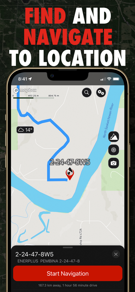
내비게이션 시작 버튼과 함께 유정 부지로 가는 경로를 보여주는 OilTrails 앱의 내비게이션 화면
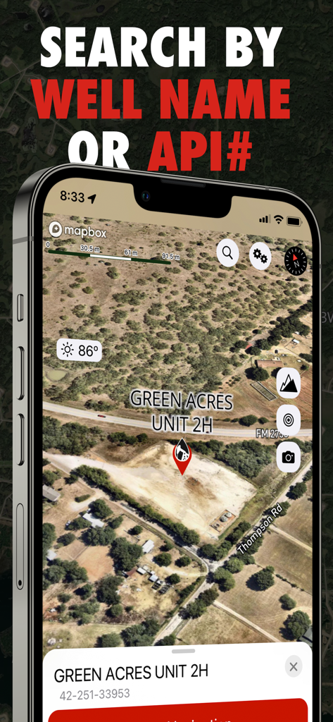
유정 이름 또는 API 번호 검색 기능이 있는 Green Acres Unit 2H의 위성 지도 위치를 보여주는 OilTrails 앱 화면
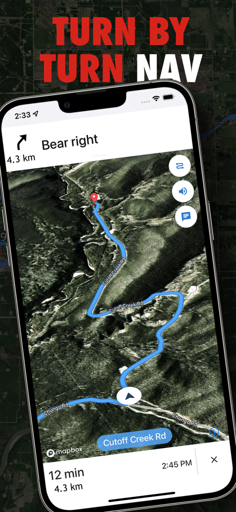
석유 및 가스전 위치에 대한 위성 지도의 턴바이턴 내비게이션을 보여주는 OilTrails 앱의 스크린샷
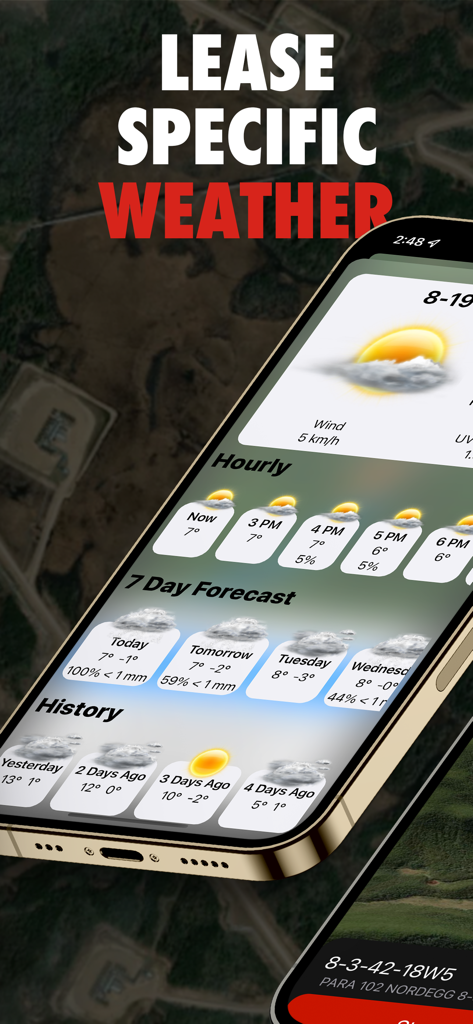
유전 운영을 위한 리스별 일기 예보 및 강수 기록을 보여주는 OilTrails 모바일 앱 인터페이스
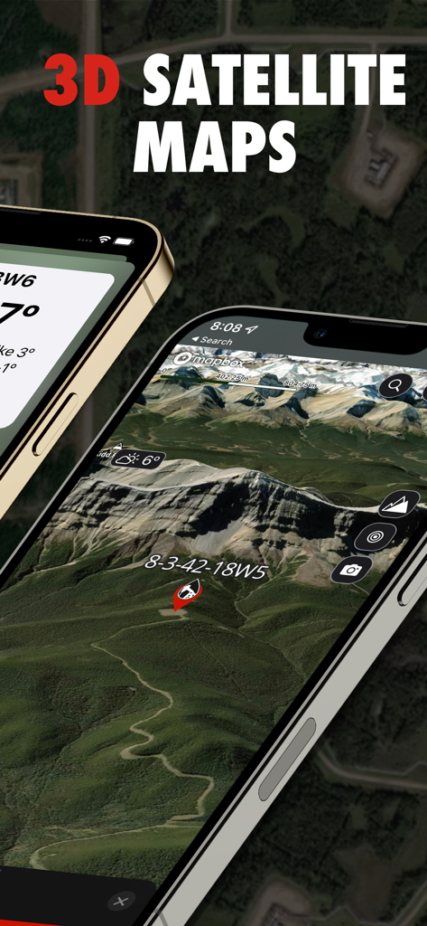
유정 위치의 3D 위성 지도를 보여주는 OilTrails 앱 인터페이스
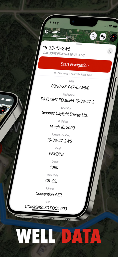
운영자 굴착 날짜 및 현장 데이터를 포함한 상세한 유정 정보를 표시하는 OilTrails 앱 화면
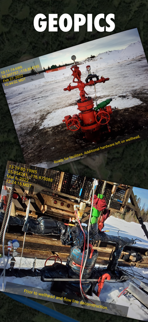
GPS 좌표 및 상태 메모와 함께 위치 정보가 태그된 유정 헤드 사진을 표시하는 OilTrails 앱 인터페이스
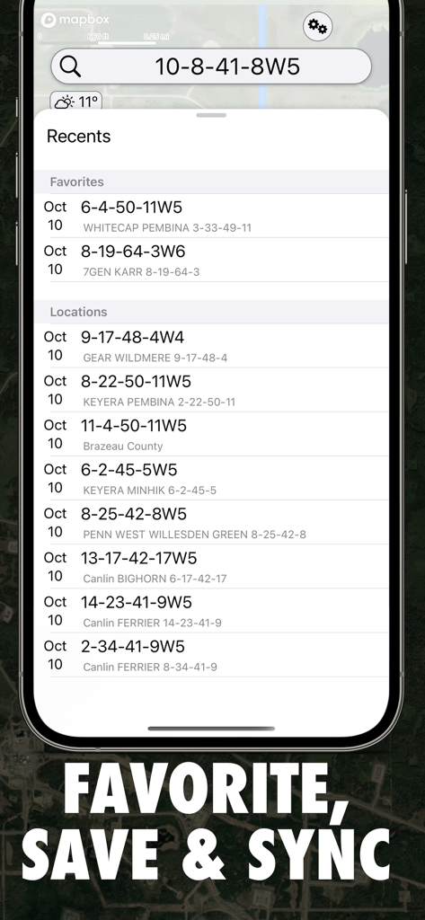
법적 토지 설명이 포함된 즐겨찾기 및 최근 유전 위치를 보여주는 OilTrails 앱 인터페이스
설명
Download


이 페이지는 앱이나 개발자의 공식 페이지가 아니며, 정보 제공 및 논평을 목적으로 작성된 독립 편집 간행물입니다. 명시적으로 달리 언급되지 않는 한, 해당 앱이나 개발자는 MWM, Apple, Google Play, 앱 퍼블리셔 또는 앱 개발자와 제휴, 보증, 후원, 승인 또는 공식적으로 연결되어 있지 않으며, 이 페이지의 어떤 내용도 해당 앱이 MWM의 서비스를 사용하여 개발되었음을 의미하지 않습니다. 모든 상표, 로고, 스크린샷 및 기타 콘텐츠는 해당 소유자의 자산입니다.