이 페이지는 앱이나 개발자의 공식 페이지가 아니며, 정보 제공 및 논평을 목적으로 작성된 독립 편집 간행물입니다. 명시적으로 달리 언급되지 않는 한, 해당 앱이나 개발자는 MWM, Apple, Google Play, 앱 퍼블리셔 또는 앱 개발자와 제휴, 보증, 후원, 승인 또는 공식적으로 연결되어 있지 않으며, 이 페이지의 어떤 내용도 해당 앱이 MWM의 서비스를 사용하여 개발되었음을 의미하지 않습니다. 모든 상표, 로고, 스크린샷 및 기타 콘텐츠는 해당 소유자의 자산입니다.

OldMapsOnline - History & Maps
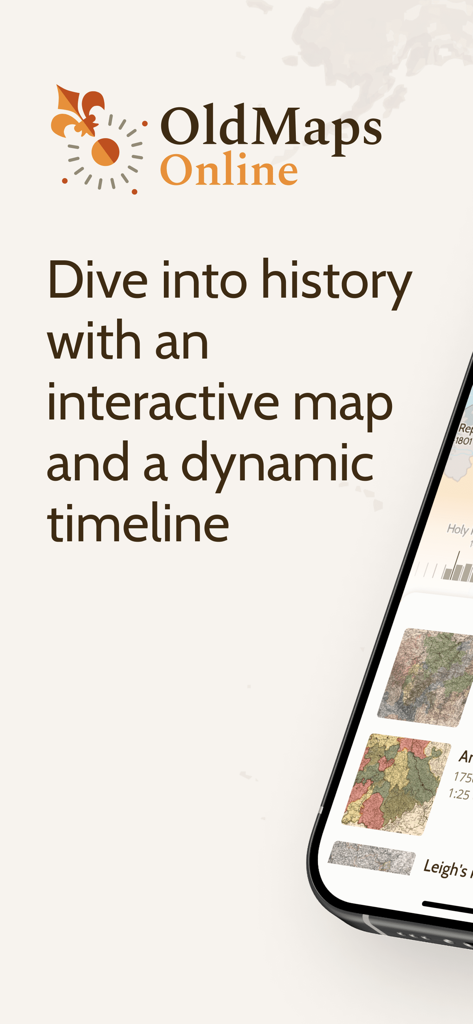
세계에서 가장 명망 있는 기록 보관소에서 가져온 500,000개 이상의 고해상도 지도의 보물창고를 발견하세요. 대화형 타임라인과 AR 오버레이를 통해 당신의 유산을 추적하고, 과거와 현재의 풍경을 비교하며, 수세기에 걸친 지리적 진화를 탐험하세요.
다운로드
98K+사용자 평점
총 평가 수
400개발사
카테고리
Education지원 언어
1최신 버전
2.0크기
9.6 MB출시일
2015년 7월 20일당신의 발 아래 숨겨진 역사를 발견하세요
OldMapsOnline은 세계 최고의 기록 보관소를 여러분의 손끝으로 가져와, 고급 대화형 도구를 통해 잊혀진 풍경을 탐험할 수 있게 해줍니다.
매끄러운 지도 오버레이
고해상도 역사 스캔본을 현대의 GPS 지도 위에 겹쳐서 당신의 동네나 유적지가 어떻게 변해왔는지 시각화해 보세요.
아카이브 품질의 연구
대영 도서관 및 스탠퍼드와 같은 기관의 500,000개 이상의 지도에 액세스하여 족보 및 전문 연구를 위한 검증된 역사적 맥락을 확인하세요.
다음 스크린샷과 설명은 앱의 공식 스토어 목록에서 직접 가져온 것이며 앱 개발자의 자산입니다.
앱 스토어
스크린샷
OldMapsOnline 앱은 역사적 기록을 탐색하기 위한 대화형 지도와 역동적인 타임라인을 제공합니다.
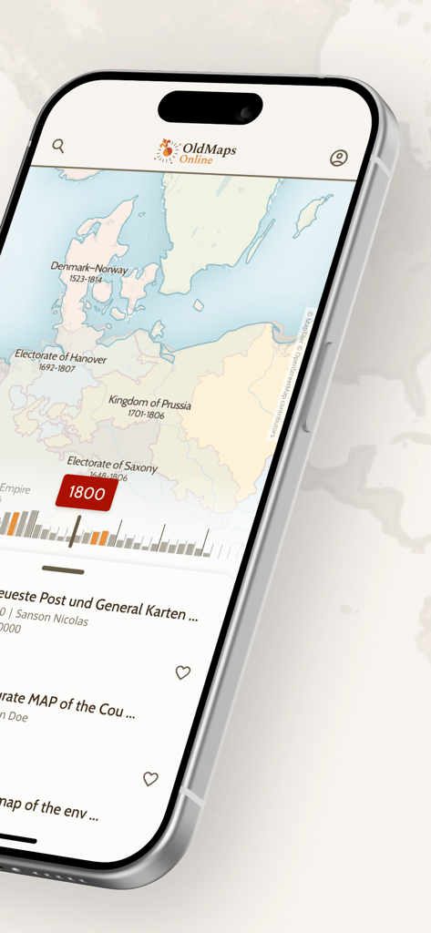
1800년경 유럽의 역사 지도와 타임라인 탐색 슬라이더를 보여주는 OldMapsOnline 모바일 앱 인터페이스
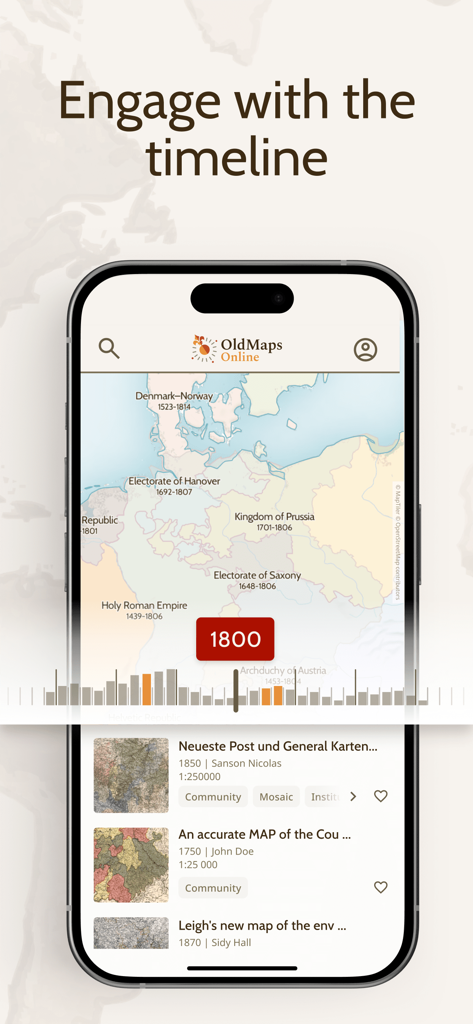
대화형 타임라인 슬라이더와 함께 1800년 유럽의 역사 지도를 보여주는 OldMapsOnline 앱 인터페이스.
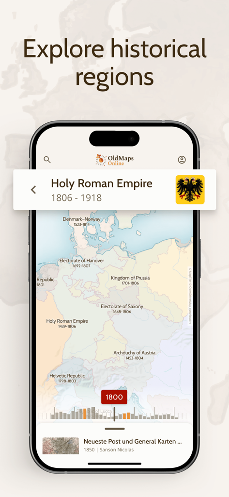
1800년 당시의 유럽 및 신성 로마 제국 역사 지도를 표시하는 OldMapsOnline 앱.
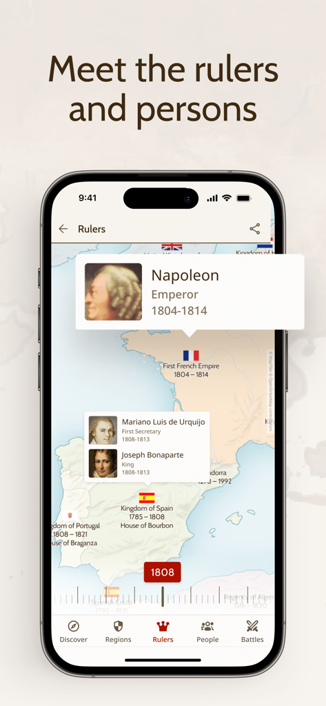
나폴레옹 및 기타 통치자들에 대한 정보와 함께 1808년 유럽의 역사 지도를 표시하는 OldMapsOnline 앱의 스크린샷.
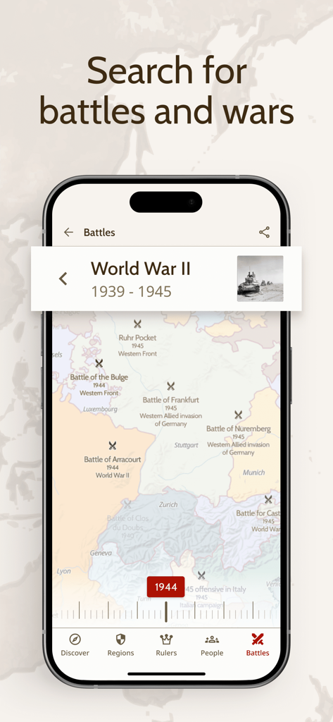
1944년 유럽 지도에 제2차 세계 대전의 역사적 전투 위치가 표시된 OldMapsOnline 앱 인터페이스를 보여주는 스마트폰 화면.
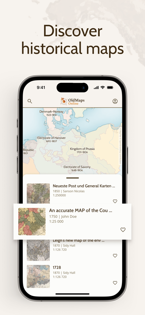
역사 지도 및 아카이브 검색 결과와 함께 OldMapsOnline 앱 인터페이스를 보여주는 iPhone 화면
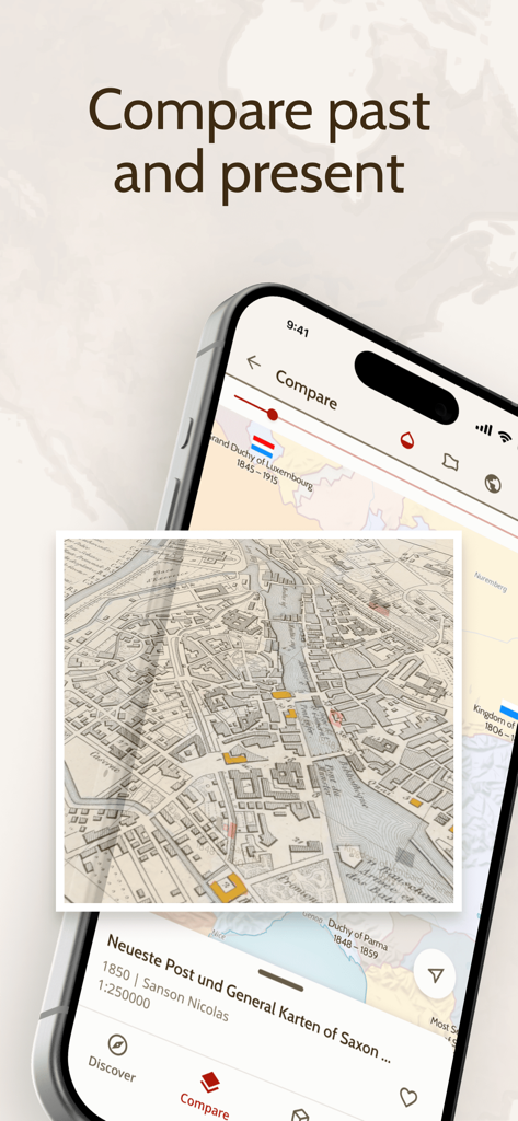
오버레이 기능을 통해 역사 지도와 현대 지도를 비교하는 OldMapsOnline 앱을 보여주는 스마트폰 화면
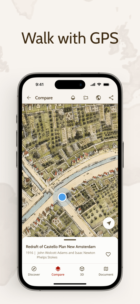
뉴암스테르담의 역사 지도 위에 실시간 GPS 위치 마커를 보여주는 OldMapsOnline 앱
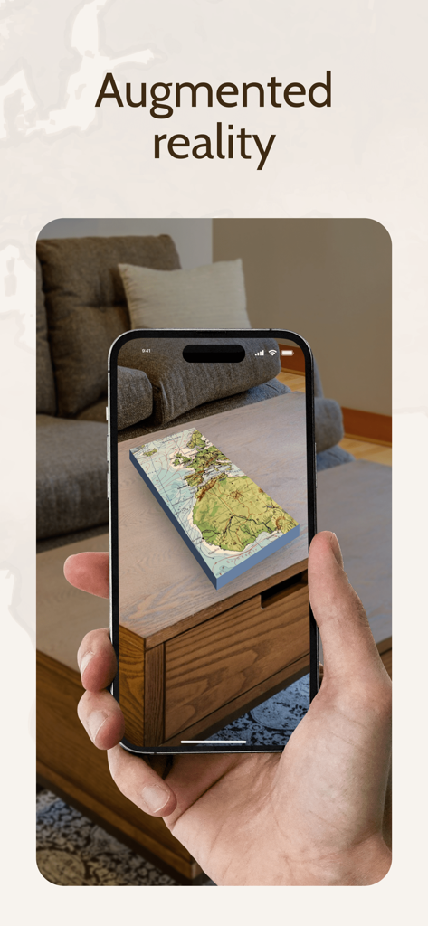
증강 현실을 사용하여 커피 테이블 위에 투사된 3D 역사 지도를 보여주는 스마트폰 화면.
설명
Download
비슷한 앱
유사한 기능과 사용자 경험을 가진 앱

西窗烛 - 品味中国诗词之美
Beijing xichuang culture media co., Ltd.

全知识-原全历史、艺术哲学文学心理经管学习视频在线平台
Beijing Perfect Knowledge Technology Co. LTD

Teller
LHT HIGGS Producoes Audiovisuais LTDA

Google Arts & Culture
Google LLC

NYMF: Art Nude Female Beauty
Dmytro Dubnytskyi

Art History & Museums - Artify
Hasret Ozkan

History Extra: Unlock the past
Immediate Media Company Limited

LearnArt - Art app
Maria Samoshenkova

Tammo
Emanuele Valeri
이 페이지는 앱이나 개발자의 공식 페이지가 아니며, 정보 제공 및 논평을 목적으로 작성된 독립 편집 간행물입니다. 명시적으로 달리 언급되지 않는 한, 해당 앱이나 개발자는 MWM, Apple, Google Play, 앱 퍼블리셔 또는 앱 개발자와 제휴, 보증, 후원, 승인 또는 공식적으로 연결되어 있지 않으며, 이 페이지의 어떤 내용도 해당 앱이 MWM의 서비스를 사용하여 개발되었음을 의미하지 않습니다. 모든 상표, 로고, 스크린샷 및 기타 콘텐츠는 해당 소유자의 자산입니다.