이 페이지는 앱이나 개발자의 공식 페이지가 아니며, 정보 제공 및 논평을 목적으로 작성된 독립 편집 간행물입니다. 명시적으로 달리 언급되지 않는 한, 해당 앱이나 개발자는 MWM, Apple, Google Play, 앱 퍼블리셔 또는 앱 개발자와 제휴, 보증, 후원, 승인 또는 공식적으로 연결되어 있지 않으며, 이 페이지의 어떤 내용도 해당 앱이 MWM의 서비스를 사용하여 개발되었음을 의미하지 않습니다. 모든 상표, 로고, 스크린샷 및 기타 콘텐츠는 해당 소유자의 자산입니다.

PredictWind Offshore Weather
위성 연결에 최적화된 고해상도 기상 경로 및 GRIB 다운로드로 기상 요소를 마스터하세요. ECMWF 및 UKMO와 같은 세계 최고의 모델을 활용하여 먼 바다에서의 안전과 성능을 보장합니다.
다운로드
477K+사용자 평점
총 평가 수
100개발사
카테고리
Weather지원 언어
1최신 버전
7.5.1크기
157.9 MB출시일
2016년 1월 7일전문 항해사를 위한 정밀 기상 도구
위성 또는 셀룰러 데이터를 통해 지구 어디에서나 작동하도록 설계된 고해상도 예보, 기상 경로 및 안전을 위한 최고의 해상 툴킷입니다.
위성에 최적화된 효율성
저대역폭 연결을 위해 설계된 초압축 파일을 사용하여 Iridium GO!, Globalstar 또는 Starlink를 통해 중요한 GRIB 파일과 기상 경로를 다운로드하세요.
독보적인 모델 정확도
ECMWF, SPIRE, UKMO를 포함한 세계 최고 수준의 모델과 초국지적 정밀도를 위한 독점적인 1km 해상도 PWG 및 PWE 예보를 활용하세요.
다음 스크린샷과 설명은 앱의 공식 스토어 목록에서 직접 가져온 것이며 앱 개발자의 자산입니다.
앱 스토어
스크린샷
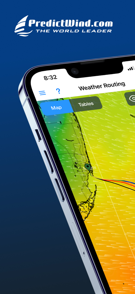
마이애미 인근의 바람 데이터가 포함된 해상 기상 경로 지도를 보여주는 PredictWind Offshore 앱 인터페이스
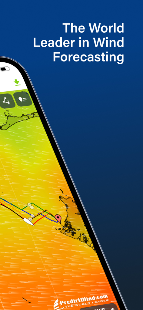
PredictWind 해상 바람 예보 및 기상 경로를 표시하는 모바일 화면
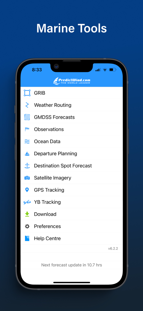
기상 경로 및 GRIB 파일과 같은 기능이 있는 해양 도구 메뉴를 표시하는 PredictWind Offshore Weather 앱 인터페이스
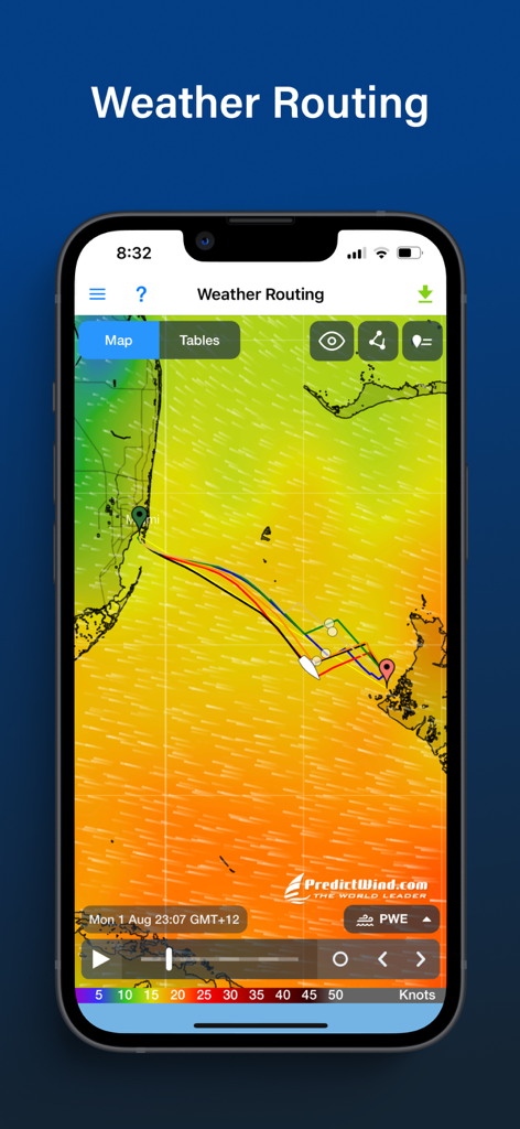
해상 항해를 위한 기상 경로 및 바람 예보 지도를 표시하는 PredictWind Offshore 앱 인터페이스
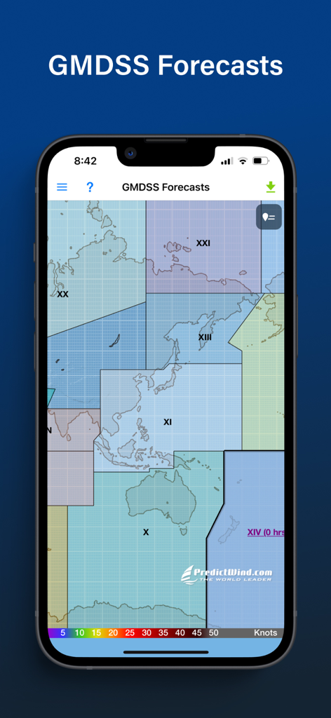
지도에 GMDSS 해상 예보 구역을 표시하는 PredictWind Offshore Weather 앱
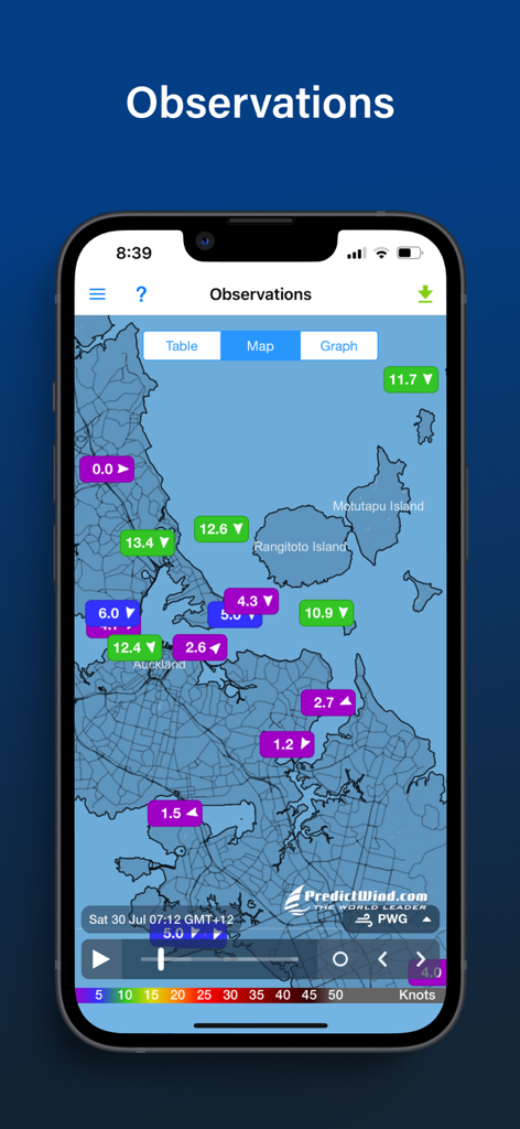
해안 지도에 실시간 해상 바람 관측치를 표시하는 PredictWind 앱 화면
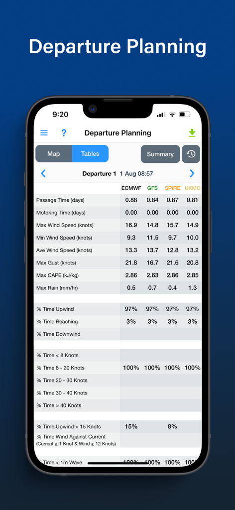
해상 항로에 대한 다양한 기상 모델을 비교하는 PredictWind Offshore 앱 출발 계획표
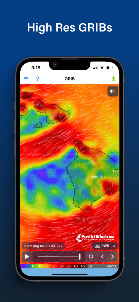
하와이 제도 주변의 바람 패턴이 포함된 고해상도 GRIB 기상 지도를 보여주는 PredictWind Offshore 앱
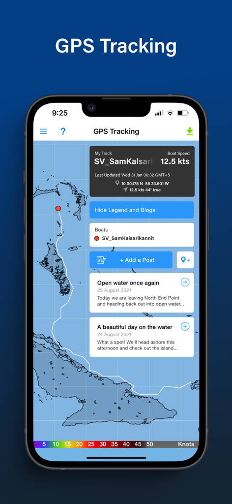
속도 및 블로그 업데이트와 함께 지도에 선박의 경로를 표시하는 PredictWind Offshore 앱의 GPS 추적 화면
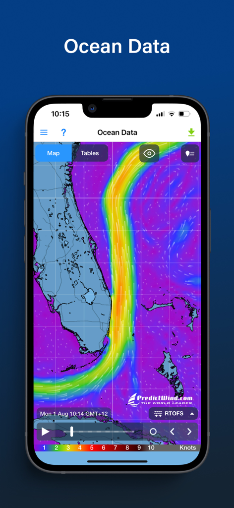
플로리다 해안의 해류 데이터 및 지도를 표시하는 PredictWind Offshore 앱
설명
Download


이 페이지는 앱이나 개발자의 공식 페이지가 아니며, 정보 제공 및 논평을 목적으로 작성된 독립 편집 간행물입니다. 명시적으로 달리 언급되지 않는 한, 해당 앱이나 개발자는 MWM, Apple, Google Play, 앱 퍼블리셔 또는 앱 개발자와 제휴, 보증, 후원, 승인 또는 공식적으로 연결되어 있지 않으며, 이 페이지의 어떤 내용도 해당 앱이 MWM의 서비스를 사용하여 개발되었음을 의미하지 않습니다. 모든 상표, 로고, 스크린샷 및 기타 콘텐츠는 해당 소유자의 자산입니다.