이 페이지는 앱이나 개발자의 공식 페이지가 아니며, 정보 제공 및 논평을 목적으로 작성된 독립 편집 간행물입니다. 명시적으로 달리 언급되지 않는 한, 해당 앱이나 개발자는 MWM, Apple, Google Play, 앱 퍼블리셔 또는 앱 개발자와 제휴, 보증, 후원, 승인 또는 공식적으로 연결되어 있지 않으며, 이 페이지의 어떤 내용도 해당 앱이 MWM의 서비스를 사용하여 개발되었음을 의미하지 않습니다. 모든 상표, 로고, 스크린샷 및 기타 콘텐츠는 해당 소유자의 자산입니다.

RiverApp - River levels
전 세계 40,000개 이상의 스테이션에서 정확한 데이터에 액세스하세요. 카약커, 낚시꾼 및 전문가가 강 상태, 항해 가능성 및 홍수 경보를 완벽하게 자신 있게 모니터링할 수 있는 궁극의 도구입니다.
다운로드
499K+사용자 평점
총 평가 수
4K+개발사
카테고리
Weather지원 언어
6최신 버전
5.15.9크기
49.1 MB출시일
2013년 7월 4일모든 흐름을 마스터하세요
40,000개 이상의 글로벌 스테이션에서 실시간 데이터를 활용하여 전문적인 정밀도로 강 여행을 계획하세요.
정밀 경보
'주행 가능한' 시기를 놓치지 마세요. 특정 CFS 또는 게이지 높이에 대한 사용자 지정 트리거를 설정하고 수위가 완벽해지는 즉시 알림을 받으세요.
급류 정보
정확한 출발 및 도착 지점, 위험 보고서 및 실시간 항해 가능성 상태가 포함된 4,000개 이상의 상세 강 구간에 액세스하세요.
다음 스크린샷과 설명은 앱의 공식 스토어 목록에서 직접 가져온 것이며 앱 개발자의 자산입니다.
앱 스토어
스크린샷
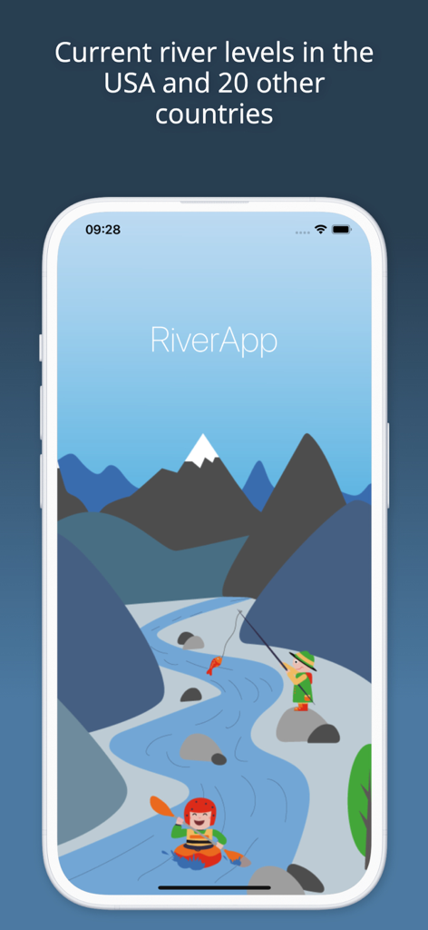
카약커와 낚시꾼이 그림 같은 산악 강에 있는 RiverApp 스플래시 화면
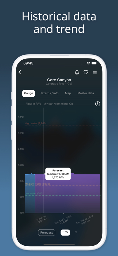
콜로라도 강 고어 캐니언의 과거 유량 데이터 및 예보를 표시하는 RiverApp 스크린샷.
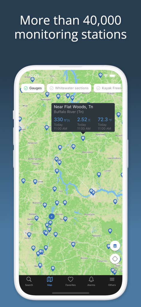
테네시주 버팔로 강의 수문 스테이션 및 실시간 유량 및 온도 데이터를 보여주는 RiverApp 인터페이스 지도
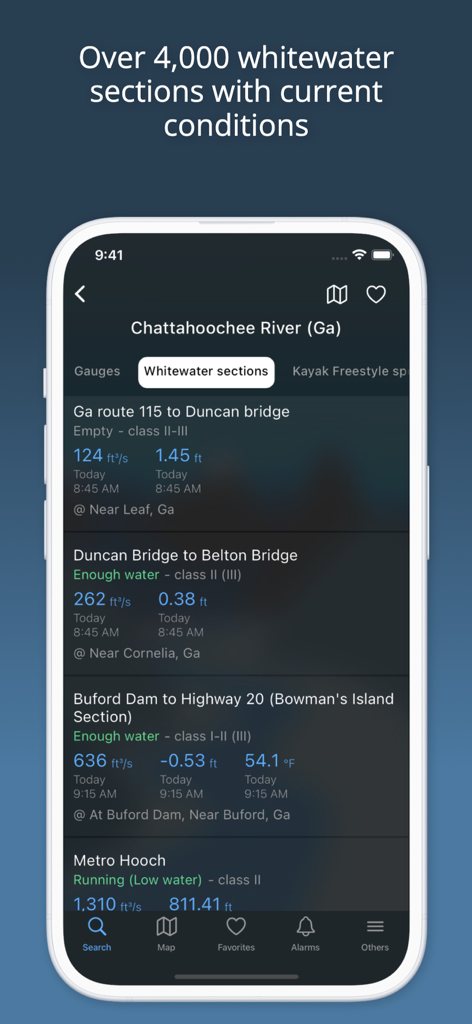
채터후치 강의 여러 구간의 유량 및 항해 가능성을 보여주는 RiverApp 모바일 인터페이스
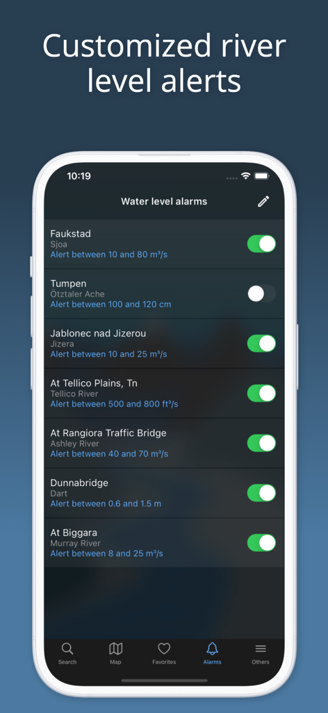
여러 강의 사용자 지정 수위 알림을 보여주는 RiverApp 인터페이스
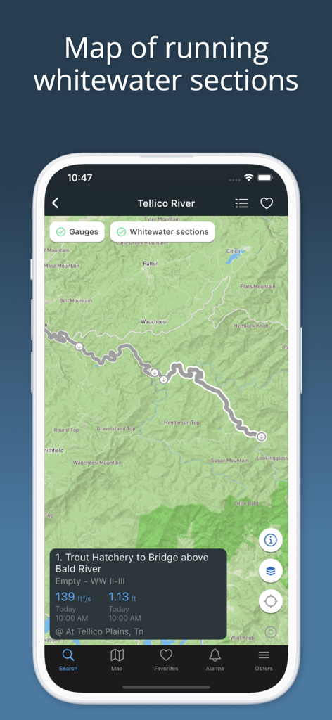
텔리코 강의 주행 가능한 급류 구간 및 강 유량 데이터를 보여주는 RiverApp의 지도 보기
설명
Download
비슷한 앱
유사한 기능과 사용자 경험을 가진 앱

IQAir AirVisual | Air Quality
IQAir AG

CalTopo: Backcountry Mapping
CalTopo LLC

My Altitude
Dayana Networks Ltd

Mountain-Forecast.com
Meteo365 Ltd.

My Tide Times - Tables & Chart
JRustonApps B.V.

UV Index Widget - Worldwide
Bjorn Jenssen

My Aurora Forecast Pro
JRustonApps B.V.

Aviation weather - METAR & TAF
Hermann Hoelter

Dronecast: UAV & Drone Weather
Pinverse LTD
이 페이지는 앱이나 개발자의 공식 페이지가 아니며, 정보 제공 및 논평을 목적으로 작성된 독립 편집 간행물입니다. 명시적으로 달리 언급되지 않는 한, 해당 앱이나 개발자는 MWM, Apple, Google Play, 앱 퍼블리셔 또는 앱 개발자와 제휴, 보증, 후원, 승인 또는 공식적으로 연결되어 있지 않으며, 이 페이지의 어떤 내용도 해당 앱이 MWM의 서비스를 사용하여 개발되었음을 의미하지 않습니다. 모든 상표, 로고, 스크린샷 및 기타 콘텐츠는 해당 소유자의 자산입니다.