이 페이지는 앱이나 개발자의 공식 페이지가 아니며, 정보 제공 및 논평을 목적으로 작성된 독립 편집 간행물입니다. 명시적으로 달리 언급되지 않는 한, 해당 앱이나 개발자는 MWM, Apple, Google Play, 앱 퍼블리셔 또는 앱 개발자와 제휴, 보증, 후원, 승인 또는 공식적으로 연결되어 있지 않으며, 이 페이지의 어떤 내용도 해당 앱이 MWM의 서비스를 사용하여 개발되었음을 의미하지 않습니다. 모든 상표, 로고, 스크린샷 및 기타 콘텐츠는 해당 소유자의 자산입니다.

다운로드
125K+사용자 평점
총 평가 수
2K+개발사
카테고리
Travel지원 언어
1최신 버전
3.1크기
70.8 MB출시일
2023년 3월 9일정밀함으로 모든 봉우리 정복
아웃도어 모험가를 위한 최고의 올인원 대시보드. 고도를 추적하고, 오프라인에서 길을 찾고, 전문적인 데이터 오버레이로 여정을 기록하세요.
신뢰할 수 있는 오프라인 탐색
완전히 오프라인 상태에서도 실시간 고도, GPS 좌표, 나침반 데이터를 이용할 수 있어 가장 깊은 야생을 자신 있게 탐험하세요.
검증된 정상 증명
정상 셀카를 기술적인 성취로 바꾸세요. 세련된 워터마크로 고도, 기압, 위치 데이터를 사진에 직접 오버레이하세요.
다음 스크린샷과 설명은 앱의 공식 스토어 목록에서 직접 가져온 것이며 앱 개발자의 자산입니다.
앱 스토어
스크린샷
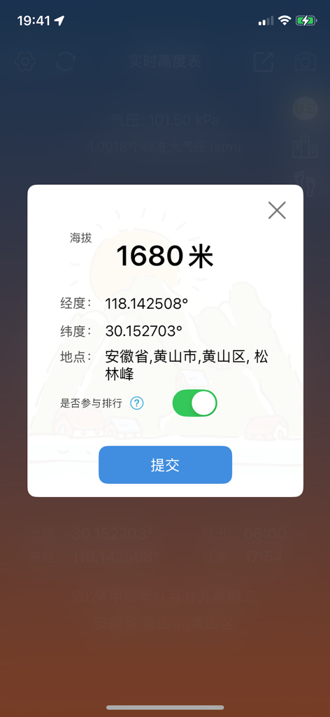
1680미터 고도와 나침반 및 GPS 데이터를 보여주는 실시간 고도계의 모바일 앱 인터페이스
1680미터 고도와 야외 하이킹용 GPS 좌표를 보여주는 모바일 앱 인터페이스
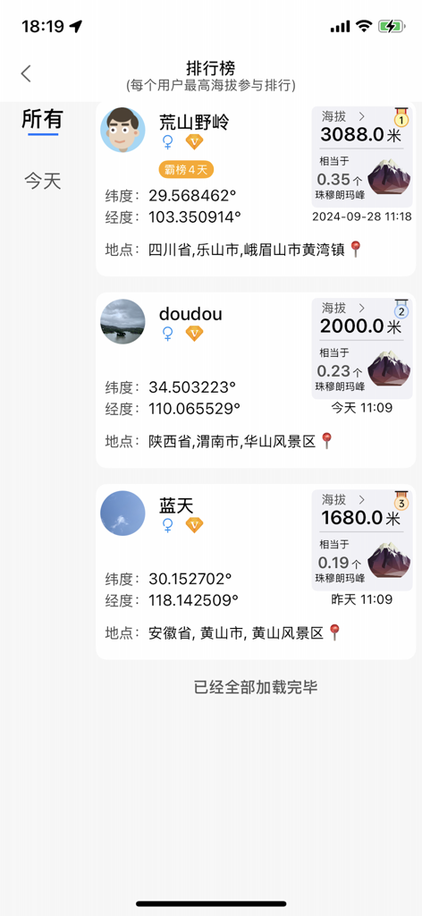
GPS 좌표 및 위치와 함께 최고 기록 고도별 사용자 순위를 매기는 실시간 고도계 앱의 리더보드 보기
사진용 GPS 좌표, 기압, 고도 워터마크 스타일을 보여주는 모바일 앱 화면
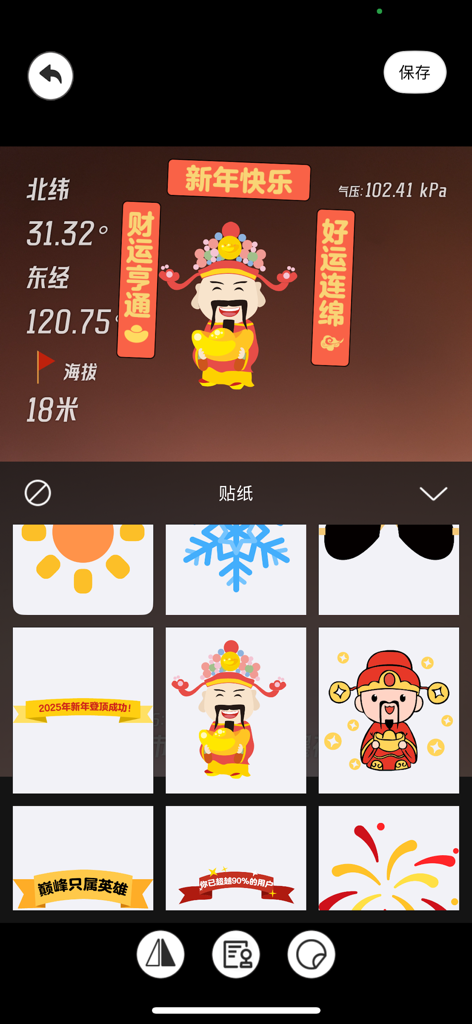
고도 및 GPS 좌표와 함께 사진 워터마킹용 축제 스티커 선택을 보여주는 모바일 앱 인터페이스
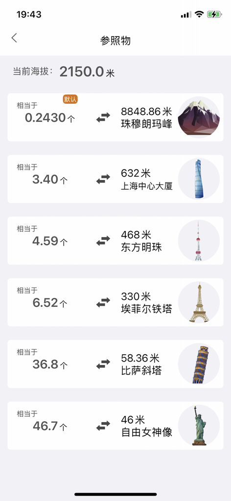
현재 고도를 세계 유명 랜드마크 높이와 비교하는 모바일 앱 인터페이스
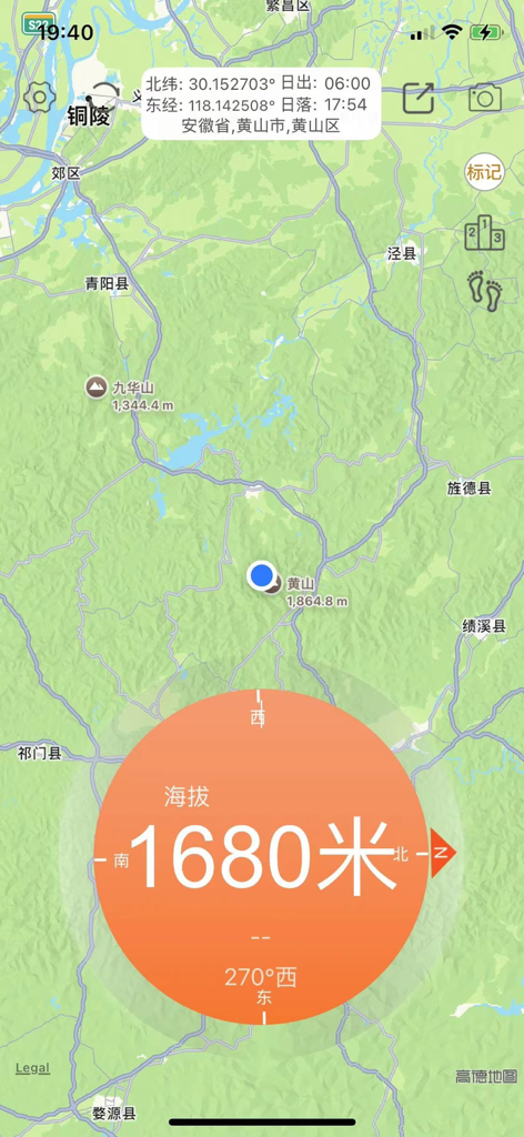
1680미터의 실시간 고도 측정값과 GPS 좌표가 있는 지형도와 함께 표시되는 모바일 앱 인터페이스
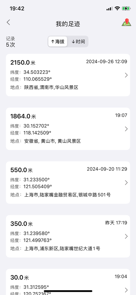
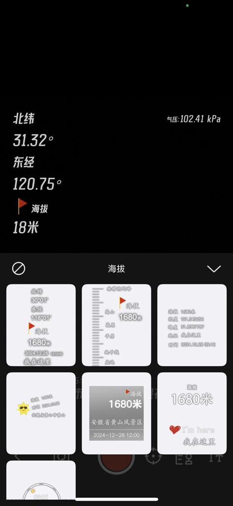
GPS 좌표 및 타임스탬프와 함께 기록된 고도 측정 목록을 표시하는 모바일 앱 인터페이스
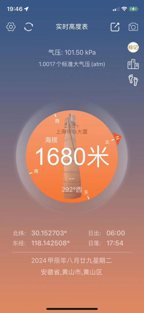
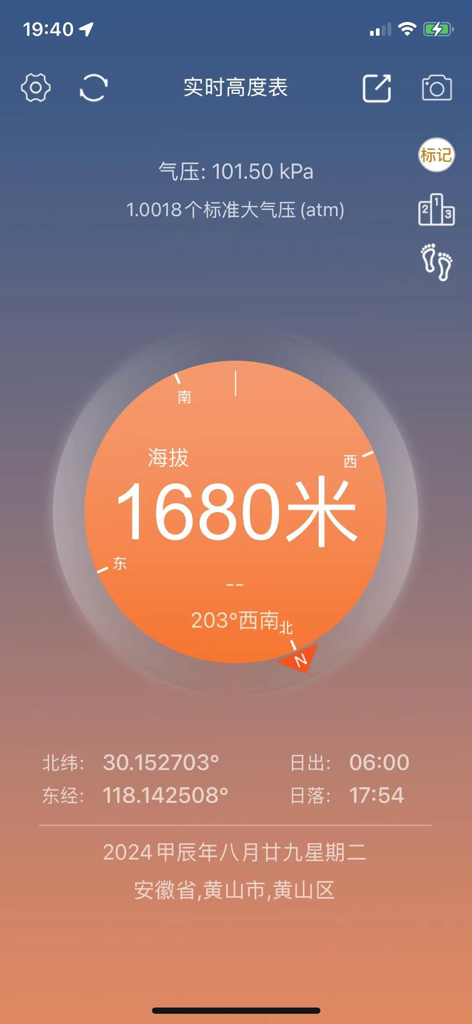
1680미터 고도, GPS 좌표 및 나침반 방향을 보여주는 실시간 고도계 앱의 메인 인터페이스
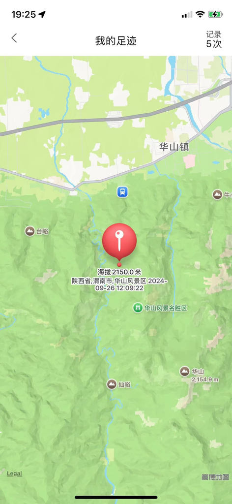
고도 데이터와 추적 발자국이 있는 위치 핀을 보여주는 고도계 앱의 지도 인터페이스
설명
Download
비슷한 앱
같은 카테고리의 상위 앱

Uber - Request a ride
Uber Technologies, Inc.

Airbnb
Airbnb, Inc.

铁路12306
ACADEMY OF RAILWAY SCIENCES CO., ltd.

Booking.com: Hotels & Travel
Booking.com B.V.

Grab: Taxi Ride, Food Delivery
GRABTAXI HOLDINGS PTE. LTD.

Trip.com: Book Flights, Hotels
Trip.com Travel Singapore Pte. Ltd.

DiDi China: Ride Hailing
Didi Chuxing (Beijing) Network Platform Technology Co., Ltd

去哪儿旅行-订酒店机票火车票
Beijing Qunar Information Technology Company Limit

Bolt: Request a Ride
BOLT TECHNOLOGY OU
이 페이지는 앱이나 개발자의 공식 페이지가 아니며, 정보 제공 및 논평을 목적으로 작성된 독립 편집 간행물입니다. 명시적으로 달리 언급되지 않는 한, 해당 앱이나 개발자는 MWM, Apple, Google Play, 앱 퍼블리셔 또는 앱 개발자와 제휴, 보증, 후원, 승인 또는 공식적으로 연결되어 있지 않으며, 이 페이지의 어떤 내용도 해당 앱이 MWM의 서비스를 사용하여 개발되었음을 의미하지 않습니다. 모든 상표, 로고, 스크린샷 및 기타 콘텐츠는 해당 소유자의 자산입니다.