이 페이지는 앱이나 개발자의 공식 페이지가 아니며, 정보 제공 및 논평을 목적으로 작성된 독립 편집 간행물입니다. 명시적으로 달리 언급되지 않는 한, 해당 앱이나 개발자는 MWM, Apple, Google Play, 앱 퍼블리셔 또는 앱 개발자와 제휴, 보증, 후원, 승인 또는 공식적으로 연결되어 있지 않으며, 이 페이지의 어떤 내용도 해당 앱이 MWM의 서비스를 사용하여 개발되었음을 의미하지 않습니다. 모든 상표, 로고, 스크린샷 및 기타 콘텐츠는 해당 소유자의 자산입니다.

Sun Tracker AR
증강 현실에서 태양 위치를 시각화하고 3D 그림자를 시뮬레이션하세요. 건축가, 사진작가, 태양광 설치 전문가가 정밀하게 계획할 수 있는 필수 툴킷입니다.
다운로드
368K+사용자 평점
총 평가 수
500개발사
카테고리
Photo & Video지원 언어
11최신 버전
3.5.5크기
27.6 MB출시일
2019년 5월 8일손끝에서 펼쳐지는 정밀 태양 계획
완벽한 빛 제어를 위해 설계된 고정밀 AR 시각화 및 그림자 시뮬레이션으로 전문 프로젝트 및 야외 취미를 강화하세요.
증강 현실 경로
카메라 보기 위에 겹쳐진 태양의 정확한 궤적을 시각화하여 시간대에 관계없이 빛이 어디에 닿을지 추측 없이 확인하세요.
3D 그림자 시뮬레이터
지도에 나무나 건물과 같은 가상 객체를 배치하여 1년 내내 그림자가 어떻게 행동할지 정확하게 예측하세요.
다음 스크린샷과 설명은 앱의 공식 스토어 목록에서 직접 가져온 것이며 앱 개발자의 자산입니다.
앱 스토어
스크린샷
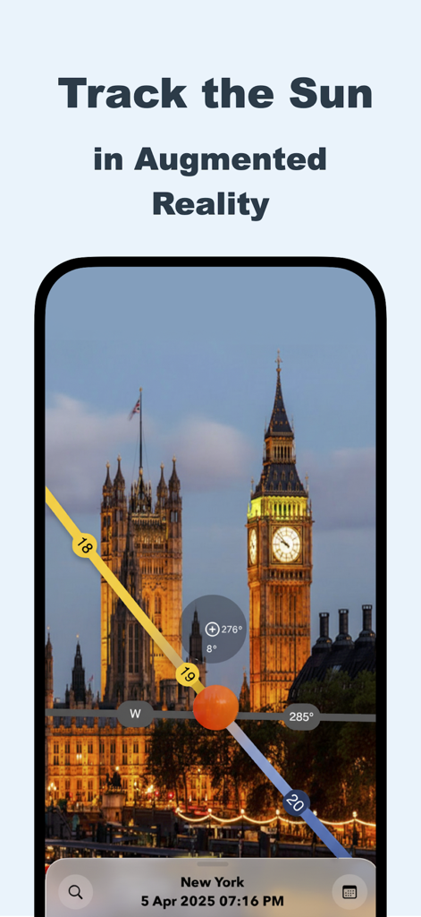
Sun Tracker AR에서 빅벤 위 태양 경로의 증강 현실 보기
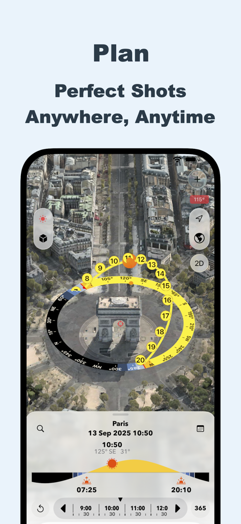
사진 계획을 위한 도시 지도 위의 3D 태양 경로 시각화를 보여주는 Sun Tracker AR 앱 인터페이스
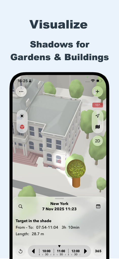
Sun Tracker AR 앱 인터페이스에서 건물 및 정원에 대한 3D 그림자 시뮬레이션
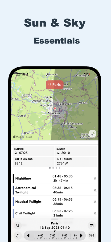
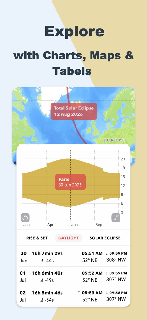
파리의 태양 경로 지도와 상세한 황혼 시간표를 보여주는 Sun Tracker AR 앱 인터페이스
일식 지도, 일조량 차트, 일출 및 일몰 데이터를 보여주는 Sun Tracker AR 모바일 앱 인터페이스

일식 및 일출 알림과 같은 태양 이벤트를 위한 캘린더 통합을 보여주는 Sun Tracker AR의 인터페이스
설명
Download
비슷한 앱
유사한 기능과 사용자 경험을 가진 앱

Moon Phases and Lunar Calendar
Business City s.r.o.

My Moon Phase - Lunar Calendar
JRustonApps B.V.

The Moon: Calendar Moon Phases
Vitalii Gryniuk

Moonlitt: Moon Phase Tracker
Flipping Hues Srls

Sunrise Sunset Times
Fascinating Projects Pty Ltd

PhotoPills
PhotoPills S.L.

AuroraReach
HuskyCodes Oy

Sun Seeker - Sunlight Tracker
Ajnaware Pty Ltd

Sundial Solar & Lunar Time
Tier 9 Digital LLC
이 페이지는 앱이나 개발자의 공식 페이지가 아니며, 정보 제공 및 논평을 목적으로 작성된 독립 편집 간행물입니다. 명시적으로 달리 언급되지 않는 한, 해당 앱이나 개발자는 MWM, Apple, Google Play, 앱 퍼블리셔 또는 앱 개발자와 제휴, 보증, 후원, 승인 또는 공식적으로 연결되어 있지 않으며, 이 페이지의 어떤 내용도 해당 앱이 MWM의 서비스를 사용하여 개발되었음을 의미하지 않습니다. 모든 상표, 로고, 스크린샷 및 기타 콘텐츠는 해당 소유자의 자산입니다.