This page is not an official page of the app or its developer, but an independent editorial publication created for informational and commentary purposes. Unless expressly stated otherwise, neither the app nor its developer is affiliated with, endorsed by, sponsored by, authorized by, or otherwise officially connected with MWM, Apple, Google Play, the app publisher, or the app's developer, and nothing on this page implies that the app was developed using MWM's services. Any trademarks, logos, screenshots, and other content remain the property of their respective owners.

Acres: Land Data & Parcel Maps
Instantly access landowner names, precise property boundaries, and comprehensive soil reports. From the desktop to the field, evaluate land potential with 3D maps, historical data, and offline tracking designed for professionals.
Downloads
469K+User Rating
Total Ratings
1K+Publisher
Category
BusinessLocales
1Latest Version
3.5.4Size
133.7 MBFirst Released
Oct 4, 2022Precision Tools for Serious Land Management
From verifying property lines to evaluating soil quality, Acres delivers the comprehensive data you need to make informed decisions on the go.
Instant Landowner Data
Identify owners and precise boundaries across millions of U.S. parcels instantly, saving you countless hours at the county clerk’s office.
Deep Parcel Intelligence
Mitigate risk with professional-grade insights into soil composition, historical crop yields, flood zones, and topography maps.
Frequently Asked Questions
Everything you need to know about Acres: Land Data & Parcel Maps
What is the Acres app used for?
The Acres app is a mapping and land analysis tool for discovering property lines, landowner information, and land for sale. It provides parcel-level insights and allows saving and sharing property maps.
Can I search for land for sale with the Acres app?
Yes, the Acres app allows users to instantly find and share land for sale across the US. This feature is directly accessible within the application.
How does Acres help locate property lines?
The Acres app enables users to check precise property boundaries. It also facilitates locating property lines and evaluating parcel-level insights for land analysis.
Does the Acres app provide landowner details?
Yes, the Acres app provides landowner information, displaying names for specific parcels. This feature aids users in their comprehensive land analysis.
Can Acres maps be used offline?
Yes, Acres supports offline maps. Users can access saved satellite-view areas or custom maps when off-grid, ensuring continuous mapping functionality without an internet connection.
Does Acres include 3D map visualization?
Yes, Acres includes 3D map visualization. Users can visualize terrain in 3D mode and toggle this feature on or off to explore land from various angles.
Does the Acres app track routes?
Yes, the Acres app features route tracking. Users can track and save their path, measuring distance and elevation changes as they walk on their property.
How can I create custom maps in Acres?
Acres allows users to create custom maps by geotagging photos, adding notes, and marking points of interest. These personalized maps automatically sync across mobile and desktop.
What land data layers are available in Acres?
Acres provides numerous land data layers including soil maps, elevation, historical imagery, vegetation index, crop history, county rent, county yield, property tax, and flood/wetlands information.
Can I share my maps and land data from Acres?
Yes, Acres allows users to share property maps and land data directly from the app. Users can also share specific waypoints from their maps.
Does Acres sync between mobile and desktop devices?
Yes, Acres provides seamless syncing for property maps and custom maps between mobile devices and desktop. This allows continuous analysis across different platforms.
How are Acres app subscriptions billed?
Acres app subscriptions are charged to your credit card through your iTunes account. They automatically renew unless canceled at least 24 hours before the current period ends.
Does Acres offer refunds for subscriptions or free trials?
No, Acres does not offer refunds for subscription fees if canceled during the term. Any unused portion of a free trial is also forfeited upon subscription activation.
Where can I read Acres' terms of use and privacy policy?
Acres' terms of use and privacy policy are available on their website. Users can access these documents via the provided links: www.acres.com/terms-of-use and www.acres.com/privacy-policy.
Does the Acres app contain advertisements?
No, the Acres app does not contain advertisements. Users experience an ad-free interface while using all its features.
The following screenshots and description are sourced directly from the app's official store listing and are the property of the app developer.
App Store
Screenshots
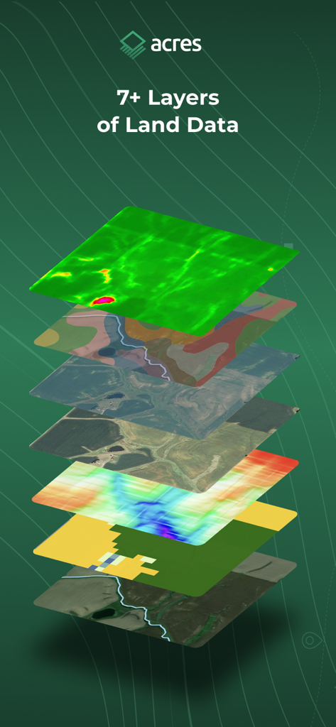
A stack of seven different map data layers showing satellite views topography and soil information from the Acres app
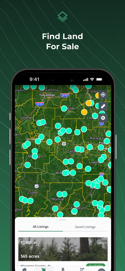
Acres app map view showing land for sale listings and property pins
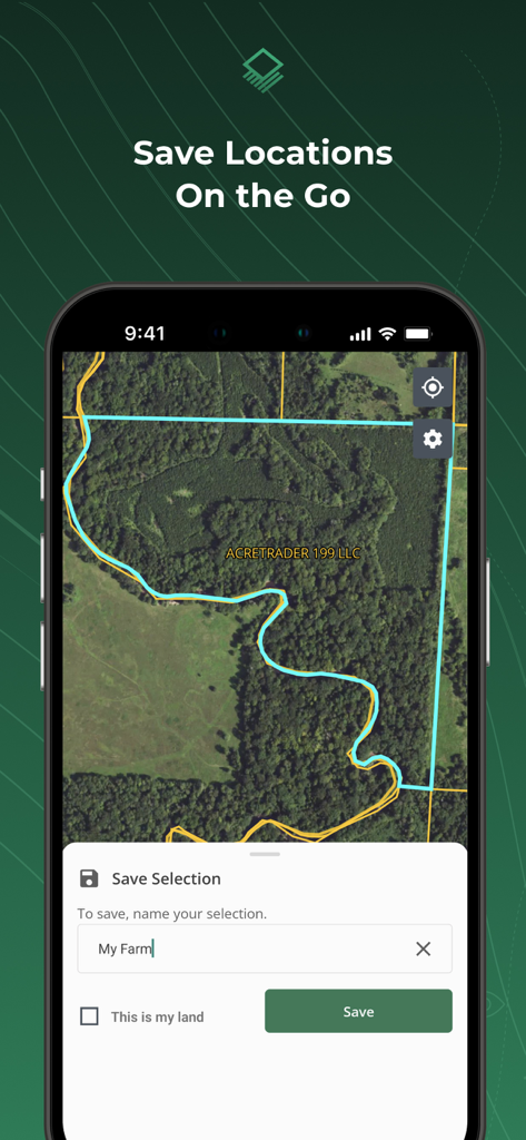
The Acres app interface showing a satellite map with a highlighted land parcel and a prompt to save the selection.
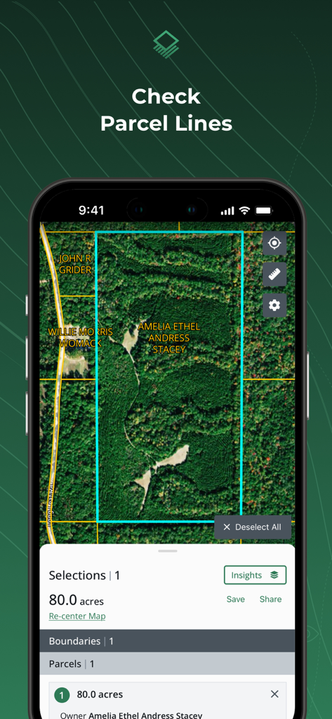
Acres app interface showing land parcel boundaries and landowner information on a satellite map
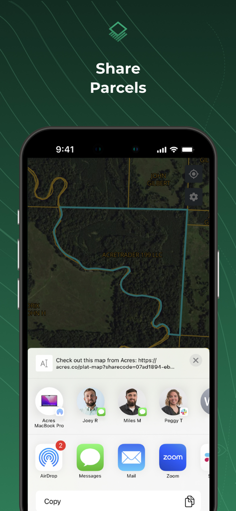
iPhone screen showing the share parcels feature in the Acres app with a land map and sharing options
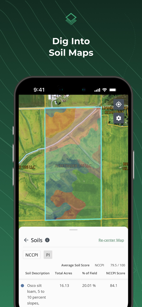
A mobile phone screen displaying the Acres app with a colorful soil map overlay and detailed soil composition data for a specific land parcel.
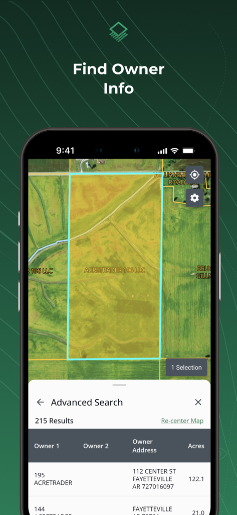
Acres app interface displaying land owner names and property parcel details on a satellite map
Description
Download
More Like This
Apps with similar features and user experience

LandGlide: Find Property Lines
Real Estate Portal USA, LLC

Regrid Property App
Loveland Technologies, LLC

DealCheck: Analyze Real Estate
Fortnoff Financial LLC

Reventure App
Reventure App LLC

Land id®
MapRight, LLC

Tapusor
TUVIMER ARGE FAALIYETLERI VE TEKNOLOJI SISTEMLERITICARET ANONIM SIRKETI

Endeksa: Value & Sell Property
Endeksa Teknoloji Anonim Sirketi

Detector Maps
GOLD DISCOVERY SOLUTIONS PTY LTD

Parceled Land Map
Uri Nemirovsky
This page is not an official page of the app or its developer, but an independent editorial publication created for informational and commentary purposes. Unless expressly stated otherwise, neither the app nor its developer is affiliated with, endorsed by, sponsored by, authorized by, or otherwise officially connected with MWM, Apple, Google Play, the app publisher, or the app's developer, and nothing on this page implies that the app was developed using MWM's services. Any trademarks, logos, screenshots, and other content remain the property of their respective owners.