This page is not an official page of the app or its developer, but an independent editorial publication created for informational and commentary purposes. Unless expressly stated otherwise, neither the app nor its developer is affiliated with, endorsed by, sponsored by, authorized by, or otherwise officially connected with MWM, Apple, Google Play, the app publisher, or the app's developer, and nothing on this page implies that the app was developed using MWM's services. Any trademarks, logos, screenshots, and other content remain the property of their respective owners.

ADFC Karten
Unlock the precision of Germany’s official cycling maps on your smartphone. Plan expert-led tours with detailed surface info, offline reliability, and the classic feel of a professional paper map.
Downloads
89K+User Rating
Total Ratings
800Publisher
Category
TravelLocales
2Latest Version
5.2.7Size
58.1 MBFirst Released
Aug 21, 2012The Gold Standard for Your European Cycling Tour
Experience the precision of official ADFC maps combined with modern GPS navigation. Perfectly curated for travelers exploring Germany’s legendary cycling routes.
Expert-Curated Routes
Skip the guesswork with hand-picked tour recommendations from ADFC experts, including detailed descriptions and elevation profiles for a stress-free ride.
Unrivaled Terrain Detail
Know the road before you go. Access specific data on surface quality, traffic density, and gradients to ensure you stay on the safest, most scenic paths.
The following screenshots and description are sourced directly from the app's official store listing and are the property of the app developer.
App Store
Screenshots
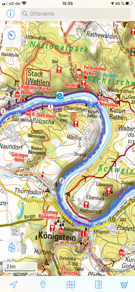
Detailed topographic cycling map of the Elbe river region in Germany shown within the ADFC Karten app
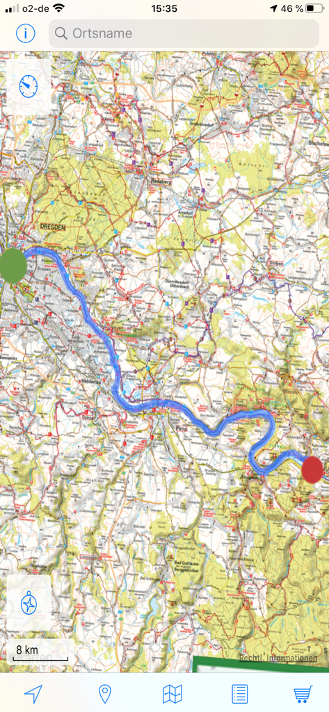
Detailed bicycle navigation map of the Dresden region in Germany showing a cycling route
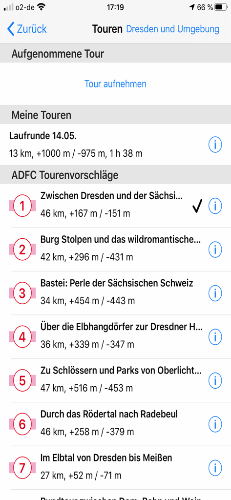
A list of recommended bicycle tours in the Dresden region within the ADFC Karten app showing route distances and elevation gain.
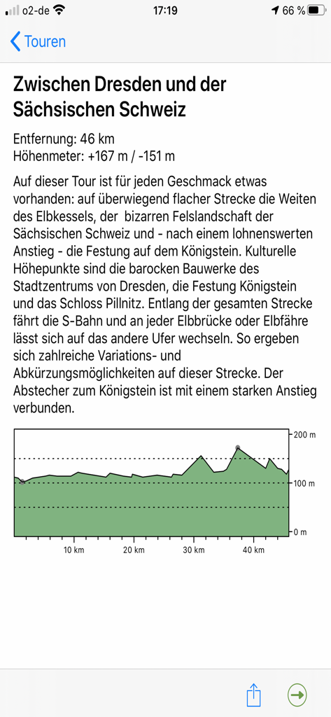
Tour details in the ADFC Karten app showing the elevation profile and description for a bike trip from Dresden to Saxon Switzerland.
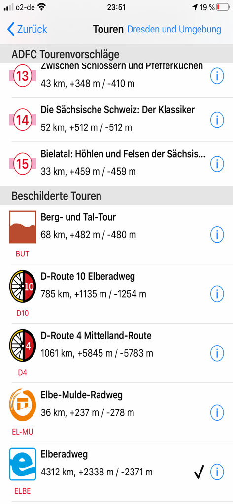
List of recommended cycling tours in Germany with distance and elevation details in the ADFC Karten app
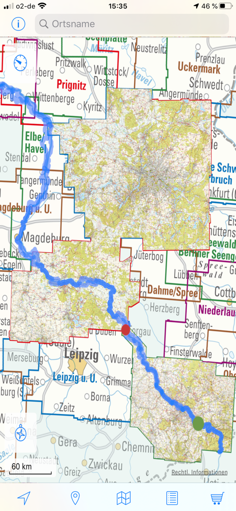
Interface of the ADFC Karten app showing a highlighted bike route across a map of German regions
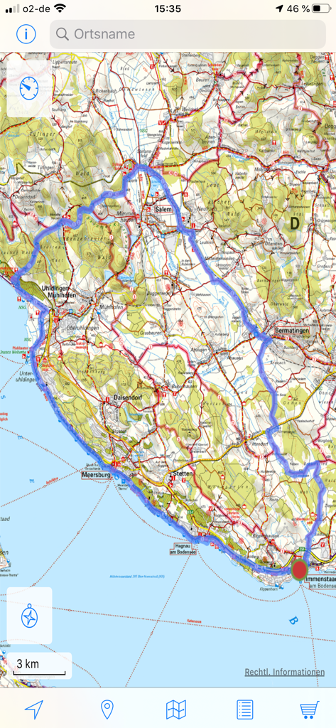
A detailed topographical cycling map in the ADFC Karten app showing a highlighted bike route near Lake Constance
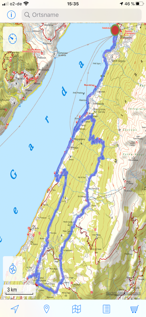
Topographic cycling map of the Lake Garda region with a blue highlighted route in the ADFC Karten app.
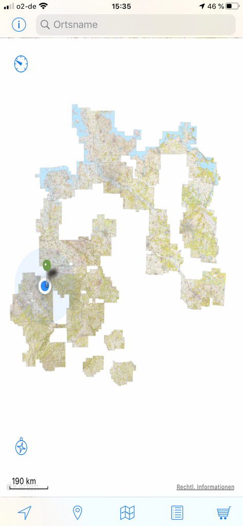
Digital cycling map interface of ADFC Karten app showing regional tiles and GPS location markers in Germany
Description
Download
More Like This
Top-ranked apps in the same category

Uber - Request a ride
Uber Technologies, Inc.

Airbnb
Airbnb, Inc.

铁路12306
ACADEMY OF RAILWAY SCIENCES CO., ltd.

Booking.com: Hotels & Travel
Booking.com B.V.

Grab: Taxi Ride, Food Delivery
GRABTAXI HOLDINGS PTE. LTD.

Trip.com: Book Flights, Hotels
Trip.com Travel Singapore Pte. Ltd.

DiDi China: Ride Hailing
Didi Chuxing (Beijing) Network Platform Technology Co., Ltd

去哪儿旅行-订酒店机票火车票
Beijing Qunar Information Technology Company Limit

Bolt: Request a Ride
BOLT TECHNOLOGY OU
This page is not an official page of the app or its developer, but an independent editorial publication created for informational and commentary purposes. Unless expressly stated otherwise, neither the app nor its developer is affiliated with, endorsed by, sponsored by, authorized by, or otherwise officially connected with MWM, Apple, Google Play, the app publisher, or the app's developer, and nothing on this page implies that the app was developed using MWM's services. Any trademarks, logos, screenshots, and other content remain the property of their respective owners.