This page is not an official page of the app or its developer, but an independent editorial publication created for informational and commentary purposes. Unless expressly stated otherwise, neither the app nor its developer is affiliated with, endorsed by, sponsored by, authorized by, or otherwise officially connected with MWM, Apple, Google Play, the app publisher, or the app's developer, and nothing on this page implies that the app was developed using MWM's services. Any trademarks, logos, screenshots, and other content remain the property of their respective owners.

Anavasi mapp - Hiking maps
Conquer remote landscapes with professional topographical accuracy, color-coded difficulty levels, and built-in emergency safety features—no cellular signal required.
Downloads
6K+User Rating
Total Ratings
0Publisher
Category
TravelLocales
1Latest Version
4.3.0Size
78.6 MBFirst Released
Oct 29, 2021Explore the Wild Side of Greece with Precision
Master every trail with high-accuracy offline maps, expert difficulty ratings, and specialized safety tools designed for the serious international trekker.
100% Offline GPS Navigation
Never lose your way in remote terrain. Access professional-grade topographical maps and track your location in real-time without needing cell service or data.
Expert-Graded Trail Difficulty
Hike within your limits using our color-coded paths. From easy strolls to demanding summits, every route is rated based on elevation, length, and terrain.
The following screenshots and description are sourced directly from the app's official store listing and are the property of the app developer.
App Store
Screenshots
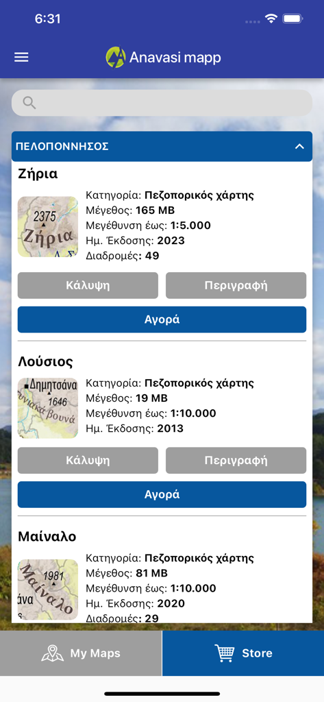
Anavasi mapp app interface showing a list of Greek hiking maps for purchase
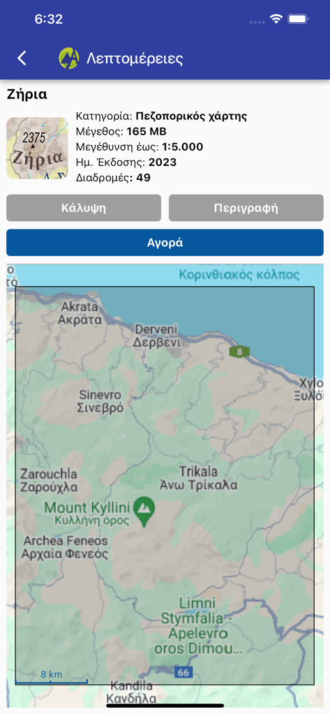
Detailed map view and purchase screen for the Ziria hiking region in the Anavasi mapp app
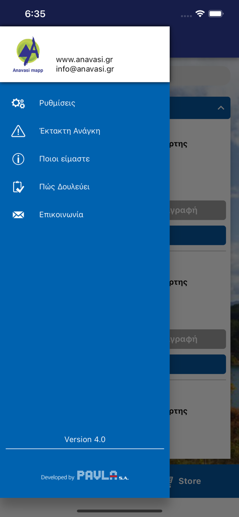
Anavasi mapp app sidebar menu featuring settings and emergency options
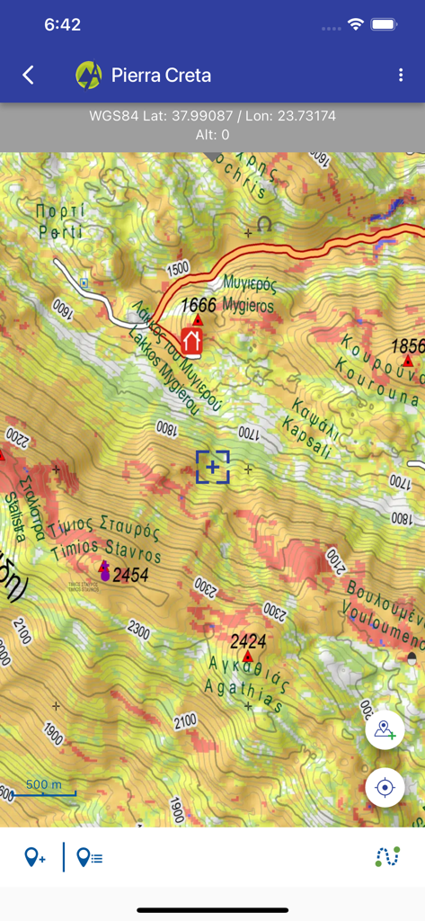
Detailed topographical hiking map of Crete in the Anavasi Mapp mobile application
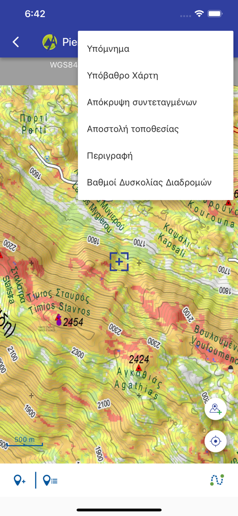
Topographic hiking map showing mountain terrain and navigation menu in the Anavasi Mapp app
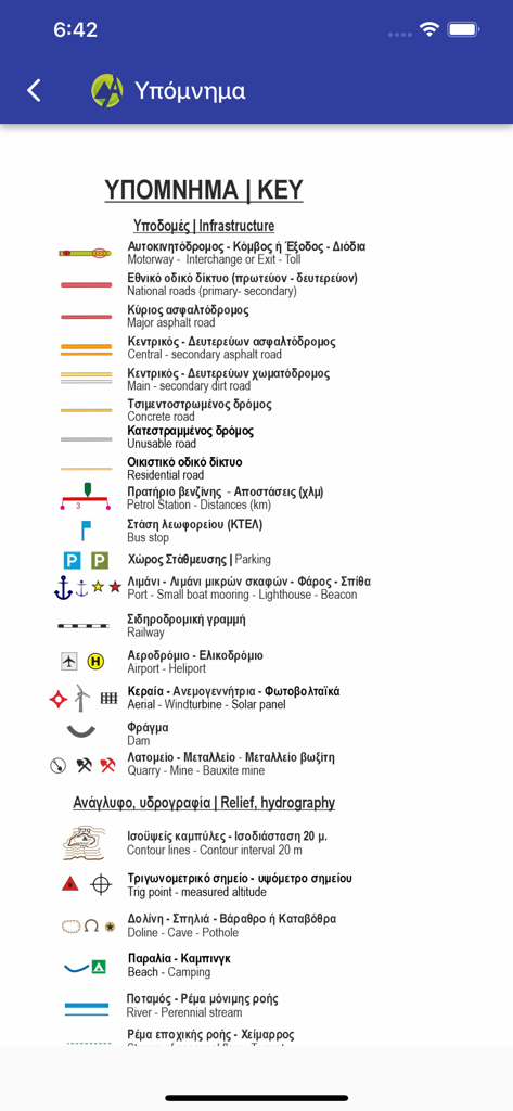
Detailed map legend for Anavasi hiking maps showing symbols for infrastructure and relief
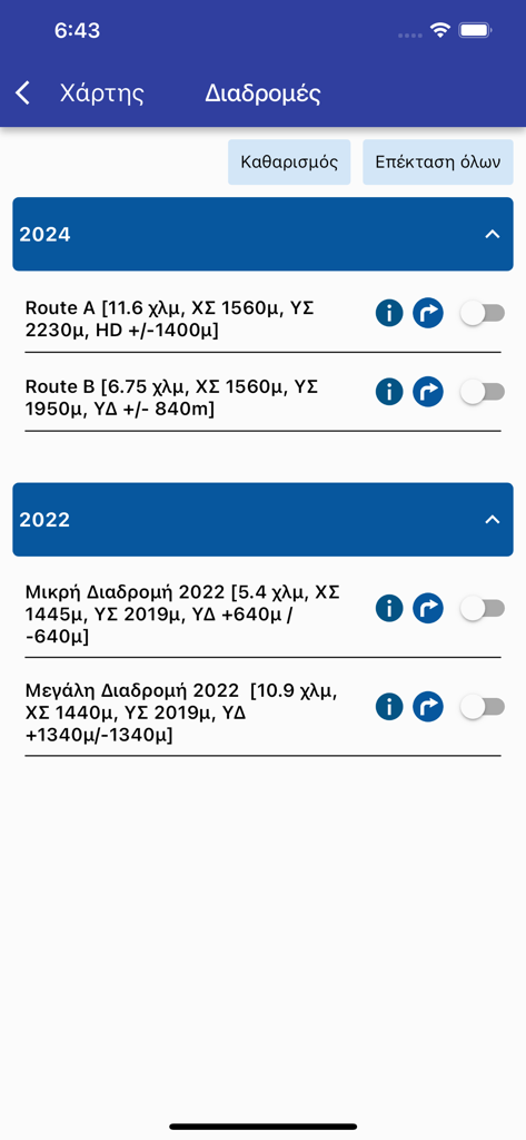
Anavasi Mapp hiking routes screen showing a list of trails with technical details like distance and elevation

Anavasi mapp settings screen showing coordinate system and language options.
Description
Download
More Like This
Top-ranked apps in the same category

Uber - Request a ride
Uber Technologies, Inc.

Airbnb
Airbnb, Inc.

铁路12306
ACADEMY OF RAILWAY SCIENCES CO., ltd.

Booking.com: Hotels & Travel
Booking.com B.V.

Grab: Taxi Ride, Food Delivery
GRABTAXI HOLDINGS PTE. LTD.

Trip.com: Book Flights, Hotels
Trip.com Travel Singapore Pte. Ltd.

DiDi China: Ride Hailing
Didi Chuxing (Beijing) Network Platform Technology Co., Ltd

去哪儿旅行-订酒店机票火车票
Beijing Qunar Information Technology Company Limit

Bolt: Request a Ride
BOLT TECHNOLOGY OU
This page is not an official page of the app or its developer, but an independent editorial publication created for informational and commentary purposes. Unless expressly stated otherwise, neither the app nor its developer is affiliated with, endorsed by, sponsored by, authorized by, or otherwise officially connected with MWM, Apple, Google Play, the app publisher, or the app's developer, and nothing on this page implies that the app was developed using MWM's services. Any trademarks, logos, screenshots, and other content remain the property of their respective owners.