This page is not an official page of the app or its developer, but an independent editorial publication created for informational and commentary purposes. Unless expressly stated otherwise, neither the app nor its developer is affiliated with, endorsed by, sponsored by, authorized by, or otherwise officially connected with MWM, Apple, Google Play, the app publisher, or the app's developer, and nothing on this page implies that the app was developed using MWM's services. Any trademarks, logos, screenshots, and other content remain the property of their respective owners.

Avalanche Forecasts
Access instant, color-coded danger levels from over 20 forecast centers across North America. Plan your backcountry adventures with confidence using real-time data and detailed regional reports.
Downloads
101K+User Rating
Total Ratings
600Publisher
Category
WeatherLocales
1Latest Version
2.3.58Size
37.7 MBFirst Released
Feb 14, 2012Stay Safe in the Backcountry
The ultimate dashboard for winter adventurers, centralizing expert avalanche forecasts from over 20 centers into one visual, real-time map.
At-a-Glance Danger Map
Quickly assess regional risk levels with our intuitive color-coded interface covering North America's top mountain ranges.
Multi-Day Trip Planning
Toggle between current and future forecasts to identify the safest windows for your next splitboarding or snowmobiling trip.
The following screenshots and description are sourced directly from the app's official store listing and are the property of the app developer.
App Store
Screenshots
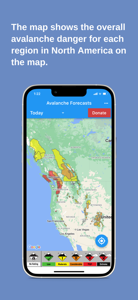
Avalanche Forecasts app showing color coded danger levels across a North American map
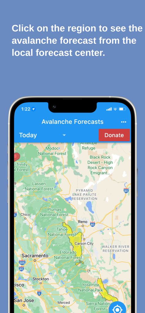
Avalanche Forecasts app showing a color coded safety map for backcountry regions
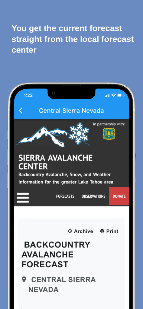
Avalanche Forecasts app screen showing a local backcountry report from the Sierra Avalanche Center.
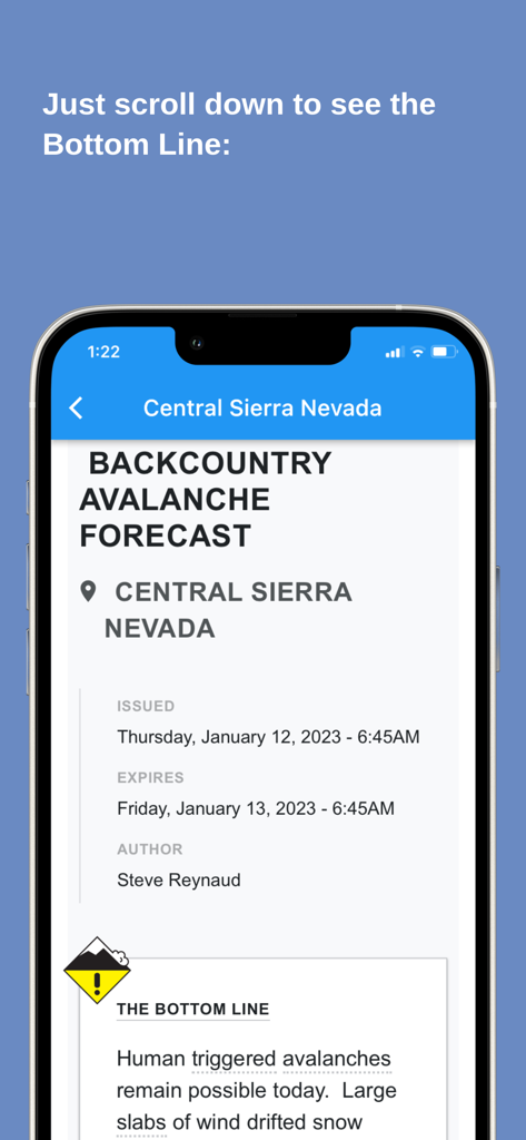
Detailed backcountry avalanche forecast report for Central Sierra Nevada on the Avalanche Forecasts app interface
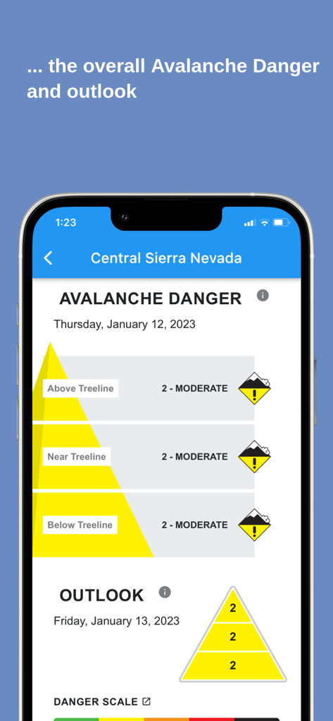
Avalanche Forecasts app displaying moderate danger levels for Central Sierra Nevada across different treelines.
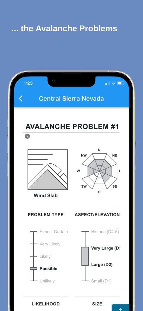
Detailed avalanche problem report for Central Sierra Nevada showing wind slab likelihood and size assessment
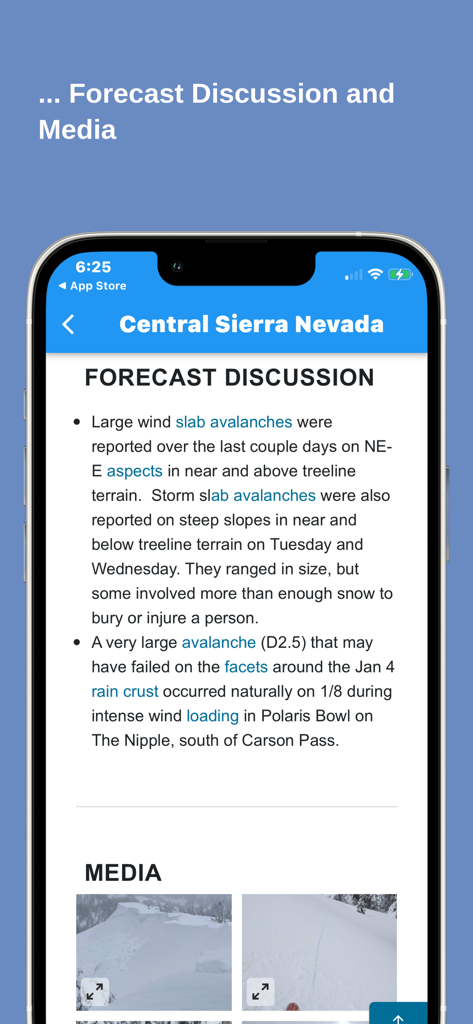
Avalanche forecast discussion and media photos for Central Sierra Nevada
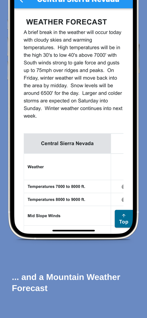
A detailed mountain weather forecast for the Central Sierra Nevada region within the Avalanche Forecasts app.
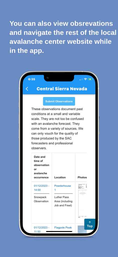
User interface of the Avalanche Forecasts app showing field observations and reports for Central Sierra Nevada.
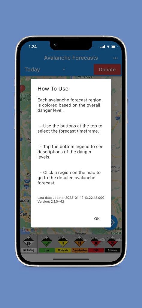
Tutorial popup on the Avalanche Forecasts app showing how to read the color coded danger levels on the map
Description
Download
More Like This
Top-ranked apps in the same category

墨迹天气-MojiWeather
Beijing MojiFengyun Technology Co.,Ltd.

The Weather Channel - Radar
The Weather Channel

Windy.com
Windyty, SE

天气预报-精准15日天气预报
Chongqing Caochen Technology Co., Ltd.

My Aurora Forecast & Alerts
JRustonApps B.V.

AccuWeather: Weather Forecast
AccuWeather International, Inc.

Weather & Radar - Storm radar
WetterOnline - Meteorologische Dienstleistungen GmbH

天气通
Weibo Internet Technology (China) Co.Ltd.

The Thermometer -Digital-
Vida Apps Incorporated
This page is not an official page of the app or its developer, but an independent editorial publication created for informational and commentary purposes. Unless expressly stated otherwise, neither the app nor its developer is affiliated with, endorsed by, sponsored by, authorized by, or otherwise officially connected with MWM, Apple, Google Play, the app publisher, or the app's developer, and nothing on this page implies that the app was developed using MWM's services. Any trademarks, logos, screenshots, and other content remain the property of their respective owners.