This page is not an official page of the app or its developer, but an independent editorial publication created for informational and commentary purposes. Unless expressly stated otherwise, neither the app nor its developer is affiliated with, endorsed by, sponsored by, authorized by, or otherwise officially connected with MWM, Apple, Google Play, the app publisher, or the app's developer, and nothing on this page implies that the app was developed using MWM's services. Any trademarks, logos, screenshots, and other content remain the property of their respective owners.

Avalanche Inclinometer
Stay avy savvy with high-visibility slope, elevation, and aspect readings. Designed for the rugged conditions of the backcountry with big fonts, voice feedback, and instant safety color-coding.
Downloads
88K+User Rating
Total Ratings
0Publisher
Category
SportsLocales
1Latest Version
1.0.1Size
53.7 MBFirst Released
Oct 12, 2016Master the Terrain with Confidence
Engineered for backcountry skiers and riders, providing the critical data you need to navigate avalanche terrain safely and efficiently.
High-Visibility Interface
Massive fonts and high-contrast displays designed for visibility in blinding sun or heavy storms, even while wearing goggles.
Eyes-Free Slope Analysis
Get instant feedback with color-coded risk dials and voice measurements that speak the steepness aloud as you measure.
The following screenshots and description are sourced directly from the app's official store listing and are the property of the app developer.
App Store
Screenshots
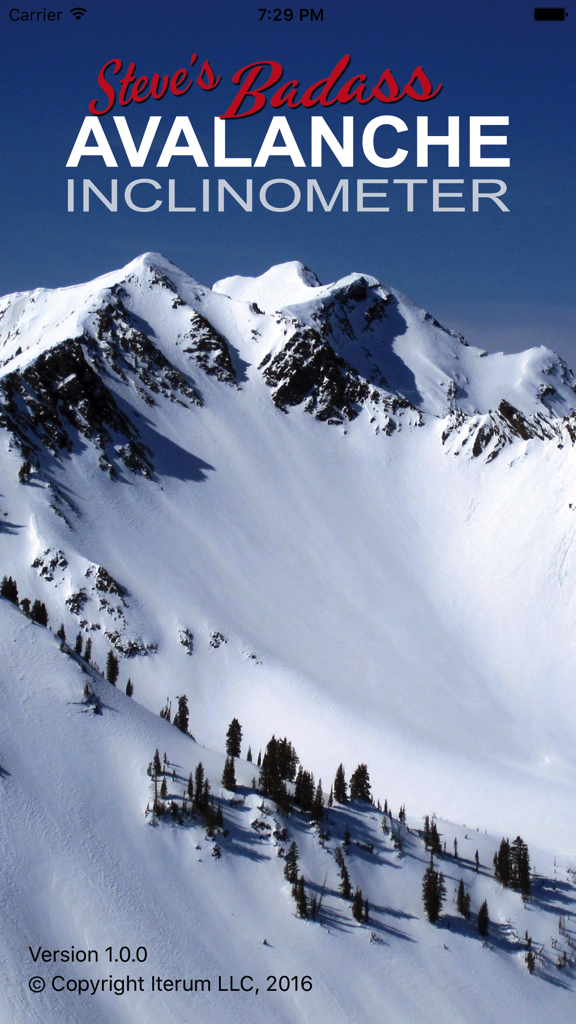
Steve's Badass Avalanche Inclinometer app home screen featuring a snow covered mountain range
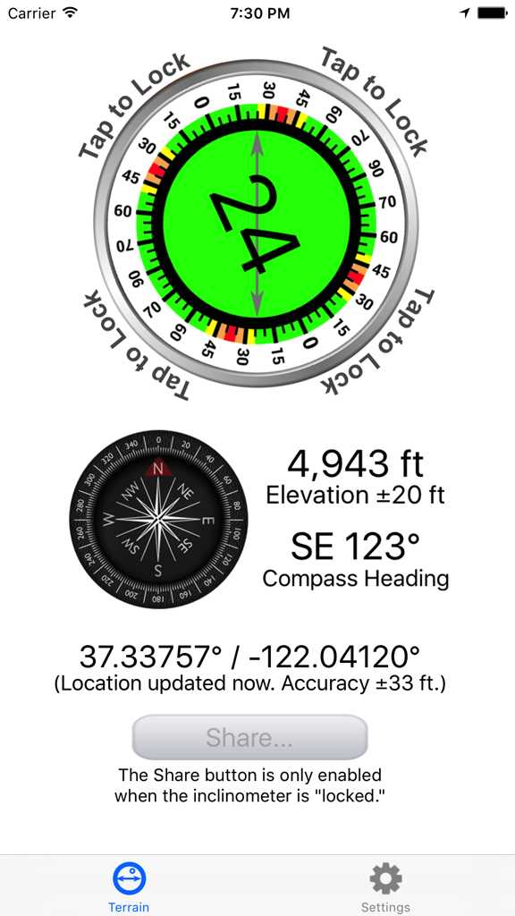
Avalanche Inclinometer app screen displaying a 24 degree slope angle elevation of 4943 feet and a compass heading
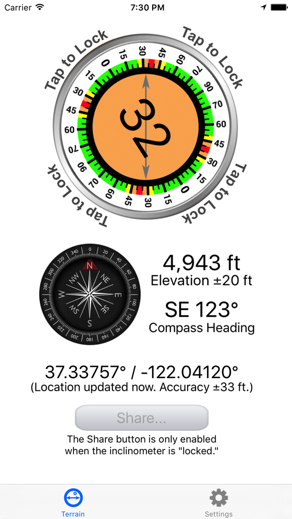
The Avalanche Inclinometer app interface displaying a 32 degree slope measurement, compass heading, elevation, and GPS coordinates.
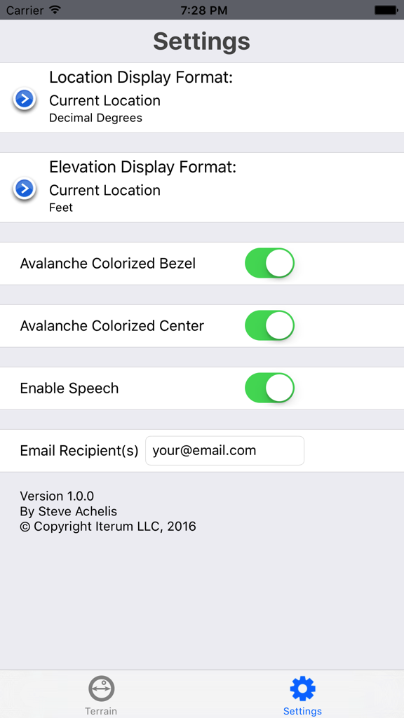
Settings screen of the Avalanche Inclinometer app with options for location format, colorized visual aids, and voice feedback.
Description
Download
More Like This
Top-ranked apps in the same category

得物 - 得到美好事物
Shanghai Dewu Information Group Co., Ltd.

懂球帝 - 足球篮球体坛数据
Hainan Football-Loving Girl Network Technology Co., Ltd.

Underdog Sports
Underdog Sports, Inc.

虎扑-评分篮球足球游戏影视
Shanghai Kuanghui Network Technology Co., LTD

ESPN: Live Sports & Scores
Disney Electronic Content, Inc.

Flashscore: Live Scores & News
Livesport s.r.o.

Polymarket
Blockratize Inc

DAZN: Stream Live Sports
DAZN Limited

DraftKings Sportsbook & Casino
DRAFTKINGS LLC.
This page is not an official page of the app or its developer, but an independent editorial publication created for informational and commentary purposes. Unless expressly stated otherwise, neither the app nor its developer is affiliated with, endorsed by, sponsored by, authorized by, or otherwise officially connected with MWM, Apple, Google Play, the app publisher, or the app's developer, and nothing on this page implies that the app was developed using MWM's services. Any trademarks, logos, screenshots, and other content remain the property of their respective owners.