This page is not an official page of the app or its developer, but an independent editorial publication created for informational and commentary purposes. Unless expressly stated otherwise, neither the app nor its developer is affiliated with, endorsed by, sponsored by, authorized by, or otherwise officially connected with MWM, Apple, Google Play, the app publisher, or the app's developer, and nothing on this page implies that the app was developed using MWM's services. Any trademarks, logos, screenshots, and other content remain the property of their respective owners.

Blue Liner Flows
Master the water with real-time USGS and NOAA insights. Track discharge, turbidity, and gauge height with custom alerts and widgets designed for serious anglers, kayakers, and rafters.
Downloads
600User Rating
Total Ratings
0Publisher
Category
WeatherLocales
1Latest Version
4.2.1Size
3.7 MBFirst Released
Jan 15, 2024Your Ultimate River Command Center
Professional-grade data from USGS and NOAA tailored for anglers and paddlers to ensure every trip is safe and successful.
Precision Stream Insights
Track more than just flow with real-time data on temperature, turbidity, and oxygen levels to find exactly where the fish are biting.
Custom Flow Alerts
Stay ahead of the curve with instant notifications the moment river conditions or gauge heights hit your preferred parameters.
The following screenshots and description are sourced directly from the app's official store listing and are the property of the app developer.
App Store
Screenshots
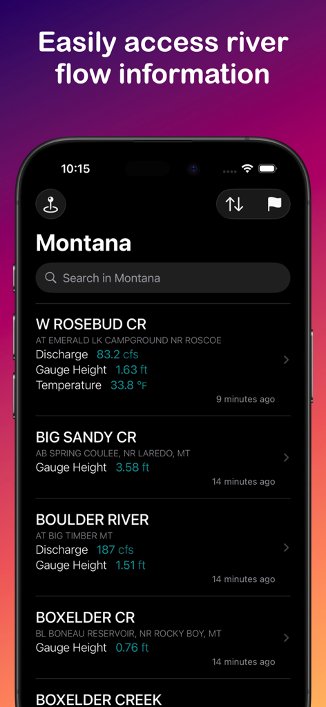
Blue Liner Flows app interface showing real time river flow data and gauge heights for Montana
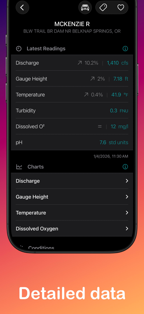
A mobile interface from the Blue Liner Flows app showing real-time river data for the McKenzie River including discharge, temperature, and turbidity.
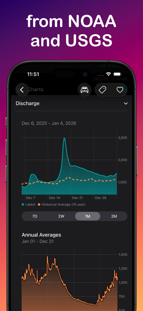
Blue Liner Flows app interface showing river discharge charts and historical average data
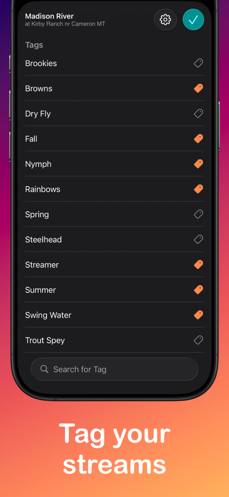
A mobile app interface from Blue Liner Flows showing a list of tags like Browns, Dry Fly, and Rainbows for organizing stream locations.
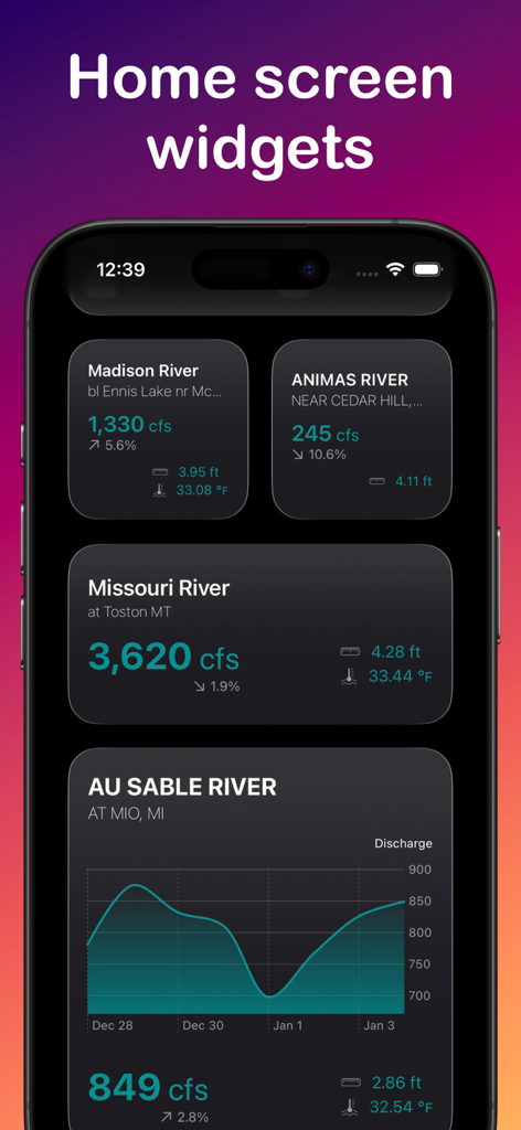
Blue Liner Flows app widgets on an iPhone home screen displaying real-time river discharge and water temperature data
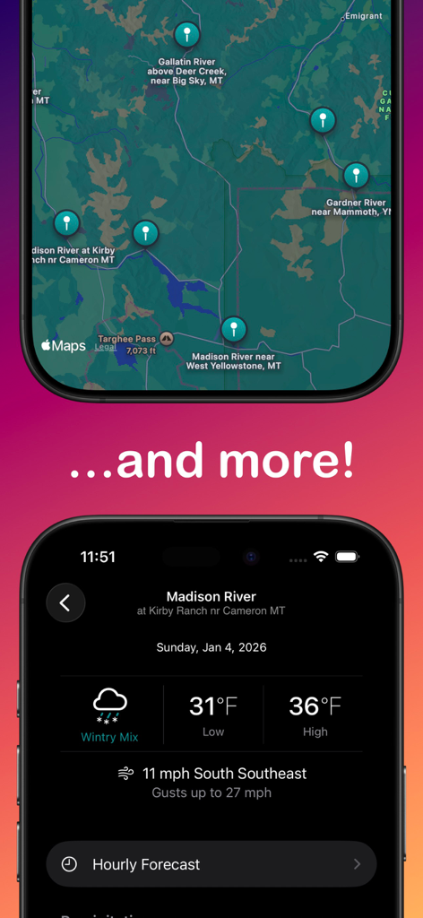
Interactive river map and detailed weather forecast screens from the Blue Liner Flows app.
Description
Download
More Like This
Top-ranked apps in the same category

墨迹天气-MojiWeather
Beijing MojiFengyun Technology Co.,Ltd.

The Weather Channel - Radar
The Weather Channel

Windy.com
Windyty, SE

天气预报-精准15日天气预报
Chongqing Caochen Technology Co., Ltd.

My Aurora Forecast & Alerts
JRustonApps B.V.

AccuWeather: Weather Forecast
AccuWeather International, Inc.

Weather & Radar - Storm radar
WetterOnline - Meteorologische Dienstleistungen GmbH

天气通
Weibo Internet Technology (China) Co.Ltd.

IQAir AirVisual | Air Quality
IQAir AG
This page is not an official page of the app or its developer, but an independent editorial publication created for informational and commentary purposes. Unless expressly stated otherwise, neither the app nor its developer is affiliated with, endorsed by, sponsored by, authorized by, or otherwise officially connected with MWM, Apple, Google Play, the app publisher, or the app's developer, and nothing on this page implies that the app was developed using MWM's services. Any trademarks, logos, screenshots, and other content remain the property of their respective owners.