This page is not an official page of the app or its developer, but an independent editorial publication created for informational and commentary purposes. Unless expressly stated otherwise, neither the app nor its developer is affiliated with, endorsed by, sponsored by, authorized by, or otherwise officially connected with MWM, Apple, Google Play, the app publisher, or the app's developer, and nothing on this page implies that the app was developed using MWM's services. Any trademarks, logos, screenshots, and other content remain the property of their respective owners.

BusBahnBim
From the streets of Vienna to the peaks of the Alps, master your journey with real-time multimodal routing for trains, trams, buses, bikes, and more.
Downloads
239K+User Rating
Total Ratings
1K+Publisher
Category
TravelLocales
11Latest Version
11.2.4Size
81.4 MBFirst Released
Apr 18, 2012Everything You Need to Navigate Austria
Stop guessing and start exploring with Austria's most accurate multimodal transit planner, designed to get you from point A to B like a local.
Seamless Multimodal Routing
Combine trains, trams, buses, and bikes into one itinerary for the fastest way across any city or alpine village.
Live Accuracy You Can Trust
Avoid travel stress with real-time updates on delays and construction powered by official Austrian traffic data.
The following screenshots and description are sourced directly from the app's official store listing and are the property of the app developer.
App Store
Screenshots
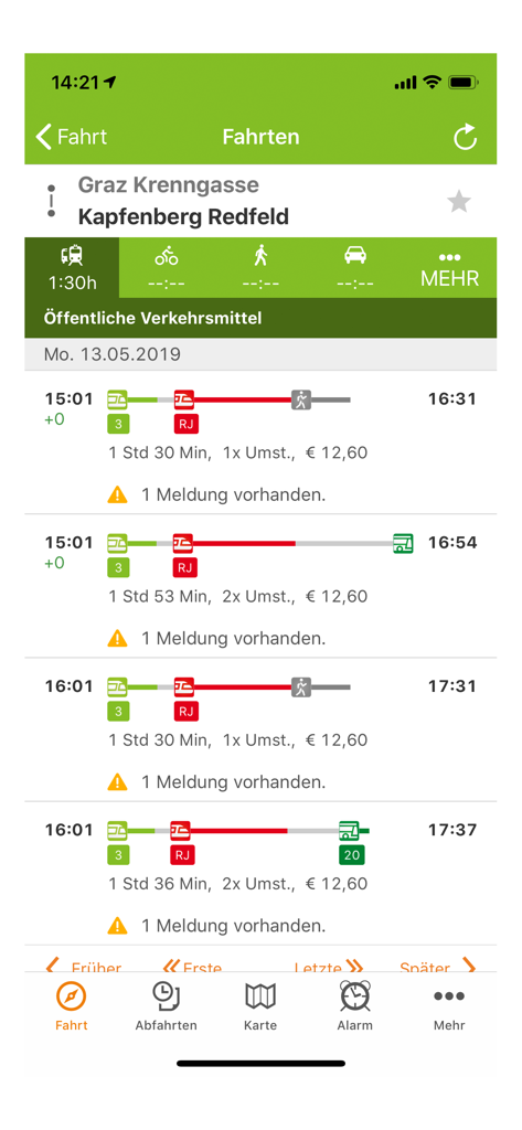
Screenshot of the BusBahnBim app showing travel routes and public transportation schedules in Austria
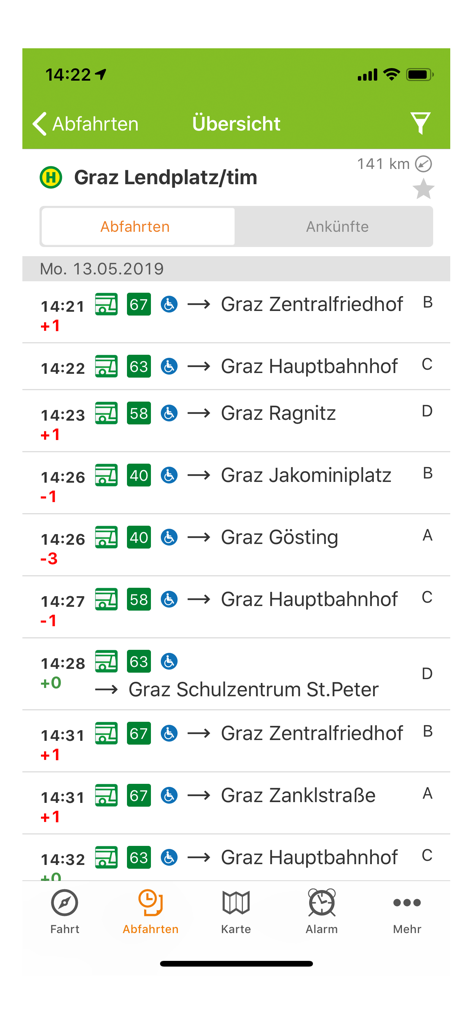
Real-time bus departure list for Graz Lendplatz in the BusBahnBim app
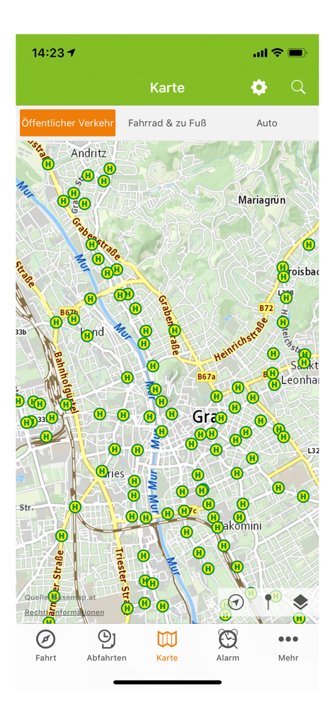
Map view of the BusBahnBim app showing public transportation stops in Graz Austria
Description
Download
More Like This
Top-ranked apps in the same category

Uber - Request a ride
Uber Technologies, Inc.

Airbnb
Airbnb, Inc.

铁路12306
ACADEMY OF RAILWAY SCIENCES CO., ltd.

Booking.com: Hotels & Travel
Booking.com B.V.

Grab: Taxi Ride, Food Delivery
GRABTAXI HOLDINGS PTE. LTD.

Trip.com: Book Flights, Hotels
Trip.com Travel Singapore Pte. Ltd.

DiDi China: Ride Hailing
Didi Chuxing (Beijing) Network Platform Technology Co., Ltd

去哪儿旅行-订酒店机票火车票
Beijing Qunar Information Technology Company Limit

Bolt: Request a Ride
BOLT TECHNOLOGY OU
This page is not an official page of the app or its developer, but an independent editorial publication created for informational and commentary purposes. Unless expressly stated otherwise, neither the app nor its developer is affiliated with, endorsed by, sponsored by, authorized by, or otherwise officially connected with MWM, Apple, Google Play, the app publisher, or the app's developer, and nothing on this page implies that the app was developed using MWM's services. Any trademarks, logos, screenshots, and other content remain the property of their respective owners.