This page is not an official page of the app or its developer, but an independent editorial publication created for informational and commentary purposes. Unless expressly stated otherwise, neither the app nor its developer is affiliated with, endorsed by, sponsored by, authorized by, or otherwise officially connected with MWM, Apple, Google Play, the app publisher, or the app's developer, and nothing on this page implies that the app was developed using MWM's services. Any trademarks, logos, screenshots, and other content remain the property of their respective owners.

Drone Forecast DJI Fly Air Map
Take the guesswork out of flying. Access altitude-specific wind speeds, real-time no-fly zones, and tailored safety alerts to protect your UAV and capture the perfect shot every time.
Downloads
22K+User Rating
Total Ratings
100Publisher
Category
WeatherLocales
32Latest Version
1.2.5Size
30.6 MBFirst Released
Dec 16, 2024Fly With Absolute Confidence
Comprehensive weather intelligence and airspace data tailored for professional UAV pilots and high-end drone enthusiasts.
Altitude-Specific Wind Data
Don't guess the gusts. Get hyper-local wind speeds at your exact flight height to ensure total stability and hardware safety.
Integrated Airspace Maps
Fly legally and avoid heavy fines with real-time No-Fly Zone overlays and FAA-compliant regional flight restrictions.
The following screenshots and description are sourced directly from the app's official store listing and are the property of the app developer.
App Store
Screenshots
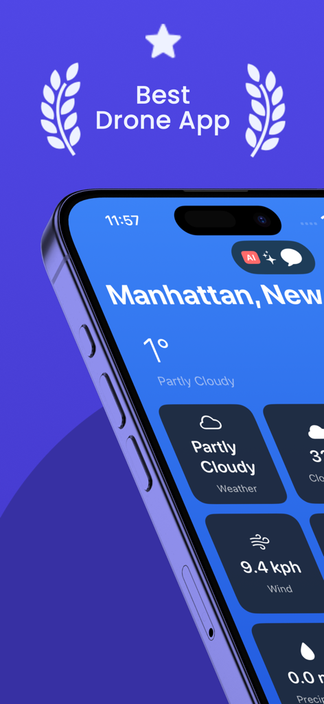
Drone forecast app interface showing wind speed and weather for safe flight planning.
Drone forecast app showing real time wind speed visibility and temperature for UAV pilots
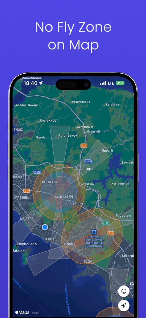
Drone Forecast app interface displaying restricted airspace and no fly zones on an interactive map for pilots.
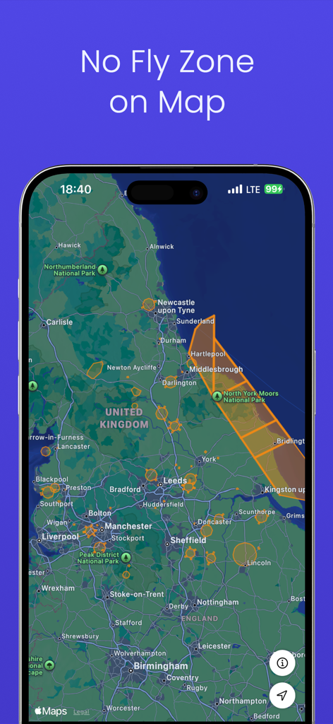
Interactive map showing restricted drone flight areas and no fly zones.
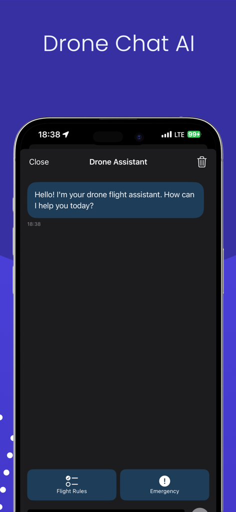
AI drone flight assistant chat interface featuring quick links for flight rules and emergency situations.
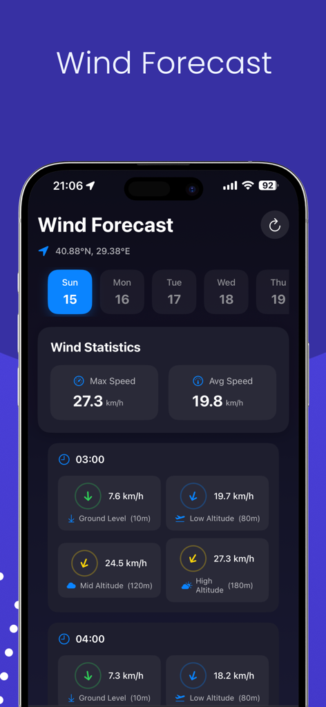
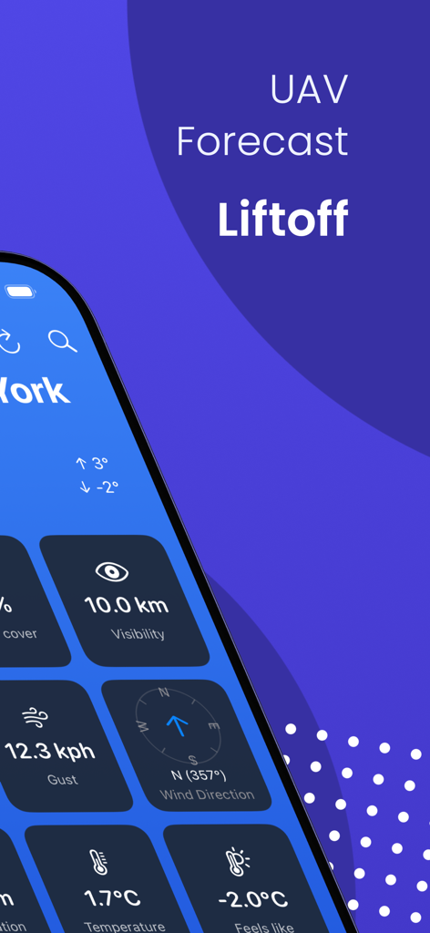
Drone wind forecast dashboard displaying wind speed statistics across different flight altitudes for safe UAV operations.
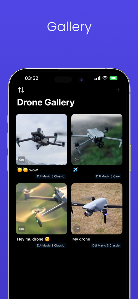
A mobile interface showing the Drone Gallery feature with various DJI Mavic drone photos
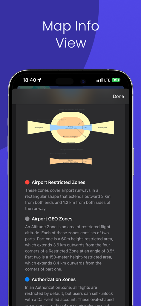
Map Info View showing drone flight restrictions and airport GEO zones diagrams
Description
Download
More Like This
Top-ranked apps in the same category

墨迹天气-MojiWeather
Beijing MojiFengyun Technology Co.,Ltd.

The Weather Channel - Radar
The Weather Channel

Windy.com
Windyty, SE

天气预报-精准15日天气预报
Chongqing Caochen Technology Co., Ltd.

My Aurora Forecast & Alerts
JRustonApps B.V.

AccuWeather: Weather Forecast
AccuWeather International, Inc.

Weather & Radar - Storm radar
WetterOnline - Meteorologische Dienstleistungen GmbH

天气通
Weibo Internet Technology (China) Co.Ltd.

The Thermometer -Digital-
Vida Apps Incorporated
This page is not an official page of the app or its developer, but an independent editorial publication created for informational and commentary purposes. Unless expressly stated otherwise, neither the app nor its developer is affiliated with, endorsed by, sponsored by, authorized by, or otherwise officially connected with MWM, Apple, Google Play, the app publisher, or the app's developer, and nothing on this page implies that the app was developed using MWM's services. Any trademarks, logos, screenshots, and other content remain the property of their respective owners.