This page is not an official page of the app or its developer, but an independent editorial publication created for informational and commentary purposes. Unless expressly stated otherwise, neither the app nor its developer is affiliated with, endorsed by, sponsored by, authorized by, or otherwise officially connected with MWM, Apple, Google Play, the app publisher, or the app's developer, and nothing on this page implies that the app was developed using MWM's services. Any trademarks, logos, screenshots, and other content remain the property of their respective owners.

Earth Maps 3D: Live Satellite
Unlock unrestricted access to high-resolution imagery, immersive 3D terrain, and pro-level measurement tools designed for landowners, travelers, and real estate experts.
Downloads
0User Rating
Total Ratings
0Publisher
Category
TravelLocales
1Latest Version
1.0Size
80.4 MBFirst Released
Mar 16, 2026Professional Geographic Intelligence
Access the world's most powerful mapping tools. From military-grade measurements to high-resolution 3D terrain, get the precision you need for land management and exploration.
Precision Measurement Tools
Calculate land area, perimeters, and exact distances with professional-grade accuracy—ideal for property scouting and landscaping.
High-Res Live Satellite
View any coordinate on Earth with crystal-clear 3D imagery and unrestricted access to detailed terrain and cityscapes.
The following screenshots and description are sourced directly from the app's official store listing and are the property of the app developer.
App Store
Screenshots
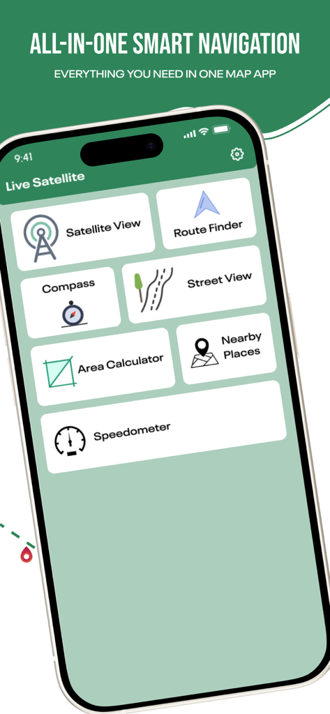
Main dashboard of Earth Maps 3D app featuring satellite view route finder and area calculator
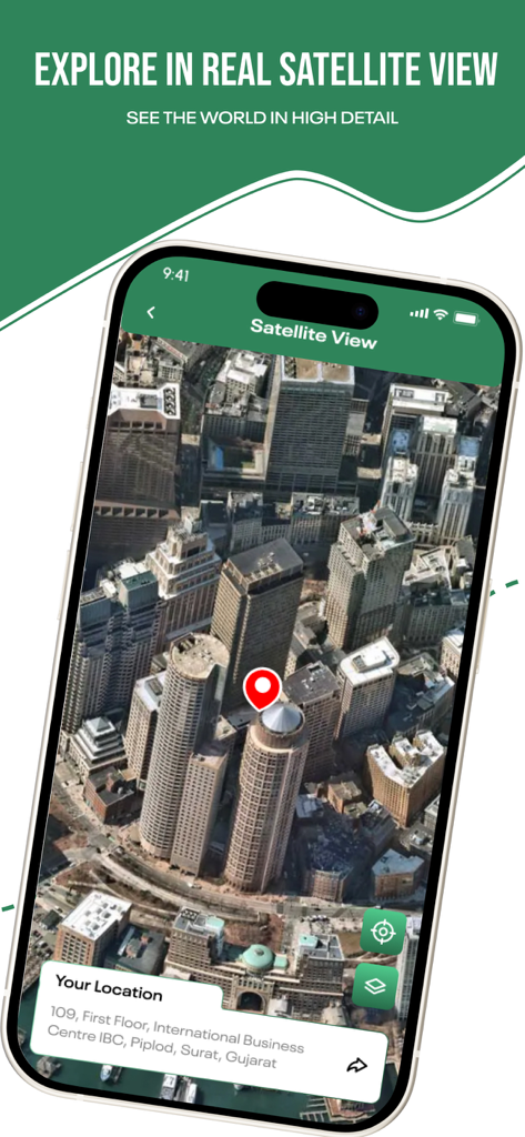
Earth Maps 3D app displaying high detail satellite view of city buildings
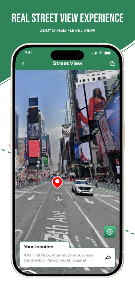
iPhone screen showing a 360 degree street level view of a city avenue
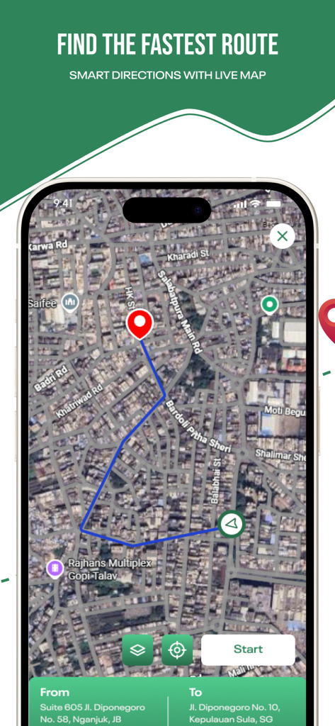
Earth Maps 3D interface showing the fastest route with smart directions on a live satellite map
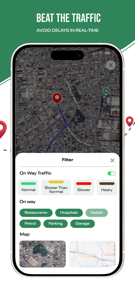
A mobile interface for Earth Maps 3D showing real-time traffic filters and nearby points of interest like restaurants and hospitals on a satellite map.
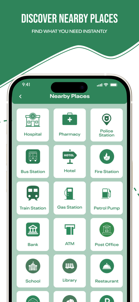
Nearby Places screen showing icons for local services like hospitals and banks
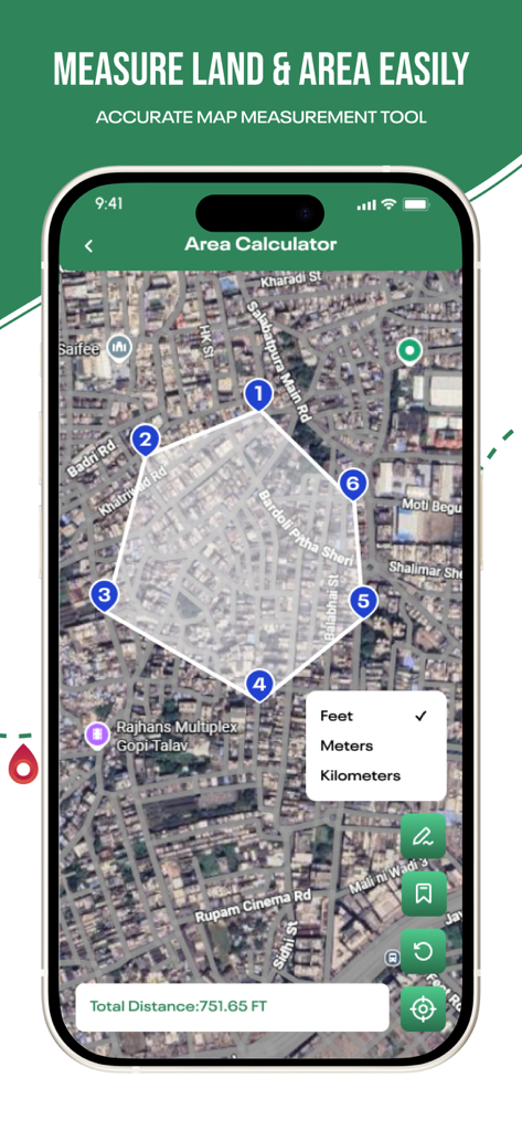
Satellite view of the app showing the area calculator tool with numbered points measuring land in feet
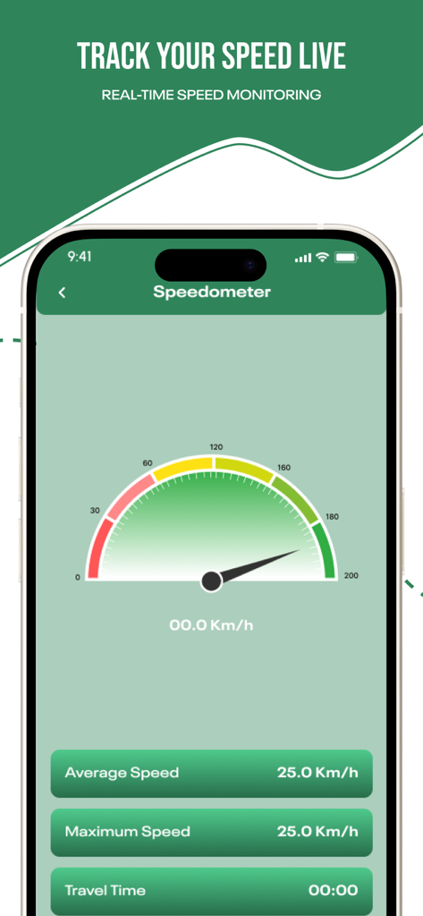
Digital speedometer interface in Earth Maps 3D showing real-time speed monitoring.
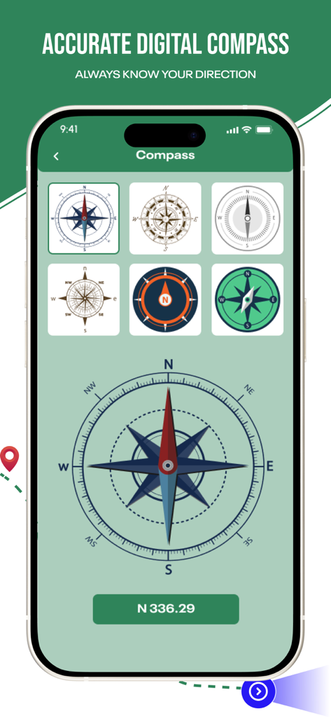
Digital compass interface in Earth Maps 3D app showing multiple compass dial styles and directional tools.
Description
Download
More Like This
Top-ranked apps in the same category

Uber - Request a ride
Uber Technologies, Inc.

铁路12306
ACADEMY OF RAILWAY SCIENCES CO., ltd.

Airbnb
Airbnb, Inc.

Grab: Taxi Ride, Food Delivery
GRABTAXI HOLDINGS PTE. LTD.

Booking.com: Hotels & Travel
Booking.com B.V.

DiDi China: Ride Hailing
Didi Chuxing (Beijing) Network Platform Technology Co., Ltd

Trip.com: Book Flights, Hotels
Trip.com Travel Singapore Pte. Ltd.

携程旅行-订酒店机票火车票
Shanghai Ctrip Commerce Co.,Ltd

去哪儿旅行-订酒店机票火车票
Beijing Qunar Information Technology Company Limit
This page is not an official page of the app or its developer, but an independent editorial publication created for informational and commentary purposes. Unless expressly stated otherwise, neither the app nor its developer is affiliated with, endorsed by, sponsored by, authorized by, or otherwise officially connected with MWM, Apple, Google Play, the app publisher, or the app's developer, and nothing on this page implies that the app was developed using MWM's services. Any trademarks, logos, screenshots, and other content remain the property of their respective owners.