This page is not an official page of the app or its developer, but an independent editorial publication created for informational and commentary purposes. Unless expressly stated otherwise, neither the app nor its developer is affiliated with, endorsed by, sponsored by, authorized by, or otherwise officially connected with MWM, Apple, Google Play, the app publisher, or the app's developer, and nothing on this page implies that the app was developed using MWM's services. Any trademarks, logos, screenshots, and other content remain the property of their respective owners.

Fires: Wildfire News and Atlas
Protect your home and family with the professional-grade tool trusted by millions. Monitor active blazes with live 3D aircraft tracking, official evacuation alerts, and high-resolution offline maps.
Downloads
349K+User Rating
Total Ratings
100Publisher
Category
NewsLocales
1Latest Version
4.7.0Size
54.6 MBFirst Released
Sep 8, 2016Professional-Grade Intelligence for Your Safety
Access the same real-time data used by first responders to protect your home, family, and outdoor adventures with the world’s most trusted wildfire tracker.
Live 3D Aircraft Tracking
Monitor firefighting tankers and helicopters in real-time with 3D flight paths to see exactly where suppression efforts are focused.
Professional Offline Atlas
Navigate safely off-the-grid with access to over 80 high-resolution National Forest and BLM maps that work without cell service.
The following screenshots and description are sourced directly from the app's official store listing and are the property of the app developer.
App Store
Screenshots
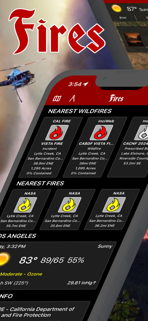
Interface of the Fires app showing real-time wildfire tracking and local weather data
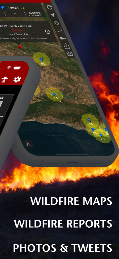
Fires app interface showing wildfire maps and incident reports over a background of flames
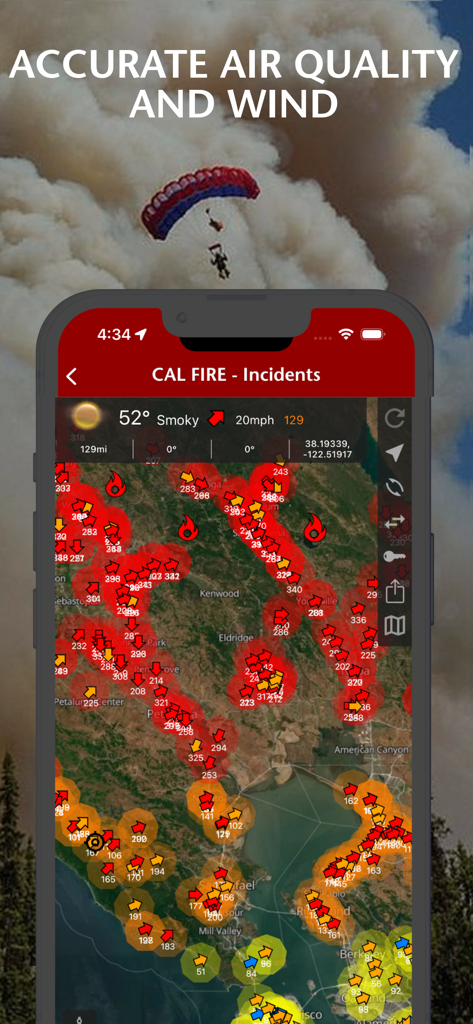
Wildfire news app displaying air quality and wind conditions on an interactive incident map.
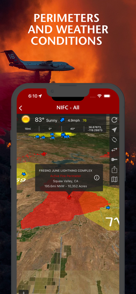
A smartphone screen displaying wildfire perimeters and weather conditions on a map from the Fires app

Mobile app interface displaying wildfire incident details including a map perimeter and photo of the 2024 Lake Fire
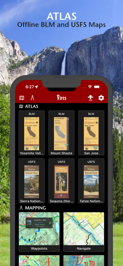
Fires app interface showing offline BLM and USFS maps for national forests and parks
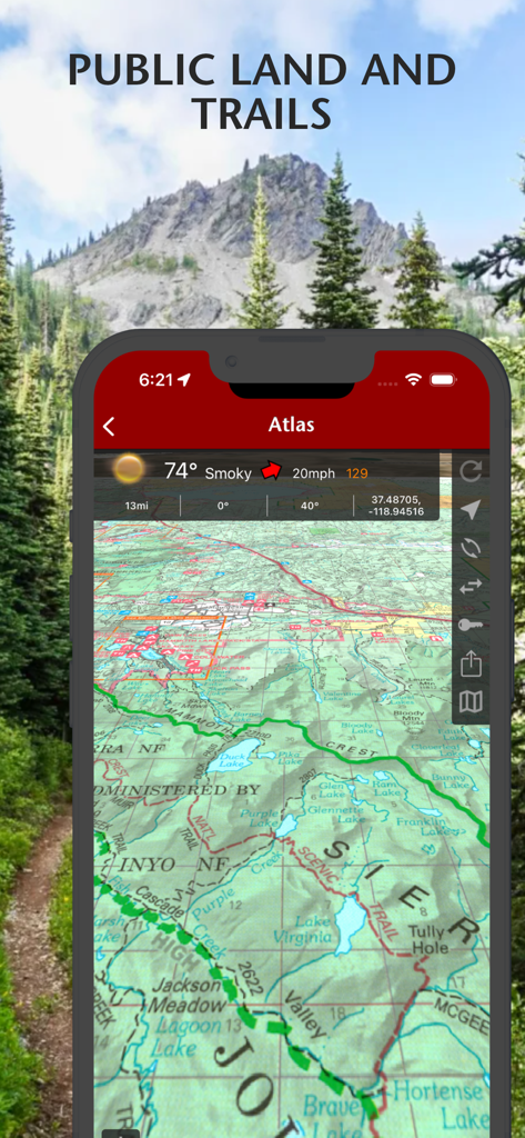
Topographic map view showing public lands and hiking trails with weather data in the Fires app.
Description
Download
More Like This
Top-ranked apps in the same category

X
X Corp.

REDDIT, INC.

Substack
Substack Inc.

NYTimes: US and Global News
The New York Times Company

Nextdoor: Neighborhood Network
Nextdoor.com, Inc.

CrimeRadar Dispatch Audio
Scoopz Inc.

NewsBreak: Local News & Alerts
Particle Media Inc.

Ground News
Snapwise Inc.

Google News
Google LLC
This page is not an official page of the app or its developer, but an independent editorial publication created for informational and commentary purposes. Unless expressly stated otherwise, neither the app nor its developer is affiliated with, endorsed by, sponsored by, authorized by, or otherwise officially connected with MWM, Apple, Google Play, the app publisher, or the app's developer, and nothing on this page implies that the app was developed using MWM's services. Any trademarks, logos, screenshots, and other content remain the property of their respective owners.