This page is not an official page of the app or its developer, but an independent editorial publication created for informational and commentary purposes. Unless expressly stated otherwise, neither the app nor its developer is affiliated with, endorsed by, sponsored by, authorized by, or otherwise officially connected with MWM, Apple, Google Play, the app publisher, or the app's developer, and nothing on this page implies that the app was developed using MWM's services. Any trademarks, logos, screenshots, and other content remain the property of their respective owners.

FlySafe paragliding
Discover new launch sites, access live weather data, and track your flight statistics. Stay connected with a global pilot network through real-time location sharing and integrated chat.
Downloads
0User Rating
Total Ratings
0Publisher
Category
SportsLocales
1Latest Version
3.25.1Size
54.4 MBFirst Released
Sep 4, 2019Fly Smarter, Fly Safer
Join the elite community of pilots using real-time data and local intelligence to master the skies and mitigate risk.
Live Flight Intelligence
Fly with confidence using live weather station data and real-time tracking so your friends and community always know you are safe.
Explore with Local Beta
Discover new sites and connect directly with local pilots to understand terrain and regulations before you ever reach the launch.
The following screenshots and description are sourced directly from the app's official store listing and are the property of the app developer.
App Store
Screenshots
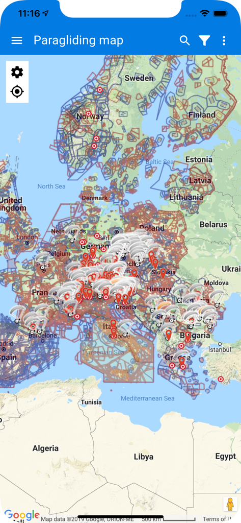
Map of Europe showing paragliding sites and flight data in the FlySafe app
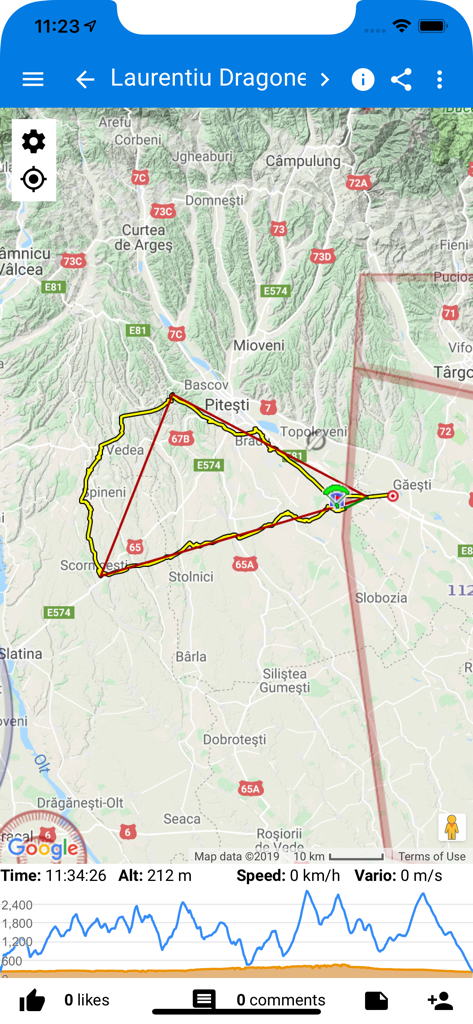
A paragliding flight track displayed on a map with an altitude graph and flight statistics including speed and time.
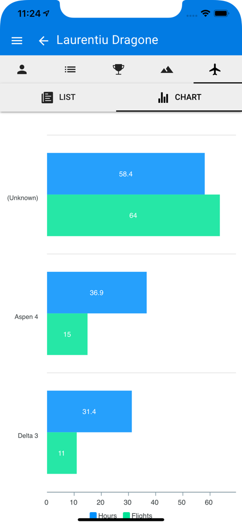
Flight statistics chart showing hours and number of flights per glider
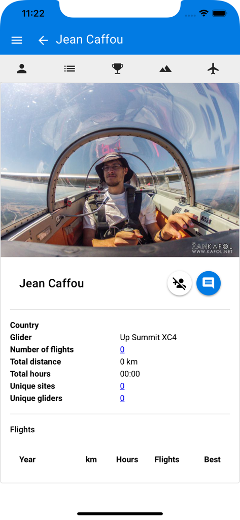
Profile page in the FlySafe paragliding app displaying pilot statistics and flight history.
Description
Download
More Like This
Top-ranked apps in the same category

得物 - 得到美好事物
Shanghai Dewu Information Group Co., Ltd.

NCAA March Madness Live
Turner Sports

MLB
Major League Baseball Advanced Media

虎扑-评分篮球足球游戏影视
Shanghai Kuanghui Network Technology Co., LTD

CBS Sports App: Scores & News
CBS Mobile

懂球帝 - 足球篮球体坛数据
Hainan Football-Loving Girl Network Technology Co., Ltd.

Flashscore: Live Scores & News
Livesport s.r.o.

运动世界校园版-大学生校园趣味运动
Zhejiang Wanhang Mdt InfoTech Co., Ltd.

MLB Ballpark
Major League Baseball Advanced Media
This page is not an official page of the app or its developer, but an independent editorial publication created for informational and commentary purposes. Unless expressly stated otherwise, neither the app nor its developer is affiliated with, endorsed by, sponsored by, authorized by, or otherwise officially connected with MWM, Apple, Google Play, the app publisher, or the app's developer, and nothing on this page implies that the app was developed using MWM's services. Any trademarks, logos, screenshots, and other content remain the property of their respective owners.