This page is not an official page of the app or its developer, but an independent editorial publication created for informational and commentary purposes. Unless expressly stated otherwise, neither the app nor its developer is affiliated with, endorsed by, sponsored by, authorized by, or otherwise officially connected with MWM, Apple, Google Play, the app publisher, or the app's developer, and nothing on this page implies that the app was developed using MWM's services. Any trademarks, logos, screenshots, and other content remain the property of their respective owners.

Green Trails
Discover family-friendly routes, detailed elevation profiles, and local hidden gems. Whether hiking or biking, stay on track with offline maps and real-time trail updates.
Downloads
0User Rating
Total Ratings
0Publisher
Category
SportsLocales
2Latest Version
2.3.0Size
168.4 MBFirst Released
May 23, 2024Master Every Trail with Precision
Your ultimate digital companion for exploring the Waldeck-Frankenberg region, offering detailed trail data, offline maps, and local gems for the perfect family adventure or solo ride.
Offline Interactive Maps
Navigate with confidence even in dead zones. Access high-resolution, filterable maps that keep you on track without needing a cellular signal.
Real-Time Trail Status
Know before you go. Get live updates on trail conditions and closures to plan your route based on difficulty, length, and elevation.
The following screenshots and description are sourced directly from the app's official store listing and are the property of the app developer.
App Store
Screenshots
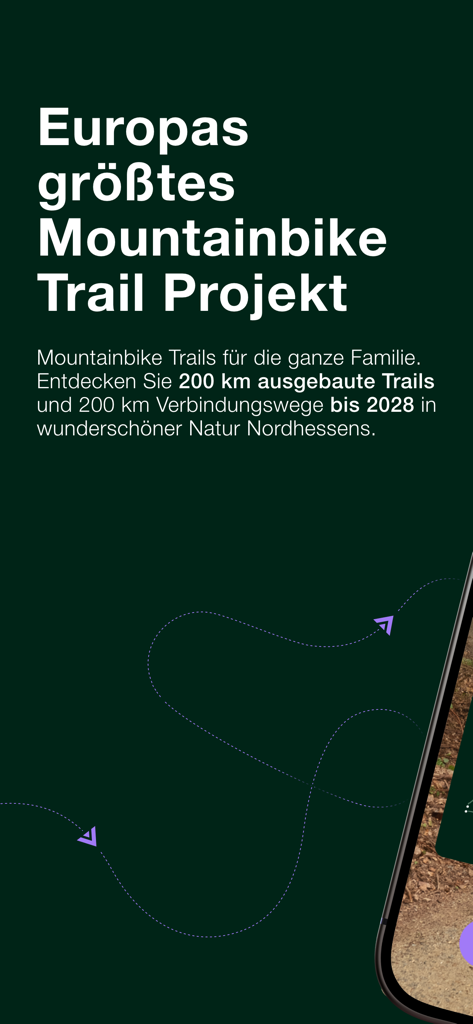
Introductory screen for the Green Trails app highlighting Europe largest mountain bike project in North Hesse Germany
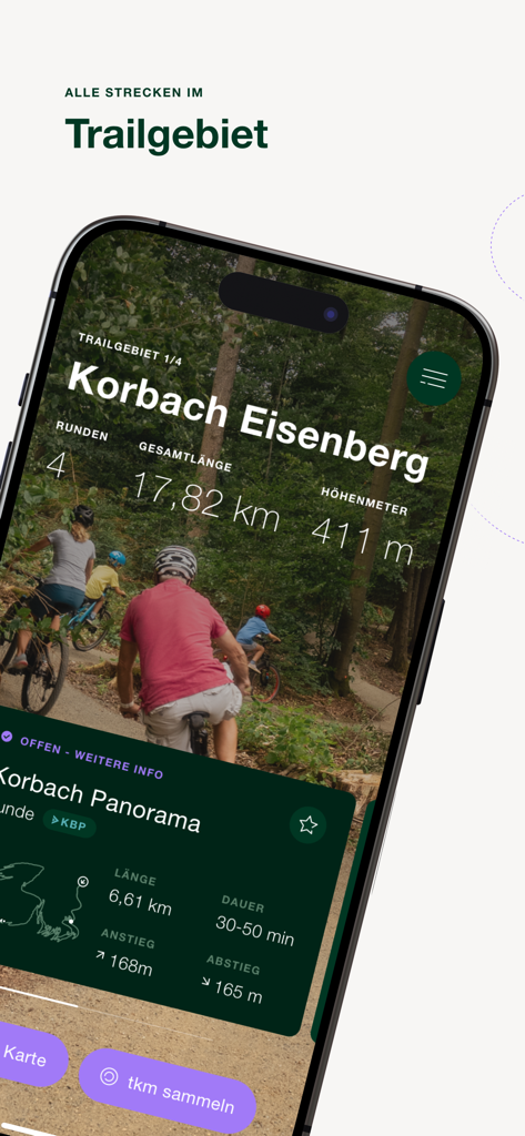
Green Trails app interface showing mountain bike trail details for Korbach Eisenberg including length and elevation
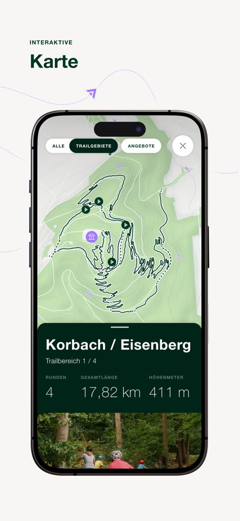
Green Trails app interactive map showing trail route and elevation statistics
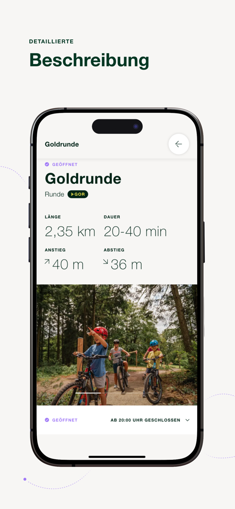
Green Trails app screen showing detailed information and photos for the Goldrunde mountain bike trail

Green Trails app interface showing a trail map with length, duration, and elevation data

Green Trails app screen highlighting the reward system for collecting trail kilometers and redeeming them for discounts.
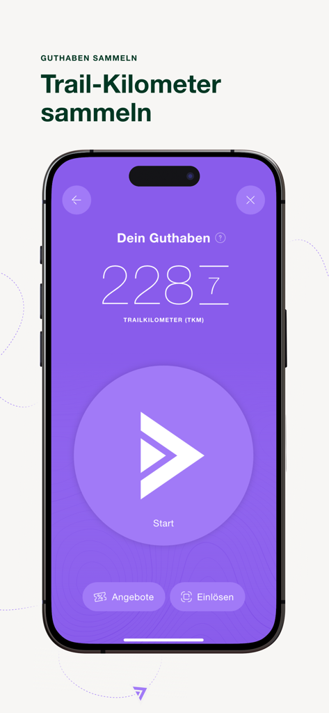
Green Trails app interface showing collected trail kilometers and a start button
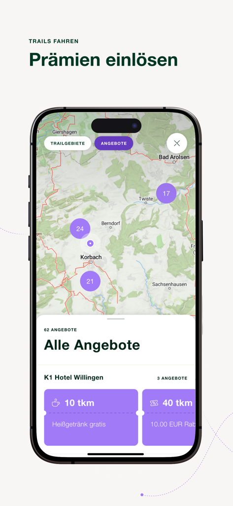
Green Trails app interface showing a map of trail locations and local rewards like free drinks
Description
Download
More Like This
Top-ranked apps in the same category

得物 - 得到美好事物
Shanghai Dewu Information Group Co., Ltd.

虎扑-评分篮球足球游戏影视
Shanghai Kuanghui Network Technology Co., LTD

运动世界校园版-大学生校园趣味运动
Zhejiang Wanhang Mdt InfoTech Co., Ltd.

NCAA March Madness Live
Turner Sports

CBS Sports App: Scores & News
CBS Mobile

F1 TV
Formula One Digital Media Limited

GameChanger
GameChanger Media, Inc.

Formula 1®
Formula One Digital Media Limited

MLB
Major League Baseball Advanced Media
This page is not an official page of the app or its developer, but an independent editorial publication created for informational and commentary purposes. Unless expressly stated otherwise, neither the app nor its developer is affiliated with, endorsed by, sponsored by, authorized by, or otherwise officially connected with MWM, Apple, Google Play, the app publisher, or the app's developer, and nothing on this page implies that the app was developed using MWM's services. Any trademarks, logos, screenshots, and other content remain the property of their respective owners.