This page is not an official page of the app or its developer, but an independent editorial publication created for informational and commentary purposes. Unless expressly stated otherwise, neither the app nor its developer is affiliated with, endorsed by, sponsored by, authorized by, or otherwise officially connected with MWM, Apple, Google Play, the app publisher, or the app's developer, and nothing on this page implies that the app was developed using MWM's services. Any trademarks, logos, screenshots, and other content remain the property of their respective owners.

Hunterra: map&book your hunts
Master your hunting grounds with real-time participant and dog tracking, offline GPS maps, and a complete land management system designed for safety and success.
Downloads
12K+User Rating
Total Ratings
100Publisher
Category
SportsLocales
16Latest Version
2.5.17Size
149.2 MBFirst Released
Aug 31, 2020Master Your Territory with Precision
From detailed land management to professional-grade group coordination, Hunterra provides the tactical advantage every modern hunter needs.
Real-Time Group Coordination
Ensure maximum safety by tracking the live movement of every participant and dog during joint hunts, with full Garmin and Dogtrace support.
Smart Lease Management
Stop the guesswork with a digital reservation system for stands and a visitor logbook designed for hunt clubs and private land managers.
The following screenshots and description are sourced directly from the app's official store listing and are the property of the app developer.
App Store
Screenshots
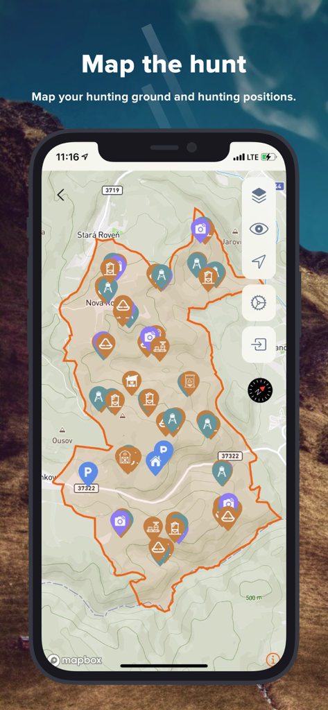
A smartphone displaying the Hunterra app interface with a topographic map showing hunting ground boundaries and markers for stands and trail cameras.
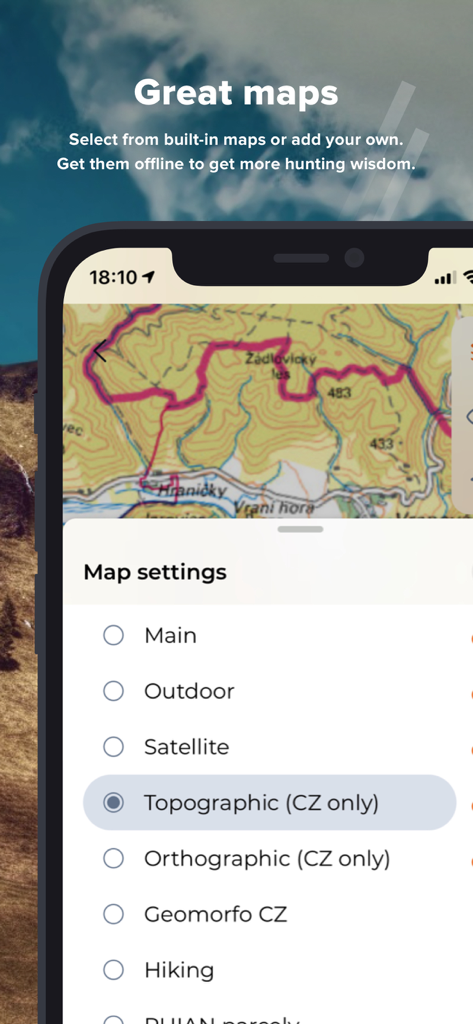
Hunterra app interface showing various topographic and satellite map settings for hunting
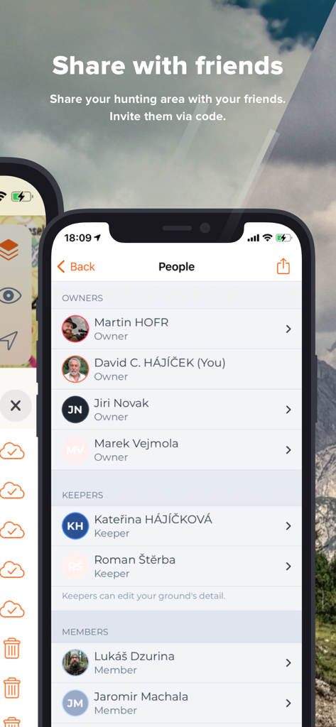
A mobile app screen from Hunterra showing a list of people categorized as owners, keepers, and members of a hunting area
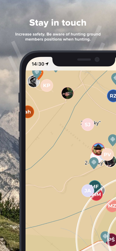
Hunterra app screen showing real-time location tracking of hunting team members on a map
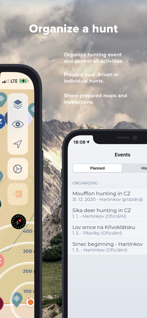
Two smartphones displaying the Hunterra app interface for organizing hunting events and planning maps against a mountain background
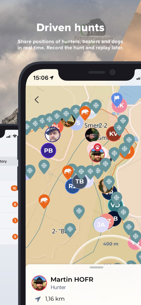
Real-time map in the Hunterra app showing the live positions of hunters and dogs during a joint hunt
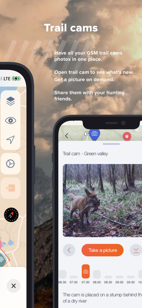
Hunterra app screen showing integrated trail camera photos and remote management tools for hunting
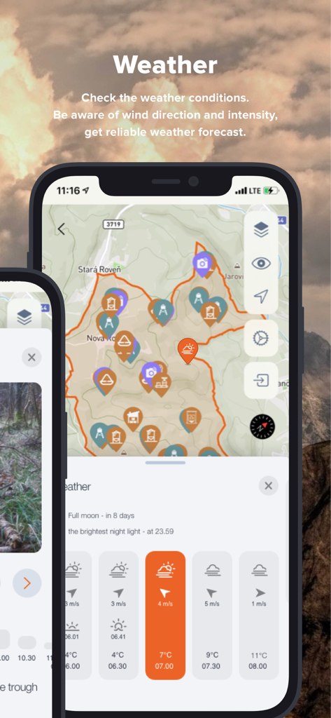
Hunterra app interface displaying hunting weather conditions and wind direction on a topographic map
Description
Download
More Like This
Top-ranked apps in the same category

得物 - 得到美好事物
Shanghai Dewu Information Group Co., Ltd.

懂球帝 - 足球篮球体坛数据
Hainan Football-Loving Girl Network Technology Co., Ltd.

Underdog Sports
Underdog Sports, Inc.

虎扑-评分篮球足球游戏影视
Shanghai Kuanghui Network Technology Co., LTD

ESPN: Live Sports & Scores
Disney Electronic Content, Inc.

Flashscore: Live Scores & News
Livesport s.r.o.

Polymarket
Blockratize Inc

DAZN: Stream Live Sports
DAZN Limited

DraftKings Sportsbook & Casino
DRAFTKINGS LLC.
This page is not an official page of the app or its developer, but an independent editorial publication created for informational and commentary purposes. Unless expressly stated otherwise, neither the app nor its developer is affiliated with, endorsed by, sponsored by, authorized by, or otherwise officially connected with MWM, Apple, Google Play, the app publisher, or the app's developer, and nothing on this page implies that the app was developed using MWM's services. Any trademarks, logos, screenshots, and other content remain the property of their respective owners.