This page is not an official page of the app or its developer, but an independent editorial publication created for informational and commentary purposes. Unless expressly stated otherwise, neither the app nor its developer is affiliated with, endorsed by, sponsored by, authorized by, or otherwise officially connected with MWM, Apple, Google Play, the app publisher, or the app's developer, and nothing on this page implies that the app was developed using MWM's services. Any trademarks, logos, screenshots, and other content remain the property of their respective owners.

Weather 4 Fly Drone & NOTAM
Get precise wind at altitude, official FAA NOTAMs, and safety evaluations tailored to 90+ drone models. No accounts, no tracking—just the mission-critical data you need to fly with total confidence.
Downloads
1K+User Rating
Total Ratings
0Publisher
Category
WeatherLocales
12Latest Version
2.2Size
19.3 MBFirst Released
Oct 7, 2025Master the Skies with Precision
The ultimate co-pilot for professional and hobbyist UAV operators. Weather 4 Fly combines hyper-local aviation weather with official FAA safety data to protect your gear and ensure every flight is 100% legal.
Total Legal Compliance
Navigate airspaces with confidence using official FAA NOTAMs, TFRs, and interactive No-Fly Zone maps to avoid costly fines and restricted areas.
Aviation-Grade Intelligence
Go beyond surface-level weather. Monitor wind speeds at your specific flight altitude and Kp-Index activity to prevent fly-aways and GPS failures.
The following screenshots and description are sourced directly from the app's official store listing and are the property of the app developer.
App Store
Screenshots
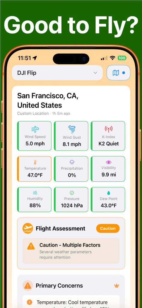
Weather 4 Fly app dashboard displaying real-time weather metrics and flight safety evaluation for drone pilots
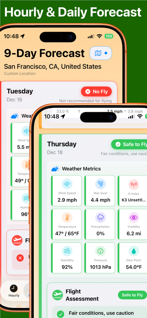
Drone flight weather forecast with safety assessment and meteorological metrics.
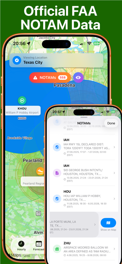
Official FAA NOTAM data and drone flight safety map showing restricted airspaces and flight alerts
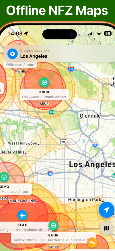
Offline No Fly Zone map of Los Angeles showing restricted airspaces around airports for drone pilots.
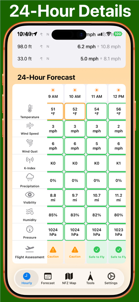
Detailed hourly drone flight safety forecast showing wind speed K-index and flight assessment indicators
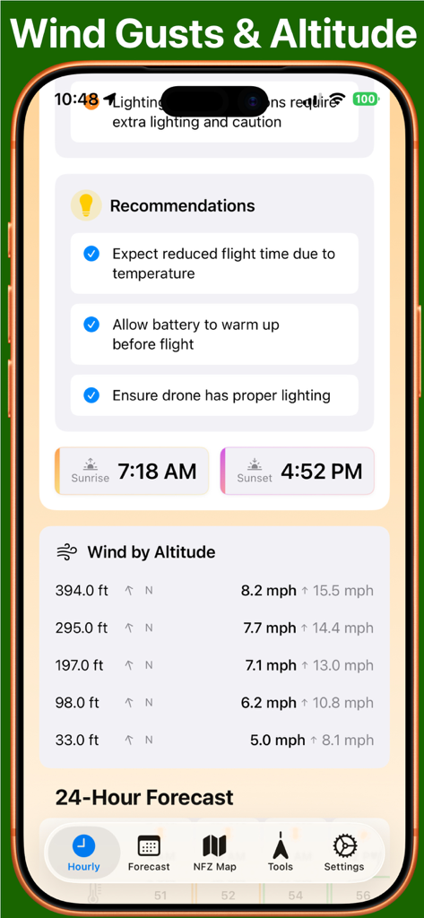
Screenshot of Weather 4 Fly app showing wind speeds at different altitudes and drone flight safety recommendations.
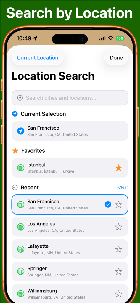
Location search screen in the drone weather app displaying recent and favorite flight locations
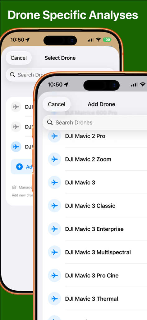
Selection screen for drone models like DJI Mavic to customize flight safety analyses
Description
Download
More Like This
Top-ranked apps in the same category

墨迹天气-MojiWeather
Beijing MojiFengyun Technology Co.,Ltd.

The Weather Channel - Radar
The Weather Channel

Windy.com
Windyty, SE

天气预报-精准15日天气预报
Chongqing Caochen Technology Co., Ltd.

My Aurora Forecast & Alerts
JRustonApps B.V.

AccuWeather: Weather Forecast
AccuWeather International, Inc.

Weather & Radar - Storm radar
WetterOnline - Meteorologische Dienstleistungen GmbH

天气通
Weibo Internet Technology (China) Co.Ltd.

The Thermometer -Digital-
Vida Apps Incorporated
This page is not an official page of the app or its developer, but an independent editorial publication created for informational and commentary purposes. Unless expressly stated otherwise, neither the app nor its developer is affiliated with, endorsed by, sponsored by, authorized by, or otherwise officially connected with MWM, Apple, Google Play, the app publisher, or the app's developer, and nothing on this page implies that the app was developed using MWM's services. Any trademarks, logos, screenshots, and other content remain the property of their respective owners.