This page is not an official page of the app or its developer, but an independent editorial publication created for informational and commentary purposes. Unless expressly stated otherwise, neither the app nor its developer is affiliated with, endorsed by, sponsored by, authorized by, or otherwise officially connected with MWM, Apple, Google Play, the app publisher, or the app's developer, and nothing on this page implies that the app was developed using MWM's services. Any trademarks, logos, screenshots, and other content remain the property of their respective owners.

Klompenpaden
Step off the beaten path and explore the hidden heritage of Utrecht and Gelderland. Immerse yourself in the landscape with interactive storytelling and GPS-guided walks through private estates and historic farmlands.
Downloads
148K+User Rating
Total Ratings
200Publisher
Category
TravelLocales
1Latest Version
4.3.2Size
112.5 MBFirst Released
Sep 11, 2012Discover the Soul of the Dutch Countryside
Go beyond the tourist trails with curated 5 to 15-kilometer walks through historic estates, private farmlands, and the most scenic landscapes of Utrecht and Gelderland.
Exclusive Heritage Access
Traverse private lands and historic estates typically hidden from the public, offering you a rare glimpse into authentic Dutch rural life.
Immersive Multimedia Stories
The landscape speaks to you through integrated videos and audio fragments that reveal the deep history and local legends of every path.
The following screenshots and description are sourced directly from the app's official store listing and are the property of the app developer.
App Store
Screenshots
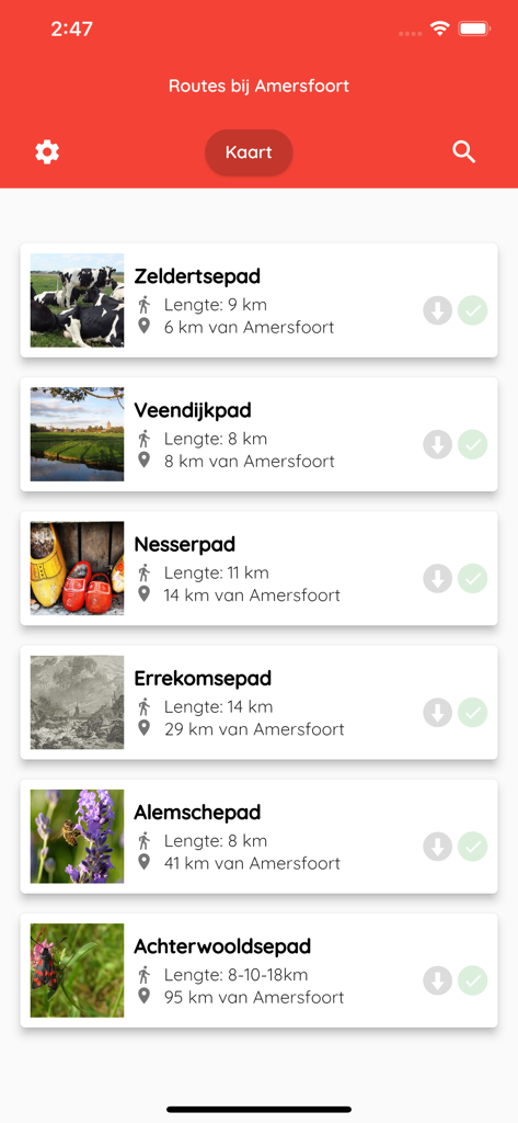
A list of various hiking routes in the Klompenpaden app near Amersfoort showing trail names and lengths.

Klompenpaden app screen showing a map with walking trail icons near Amersfoort
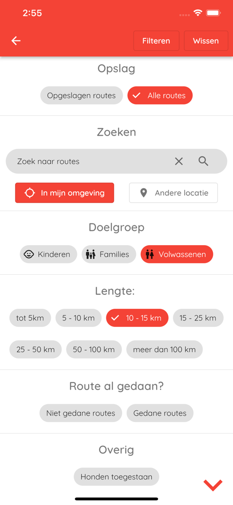
The filter menu of the Klompenpaden app for selecting hiking route preferences
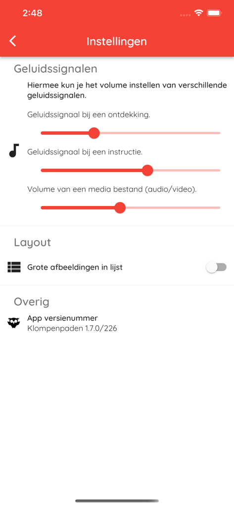
Settings screen of the Klompenpaden app showing audio volume controls and layout options
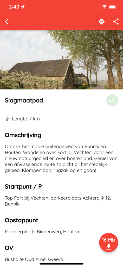
Details of the 7km Slagmaatpad walking route in the Klompenpaden app
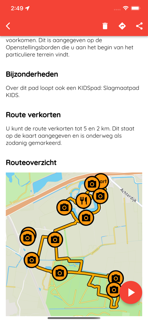
A walking route map in the Klompenpaden app showing photo spots and points of interest
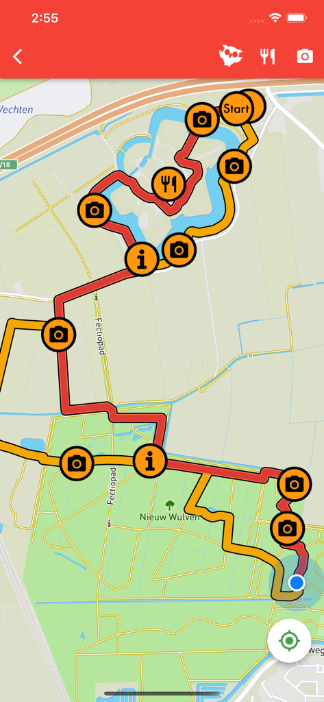
GPS map view of a Dutch hiking trail with markers for photography points and dining locations
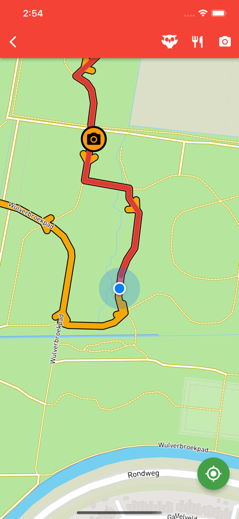
Mobile app map interface showing a rural walking trail with GPS navigation and points of interest
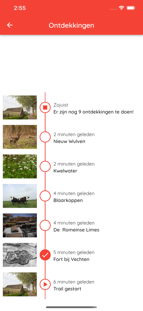
A vertical timeline showing nature and heritage discoveries made during a walking trail in the Klompenpaden app.
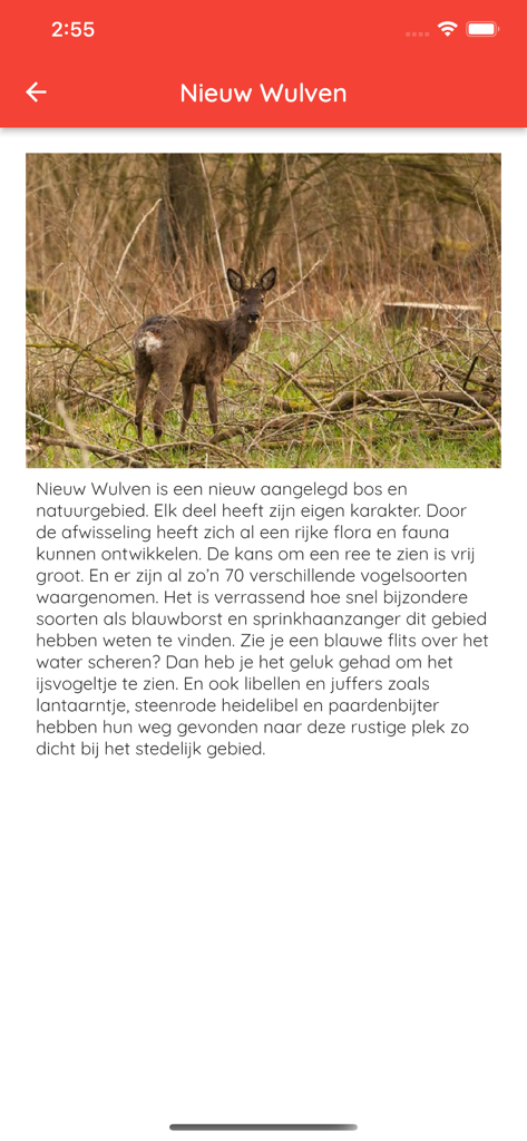
Screenshot of the Klompenpaden app showing details about the Nieuw Wulven nature area with a photo of a deer in the woods.
Description
Download
More Like This
Top-ranked apps in the same category

Uber - Request a ride
Uber Technologies, Inc.

Airbnb
Airbnb, Inc.

铁路12306
ACADEMY OF RAILWAY SCIENCES CO., ltd.

Booking.com: Hotels & Travel
Booking.com B.V.

Grab: Taxi Ride, Food Delivery
GRABTAXI HOLDINGS PTE. LTD.

Trip.com: Book Flights, Hotels
Trip.com Travel Singapore Pte. Ltd.

DiDi China: Ride Hailing
Didi Chuxing (Beijing) Network Platform Technology Co., Ltd

去哪儿旅行-订酒店机票火车票
Beijing Qunar Information Technology Company Limit

Bolt: Request a Ride
BOLT TECHNOLOGY OU
This page is not an official page of the app or its developer, but an independent editorial publication created for informational and commentary purposes. Unless expressly stated otherwise, neither the app nor its developer is affiliated with, endorsed by, sponsored by, authorized by, or otherwise officially connected with MWM, Apple, Google Play, the app publisher, or the app's developer, and nothing on this page implies that the app was developed using MWM's services. Any trademarks, logos, screenshots, and other content remain the property of their respective owners.