This page is not an official page of the app or its developer, but an independent editorial publication created for informational and commentary purposes. Unless expressly stated otherwise, neither the app nor its developer is affiliated with, endorsed by, sponsored by, authorized by, or otherwise officially connected with MWM, Apple, Google Play, the app publisher, or the app's developer, and nothing on this page implies that the app was developed using MWM's services. Any trademarks, logos, screenshots, and other content remain the property of their respective owners.

LuckGrib
The definitive tool for offshore sailors and meteorologists. Access high-resolution global models, optimize satellite downloads via Iridium GO!, and master the seas with advanced isochronal routing—all for a one-time purchase with no subscriptions.
Downloads
116K+User Rating
Total Ratings
700Publisher
Category
WeatherLocales
1Latest Version
2.5.1Size
172.5 MBFirst Released
Mar 31, 2018Advanced Tools for Serious Navigators
Master the elements with professional-grade GRIB analysis and isochronal weather routing—designed for offshore safety and data-driven precision, without the burden of subscriptions.
Satellite-Optimized Downloads
Minimize costs and maximize reliability with data packages specifically compressed for Iridium GO! and RedPort satellite connections during offshore transits.
Professional Weather Routing
Utilize our advanced isochronal solver to calculate optimal paths, ensuring your vessel avoids heavy air and respects complex navigational constraints.
The following screenshots and description are sourced directly from the app's official store listing and are the property of the app developer.
App Store
Screenshots
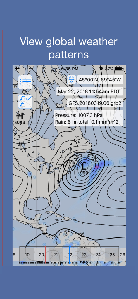
LuckGrib app interface showing a detailed meteorological map with pressure isobars and GFS model data for global weather analysis.
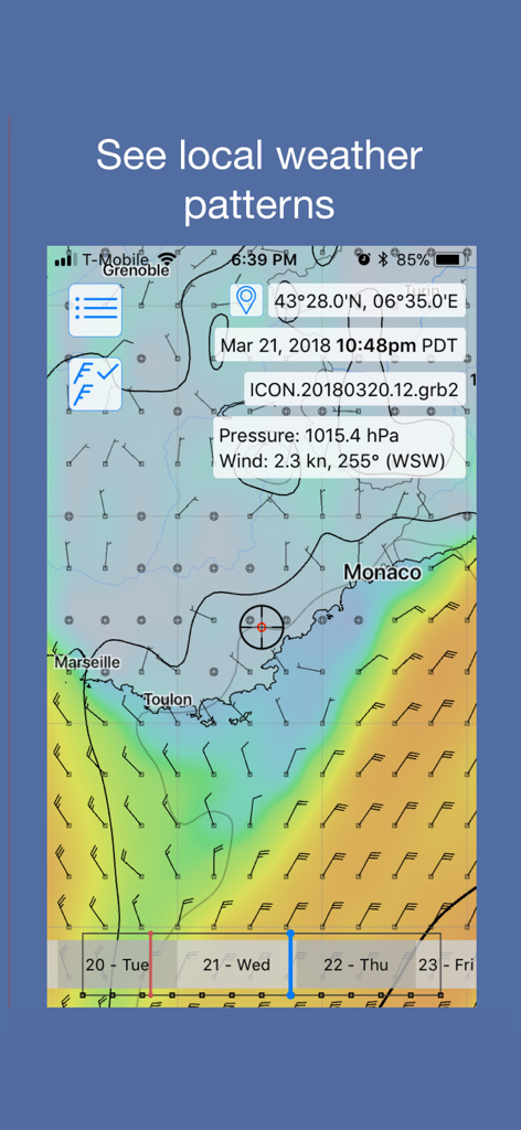
LuckGrib mobile app displaying wind barbs and weather patterns on a coastal map
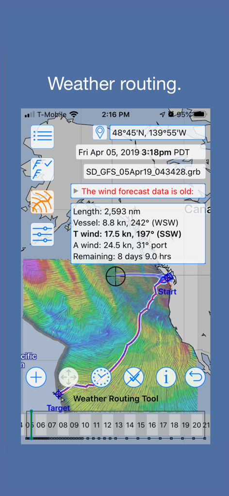
Interface of LuckGrib showing offshore weather routing with detailed wind and vessel statistics
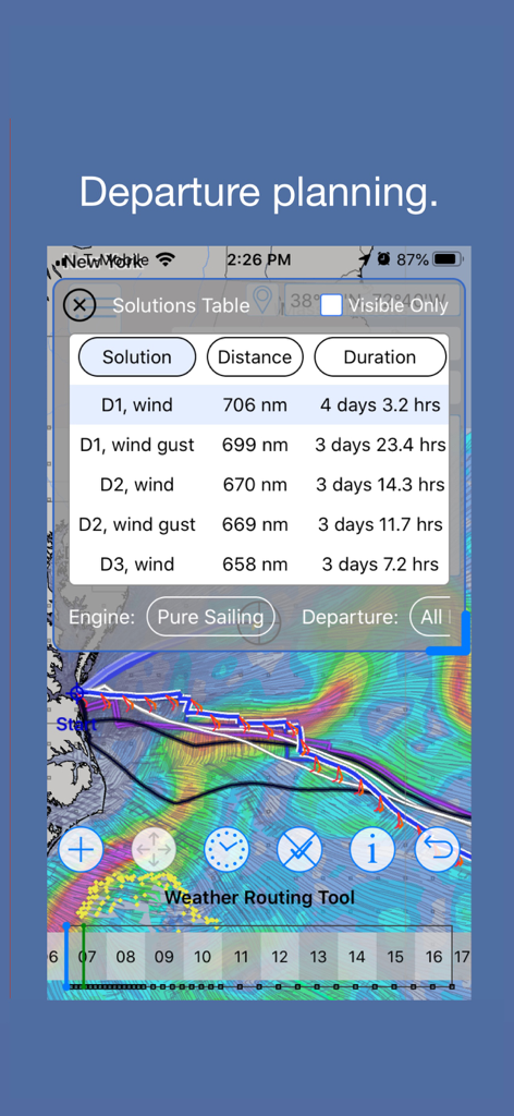
LuckGrib departure planning interface showing a solutions table with distance and duration for various sailing routes on a weather map
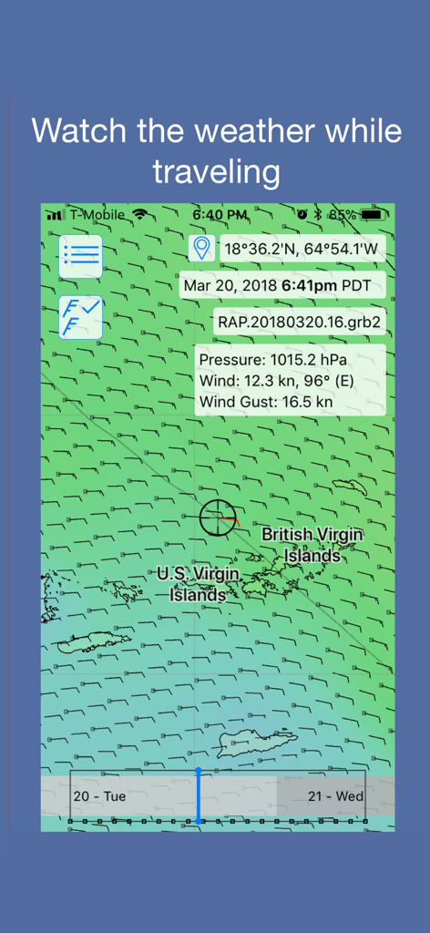
LuckGrib mobile interface displaying a detailed GRIB weather forecast map with wind barbs and pressure data over the Virgin Islands
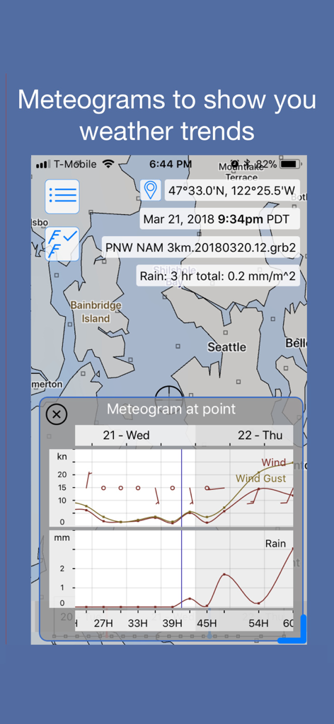
Meteogram displaying wind and rain trends in the LuckGrib weather routing app
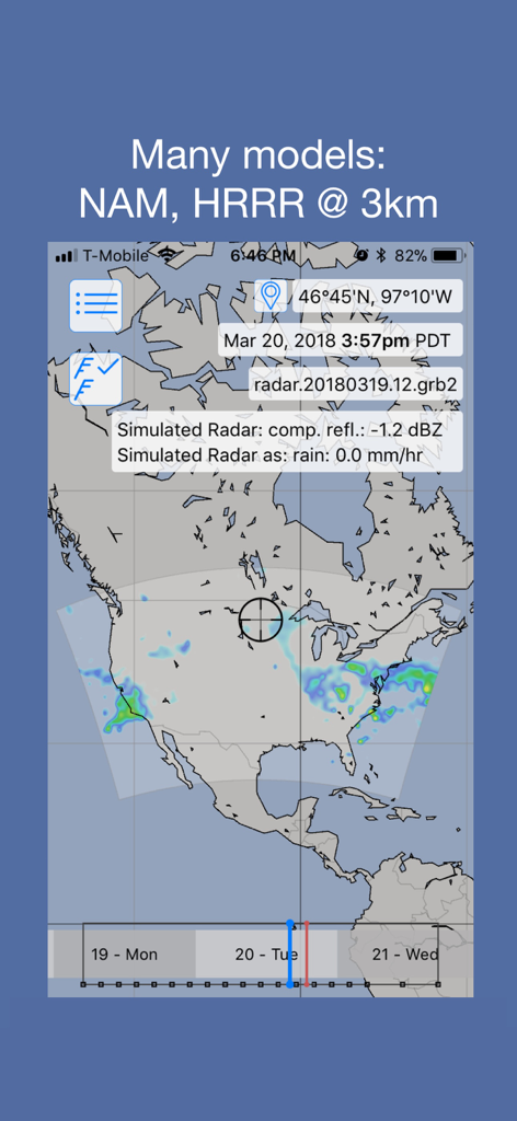
LuckGrib app displaying simulated radar weather data using high resolution NAM and HRRR models
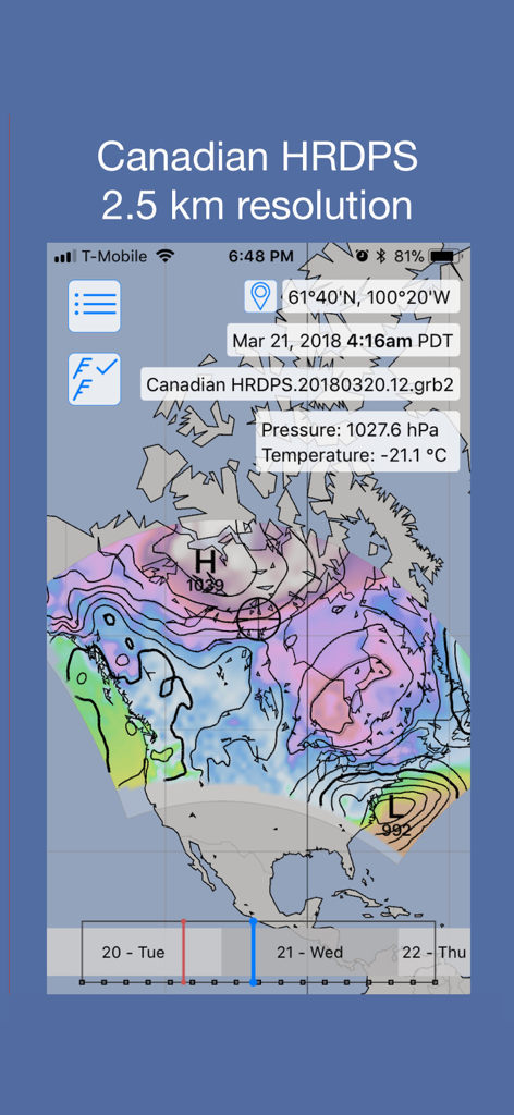
LuckGrib app displaying a high resolution Canadian HRDPS 2.5 km weather model over North America
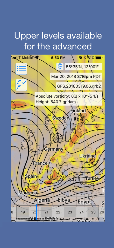
LuckGrib app interface displaying absolute vorticity and height data on a weather map of Europe
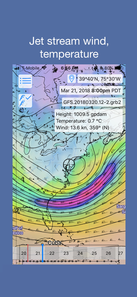
LuckGrib app displaying jet stream wind and temperature data on a weather map
Description
Download
More Like This
Apps with similar features and user experience

Tide Charts
7th Gear

Nautide: Tides, Wind, Waves +
Igoox SL

Tides Near Me
Shelter Island Mapping Company, LLC

Tide Guide: Charts & Tables
Condor Digital LLC

Surf-Forecast.com
Meteo365 Ltd.

Windfinder Pro: Wind & Weather
Windfinder.com

Tide Alert (NOAA) - Tide Chart
Rivolu LLC

Flowx - Weather
Duane Malcolm

My Tide Times Pro - Tide Chart
JRustonApps B.V.
This page is not an official page of the app or its developer, but an independent editorial publication created for informational and commentary purposes. Unless expressly stated otherwise, neither the app nor its developer is affiliated with, endorsed by, sponsored by, authorized by, or otherwise officially connected with MWM, Apple, Google Play, the app publisher, or the app's developer, and nothing on this page implies that the app was developed using MWM's services. Any trademarks, logos, screenshots, and other content remain the property of their respective owners.