This page is not an official page of the app or its developer, but an independent editorial publication created for informational and commentary purposes. Unless expressly stated otherwise, neither the app nor its developer is affiliated with, endorsed by, sponsored by, authorized by, or otherwise officially connected with MWM, Apple, Google Play, the app publisher, or the app's developer, and nothing on this page implies that the app was developed using MWM's services. Any trademarks, logos, screenshots, and other content remain the property of their respective owners.

Mappa Digitale Sentiero Italia
Master over 7,000 kilometers of the world’s longest trail with high-resolution offline maps, expert technical data, and official CAI cartography designed for serious thru-hikers.
Downloads
25K+User Rating
Total Ratings
0Publisher
Category
TravelLocales
1Latest Version
13.1.8Size
77.7 MBFirst Released
Jul 28, 2022Conquer the World’s Longest Hiking Trail
Navigate the 7,000km Sentiero Italia with official Club Alpino Italiano (CAI) data, high-resolution offline cartography, and expert-verified technical details for your next great expedition.
Mission-Critical Offline Access
Navigate the rugged Apennines and Alps with total confidence. Download high-resolution georeferenced maps and trail data to track your exact location via GPS with zero cellular service.
Official CAI Authority
Eliminate the risk of crowdsourced errors. Access the only digital cartography built directly with the Italian Alpine Club, featuring 7,000+ kilometers of verified and maintained trails.
The following screenshots and description are sourced directly from the app's official store listing and are the property of the app developer.
App Store
Screenshots
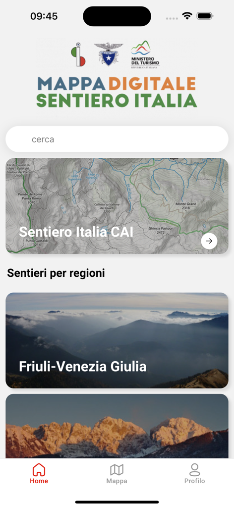
Interface of the Mappa Digitale Sentiero Italia app highlighting hiking trails and topographic maps
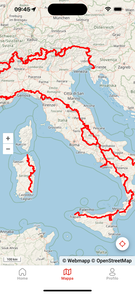
Mobile app screen showing the complete hiking route of Sentiero Italia across a map of Italy.
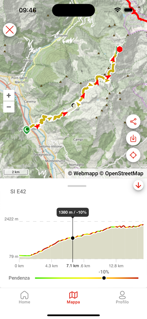
Mappa Digitale Sentiero Italia mobile app displaying a hiking trail map and elevation profile
Description
Download
More Like This
Top-ranked apps in the same category

Uber - Request a ride
Uber Technologies, Inc.

Airbnb
Airbnb, Inc.

铁路12306
ACADEMY OF RAILWAY SCIENCES CO., ltd.

Booking.com: Hotels & Travel
Booking.com B.V.

Grab: Taxi Ride, Food Delivery
GRABTAXI HOLDINGS PTE. LTD.

Trip.com: Book Flights, Hotels
Trip.com Travel Singapore Pte. Ltd.

DiDi China: Ride Hailing
Didi Chuxing (Beijing) Network Platform Technology Co., Ltd

去哪儿旅行-订酒店机票火车票
Beijing Qunar Information Technology Company Limit

Bolt: Request a Ride
BOLT TECHNOLOGY OU
This page is not an official page of the app or its developer, but an independent editorial publication created for informational and commentary purposes. Unless expressly stated otherwise, neither the app nor its developer is affiliated with, endorsed by, sponsored by, authorized by, or otherwise officially connected with MWM, Apple, Google Play, the app publisher, or the app's developer, and nothing on this page implies that the app was developed using MWM's services. Any trademarks, logos, screenshots, and other content remain the property of their respective owners.