This page is not an official page of the app or its developer, but an independent editorial publication created for informational and commentary purposes. Unless expressly stated otherwise, neither the app nor its developer is affiliated with, endorsed by, sponsored by, authorized by, or otherwise officially connected with MWM, Apple, Google Play, the app publisher, or the app's developer, and nothing on this page implies that the app was developed using MWM's services. Any trademarks, logos, screenshots, and other content remain the property of their respective owners.

Maryland Roads Traffic
Master your commute with visual certainty and official real-time data. Access live traffic cameras and severity-coded reports across Maryland with a one-time purchase—no subscriptions required.
Downloads
7K+User Rating
Total Ratings
100Publisher
Category
TravelLocales
1Latest Version
4.0Size
2.9 MBFirst Released
Jan 20, 2018Master Your Maryland Commute
Stop relying on traffic estimates. Get visual proof of road conditions with live MDOT cameras and real-time incident tracking—all with a one-time purchase and zero subscriptions.
Live Video Confirmation
Stop guessing what a 'red line' means. Access live Maryland Department of Transportation cameras to see actual road density and weather conditions before you even pull out of the driveway.
Glance-and-Go Awareness
Use the Today Widget to check for nearby incidents instantly without unlocking your phone. Stay ahead of delays on I-95, I-270, and the Beltway with distance-ranked alerts.
The following screenshots and description are sourced directly from the app's official store listing and are the property of the app developer.
App Store
Screenshots
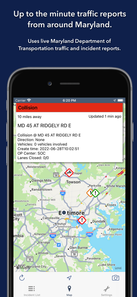
Maryland Roads Traffic app showing a live incident report and traffic camera icons on a map.
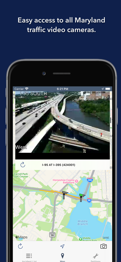
Screenshot of the Maryland Roads Traffic app showing a live traffic camera feed of I-95 in Baltimore.
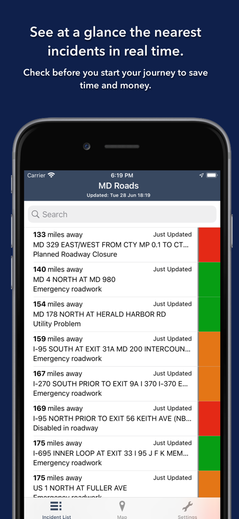
Maryland Roads app showing a list of real-time traffic incidents with color-coded severity levels.
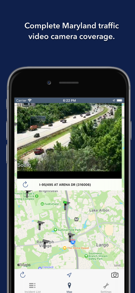
Live Maryland traffic camera feed and map display
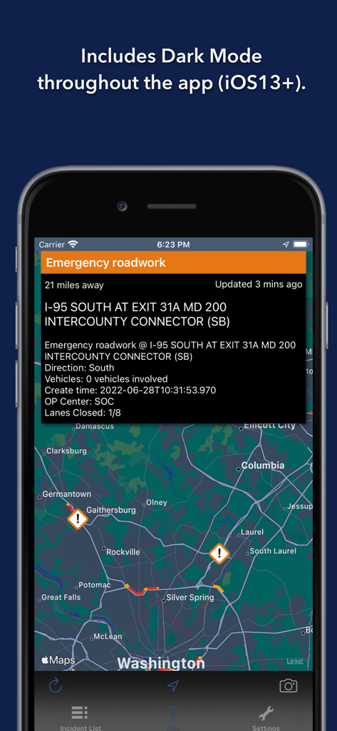
Maryland Roads Traffic app showing map and incident details in dark mode
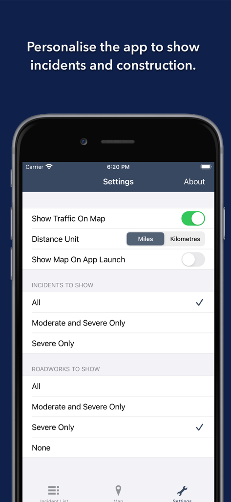
Settings screen for personalizing traffic incidents and roadwork alerts in Maryland.
Description
Download
More Like This
Top-ranked apps in the same category

Uber - Request a ride
Uber Technologies, Inc.

Airbnb
Airbnb, Inc.

铁路12306
ACADEMY OF RAILWAY SCIENCES CO., ltd.

Booking.com: Hotels & Travel
Booking.com B.V.

Grab: Taxi Ride, Food Delivery
GRABTAXI HOLDINGS PTE. LTD.

Trip.com: Book Flights, Hotels
Trip.com Travel Singapore Pte. Ltd.

DiDi China: Ride Hailing
Didi Chuxing (Beijing) Network Platform Technology Co., Ltd

去哪儿旅行-订酒店机票火车票
Beijing Qunar Information Technology Company Limit

Bolt: Request a Ride
BOLT TECHNOLOGY OU
This page is not an official page of the app or its developer, but an independent editorial publication created for informational and commentary purposes. Unless expressly stated otherwise, neither the app nor its developer is affiliated with, endorsed by, sponsored by, authorized by, or otherwise officially connected with MWM, Apple, Google Play, the app publisher, or the app's developer, and nothing on this page implies that the app was developed using MWM's services. Any trademarks, logos, screenshots, and other content remain the property of their respective owners.