This page is not an official page of the app or its developer, but an independent editorial publication created for informational and commentary purposes. Unless expressly stated otherwise, neither the app nor its developer is affiliated with, endorsed by, sponsored by, authorized by, or otherwise officially connected with MWM, Apple, Google Play, the app publisher, or the app's developer, and nothing on this page implies that the app was developed using MWM's services. Any trademarks, logos, screenshots, and other content remain the property of their respective owners.

National Public Toilet Map
Access over 23,000 public and private facilities across Australia. From accessibility details to baby care, get the reliable information you need to travel with confidence and dignity.
Downloads
154K+User Rating
Total Ratings
8K+Publisher
Category
Health & FitnessLocales
1Latest Version
5.19Size
7.0 MBFirst Released
Aug 2, 2009Travel Australia with Total Confidence
Join millions of Australians and travelers using the official map to find over 23,000 accessible facilities tailored to your specific health and family needs.
Find the Right Spot, Right Now
Instant access to 23,000+ locations with real-time opening hours and precise directions, so you are never caught off guard while exploring.
Designed for Accessibility
Search for specific requirements like adult change rooms, hoists, or MLAK access to ensure every stop meets your individual mobility needs.
The following screenshots and description are sourced directly from the app's official store listing and are the property of the app developer.
App Store
Screenshots
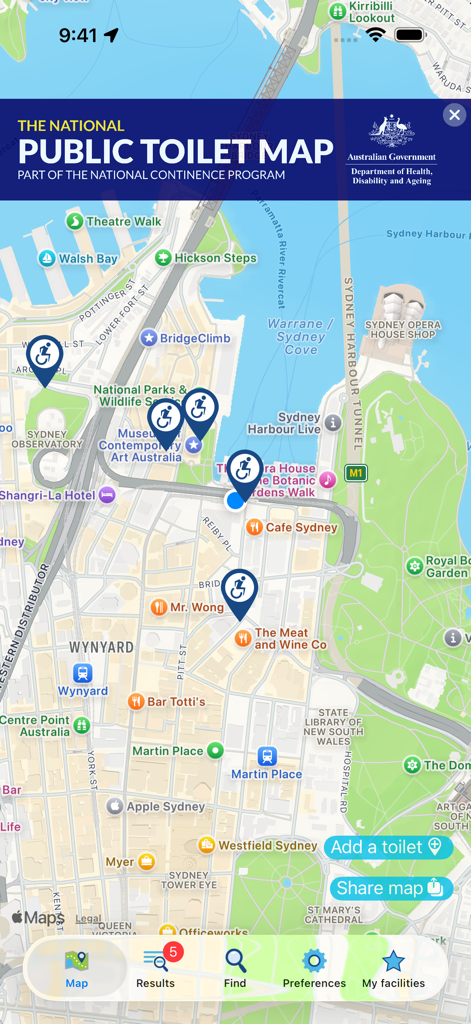
Map view of the National Public Toilet Map app showing accessible restrooms in Sydney Australia
The National Public Toilet Map app interface showing restroom locations and accessibility details in Sydney Australia
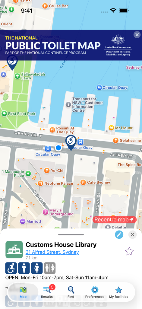
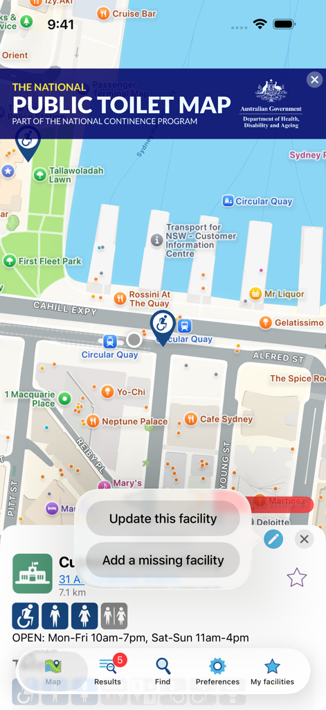
Facility details in the National Public Toilet Map app for Customs House Library showing accessibility and amenities
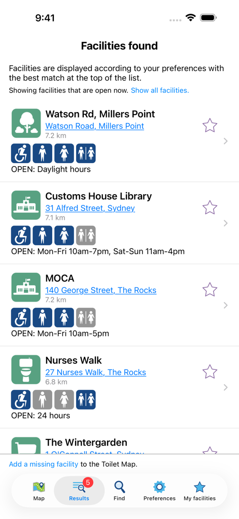
List of nearby public toilet facilities in Australia with accessibility icons and opening hours
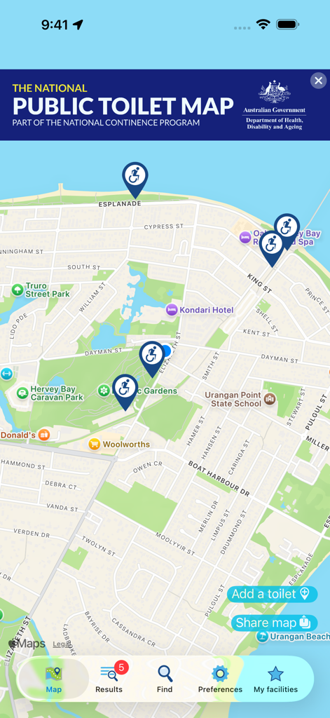
Map view of the National Public Toilet Map app showing pins for accessible public facilities
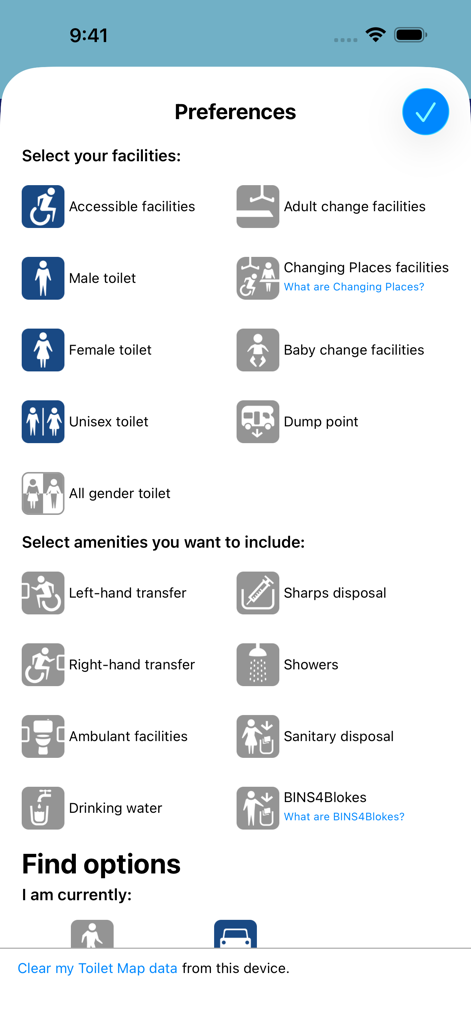
Preferences screen of the National Public Toilet Map app showing various facility and amenity filters like accessible toilets and baby change rooms
A screenshot of the National Public Toilet Map mobile application showing restroom locations in Sydney Australia
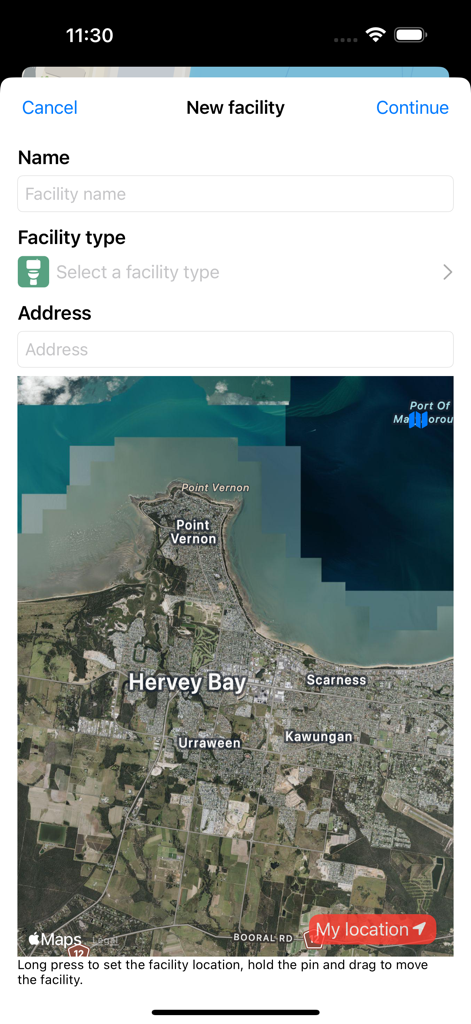
Form for adding a new public toilet facility with name and address fields and a satellite map of Hervey Bay
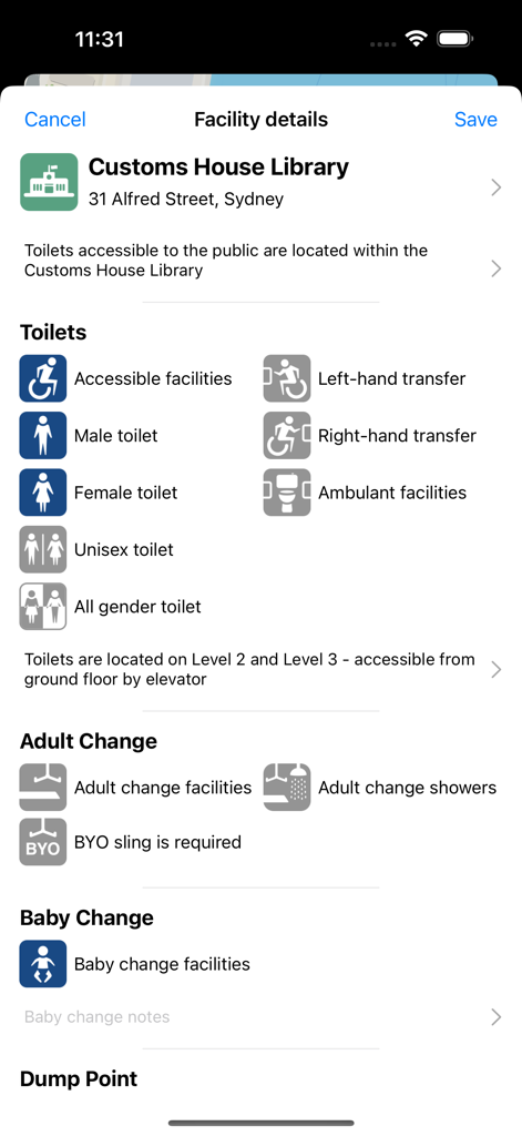
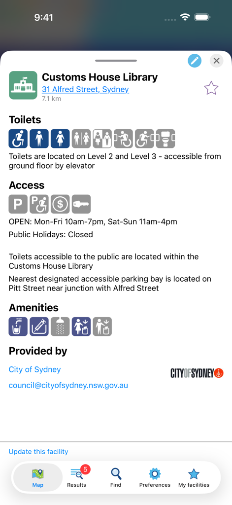
A screenshot of the National Public Toilet Map app showing detailed information and accessibility icons for public facilities at Customs House Library in Sydney
Description
Download
More Like This
Top-ranked apps in the same category

Strava: Run, Bike, Walk
Strava Inc.

Flo Cycle & Period Tracker
FLO HEALTH UK LIMITED

AI Calorie Tracker by Yazio
YAZIO GmbH

MyFitnessPal: Calorie Counter
MyFitnessPal, Inc.

Mi Fitness (Xiaomi Wear Lite)
Beijing Xiaomi Co., Ltd

美柚 - 经期·备孕·怀孕·育儿&亲友版
Xiamen Meet You Co., Ltd.

Cal AI - Calorie Tracker
Viral Development LLC

Yuka - Food & Cosmetic Scanner
Yuca

BitePal: Food Tracker Pet
REFACE LITHUANIA UAB
This page is not an official page of the app or its developer, but an independent editorial publication created for informational and commentary purposes. Unless expressly stated otherwise, neither the app nor its developer is affiliated with, endorsed by, sponsored by, authorized by, or otherwise officially connected with MWM, Apple, Google Play, the app publisher, or the app's developer, and nothing on this page implies that the app was developed using MWM's services. Any trademarks, logos, screenshots, and other content remain the property of their respective owners.