This page is not an official page of the app or its developer, but an independent editorial publication created for informational and commentary purposes. Unless expressly stated otherwise, neither the app nor its developer is affiliated with, endorsed by, sponsored by, authorized by, or otherwise officially connected with MWM, Apple, Google Play, the app publisher, or the app's developer, and nothing on this page implies that the app was developed using MWM's services. Any trademarks, logos, screenshots, and other content remain the property of their respective owners.

RWIS
Empower your decision-making with real-time road surface conditions, early ice warnings, and live field service tracking designed for infrastructure professionals.
Downloads
23K+User Rating
Total Ratings
0Publisher
Category
WeatherLocales
11Latest Version
4.1.1Size
34.0 MBFirst Released
Jul 25, 2014Operational Command in Your Pocket
Streamline your response to winter weather with real-time road conditions, live fleet tracking, and hyper-local sensor data built for infrastructure professionals.
Hyper-Local Road Intelligence
Monitor road surface temperatures, water depth, and ice risks with precision sensor data to treat roads only when necessary.
Real-Time Fleet Coordination
Track active vehicles and color-coded intervention routes on an interactive map to ensure total coverage and operational transparency.
The following screenshots and description are sourced directly from the app's official store listing and are the property of the app developer.
App Store
Screenshots
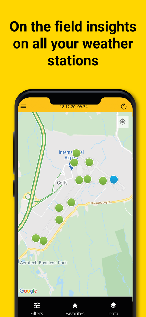
RWIS app interface showing weather station locations on an airport map.
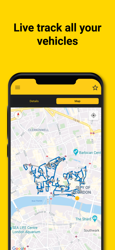
RWIS mobile app interface showing real-time vehicle route tracking on an interactive city map.
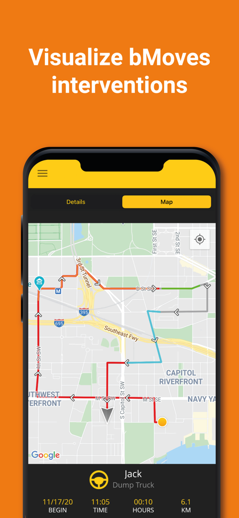
RWIS app map view showing color-coded vehicle routes and real-time fleet tracking for bMoves interventions.
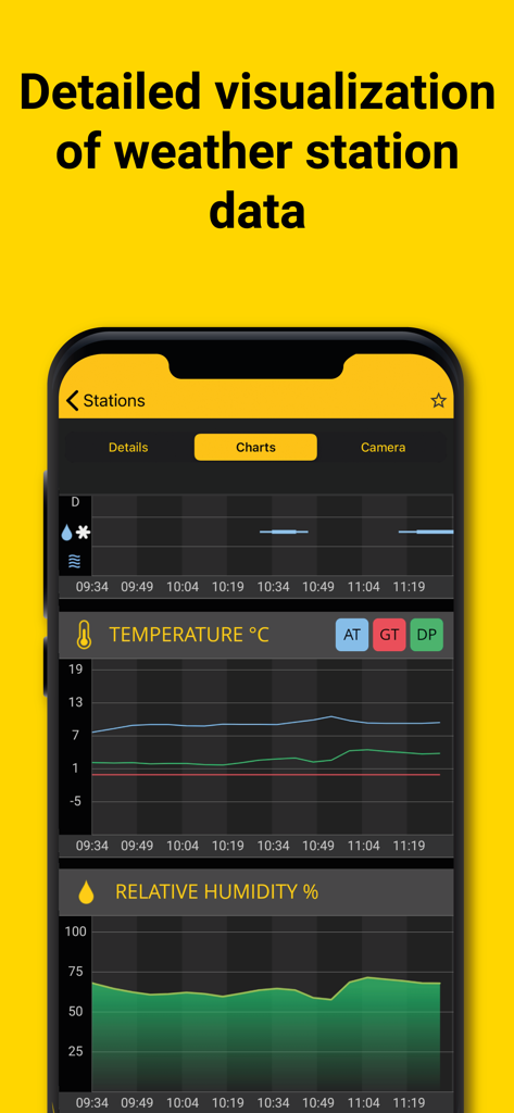
RWIS app displaying real-time temperature and relative humidity graphs for road weather station monitoring
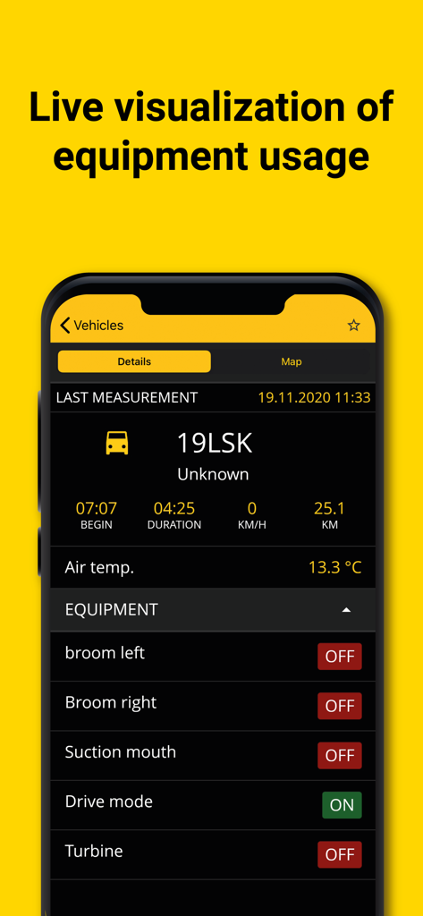
RWIS app dashboard showing live equipment status and vehicle data for road maintenance
Description
Download
More Like This
Top-ranked apps in the same category

墨迹天气-MojiWeather
Beijing MojiFengyun Technology Co.,Ltd.

The Weather Channel - Radar
The Weather Channel

Windy.com
Windyty, SE

天气预报-精准15日天气预报
Chongqing Caochen Technology Co., Ltd.

My Aurora Forecast & Alerts
JRustonApps B.V.

AccuWeather: Weather Forecast
AccuWeather International, Inc.

Weather & Radar - Storm radar
WetterOnline - Meteorologische Dienstleistungen GmbH

天气通
Weibo Internet Technology (China) Co.Ltd.

The Thermometer -Digital-
Vida Apps Incorporated
This page is not an official page of the app or its developer, but an independent editorial publication created for informational and commentary purposes. Unless expressly stated otherwise, neither the app nor its developer is affiliated with, endorsed by, sponsored by, authorized by, or otherwise officially connected with MWM, Apple, Google Play, the app publisher, or the app's developer, and nothing on this page implies that the app was developed using MWM's services. Any trademarks, logos, screenshots, and other content remain the property of their respective owners.