This page is not an official page of the app or its developer, but an independent editorial publication created for informational and commentary purposes. Unless expressly stated otherwise, neither the app nor its developer is affiliated with, endorsed by, sponsored by, authorized by, or otherwise officially connected with MWM, Apple, Google Play, the app publisher, or the app's developer, and nothing on this page implies that the app was developed using MWM's services. Any trademarks, logos, screenshots, and other content remain the property of their respective owners.

Sardegna Sentieri
Discover the Mediterranean’s most authentic landscapes with confidence. Access official GPS tracks, offline maps, and expert-vetted routes for trekking, cycling, and horseback riding directly from the regional authority.
Downloads
0User Rating
Total Ratings
0Publisher
Category
TravelLocales
1Latest Version
3.1.6Size
100.6 MBFirst Released
Nov 28, 2023Explore the Unseen Sardinia
Your official gateway to the Mediterranean’s most rugged trails, featuring expert-verified data and precision offline navigation for the ultimate adventure traveler.
Official Insider Knowledge
Skip the tourist traps with certified routes from the Italian Alpine Club (CAI), including detailed difficulty ratings and expert local descriptions.
Reliable Offline Access
Navigate the wild Supramonte or the Blue Trail with confidence, even in cellular dead zones, using downloadable high-quality maps and GPS tracking.
The following screenshots and description are sourced directly from the app's official store listing and are the property of the app developer.
App Store
Screenshots
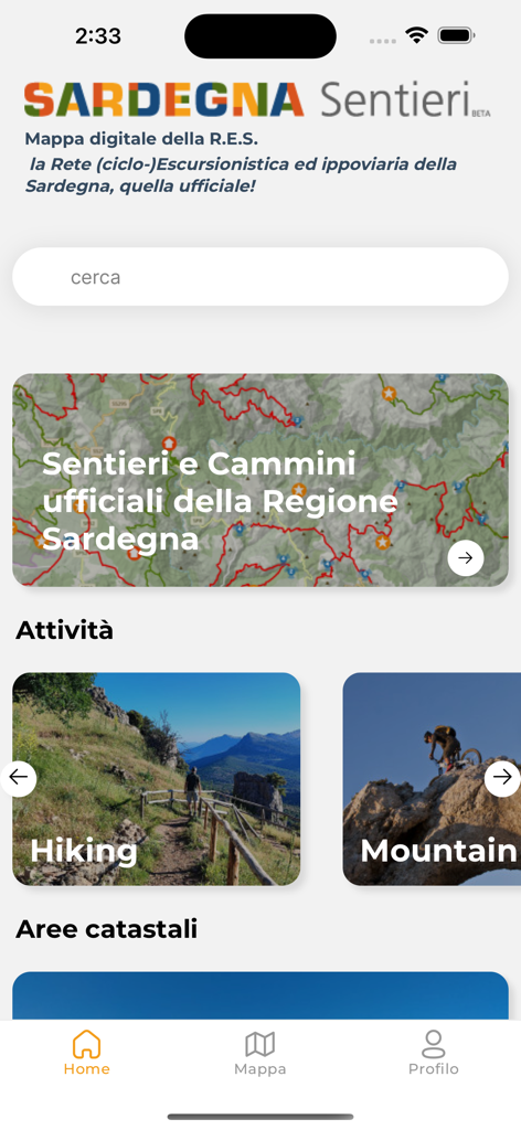
Home screen of the Sardegna Sentieri app displaying official hiking and mountain biking trails in Sardinia
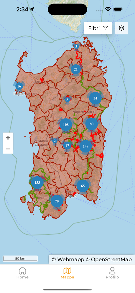
An interactive map of Sardinia displaying hiking trails and trekking routes with location clusters
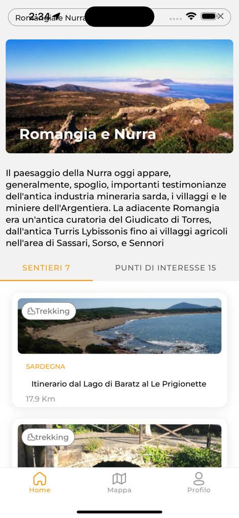
Sardegna Sentieri app interface displaying trekking routes and hiking information for the Romangia and Nurra area.
Description
Download
More Like This
Top-ranked apps in the same category

Uber - Request a ride
Uber Technologies, Inc.

铁路12306
ACADEMY OF RAILWAY SCIENCES CO., ltd.

Airbnb
Airbnb, Inc.

Booking.com: Hotels & Travel
Booking.com B.V.

Grab: Taxi Ride, Food Delivery
GRABTAXI HOLDINGS PTE. LTD.

DiDi China: Ride Hailing
Didi Chuxing (Beijing) Network Platform Technology Co., Ltd

Bolt: Request a Ride
BOLT TECHNOLOGY OU

携程旅行-订酒店机票火车票
Shanghai Ctrip Commerce Co.,Ltd

Trip.com: Book Flights, Hotels
Trip.com Travel Singapore Pte. Ltd.
This page is not an official page of the app or its developer, but an independent editorial publication created for informational and commentary purposes. Unless expressly stated otherwise, neither the app nor its developer is affiliated with, endorsed by, sponsored by, authorized by, or otherwise officially connected with MWM, Apple, Google Play, the app publisher, or the app's developer, and nothing on this page implies that the app was developed using MWM's services. Any trademarks, logos, screenshots, and other content remain the property of their respective owners.