This page is not an official page of the app or its developer, but an independent editorial publication created for informational and commentary purposes. Unless expressly stated otherwise, neither the app nor its developer is affiliated with, endorsed by, sponsored by, authorized by, or otherwise officially connected with MWM, Apple, Google Play, the app publisher, or the app's developer, and nothing on this page implies that the app was developed using MWM's services. Any trademarks, logos, screenshots, and other content remain the property of their respective owners.

实时高度表Plus - 户外旅游必备,水印相机小红书打卡神器
专为登山徒步与旅行爱好者打造。实时掌控海拔、气压、坐标,通过专业水印相机记录你的每一座顶峰。离线可用,让你的小红书打卡既有颜值又有实力。
Downloads
0User Rating
Total Ratings
0Publisher
Category
TravelLocales
1Latest Version
1.0.0Size
13.8 MBFirst Released
Feb 21, 2026Elevate Your Outdoor Adventures
A professional-grade toolkit for hikers and travelers. Track elevation, orientation, and weather changes offline, while capturing data-rich photos ready for your next social post.
Professional-Grade Sensors
Navigate with confidence using a high-precision 360° compass and real-time barometer. Monitor magnetic field strength and air pressure to stay ahead of weather changes.
Smart Watermark Camera
Turn your photos into trophies. Automatically overlay precise coordinates, elevation, and time to create professional 'check-in' posts for Xiaohongshu or Instagram.
The following screenshots and description are sourced directly from the app's official store listing and are the property of the app developer.
App Store
Screenshots

Splash screen of the Real-time Altimeter Plus app showing the app icon and title in Chinese on a red gradient background.
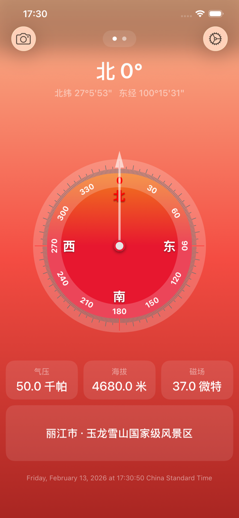
Digital compass interface showing altitude and coordinates for outdoor hiking
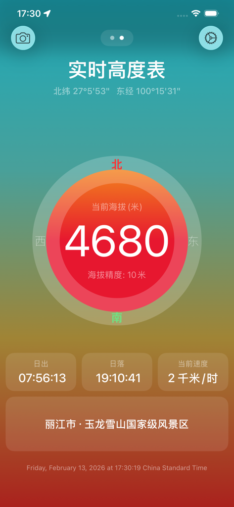
Real-time Altimeter Plus app interface showing 4680 meters altitude and GPS coordinates
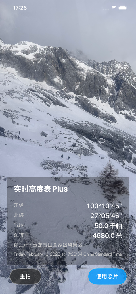
A snowy mountain landscape photo with a data overlay showing altitude, coordinates, and air pressure in the Real-time Altimeter Plus app.
Description
Download
More Like This
Top-ranked apps in the same category

Uber - Request a ride
Uber Technologies, Inc.

铁路12306
ACADEMY OF RAILWAY SCIENCES CO., ltd.

Airbnb
Airbnb, Inc.

Booking.com: Hotels & Travel
Booking.com B.V.

Grab: Taxi Ride, Food Delivery
GRABTAXI HOLDINGS PTE. LTD.

DiDi China: Ride Hailing
Didi Chuxing (Beijing) Network Platform Technology Co., Ltd

Bolt: Request a Ride
BOLT TECHNOLOGY OU

携程旅行-订酒店机票火车票
Shanghai Ctrip Commerce Co.,Ltd

Trip.com: Book Flights, Hotels
Trip.com Travel Singapore Pte. Ltd.
This page is not an official page of the app or its developer, but an independent editorial publication created for informational and commentary purposes. Unless expressly stated otherwise, neither the app nor its developer is affiliated with, endorsed by, sponsored by, authorized by, or otherwise officially connected with MWM, Apple, Google Play, the app publisher, or the app's developer, and nothing on this page implies that the app was developed using MWM's services. Any trademarks, logos, screenshots, and other content remain the property of their respective owners.