This page is not an official page of the app or its developer, but an independent editorial publication created for informational and commentary purposes. Unless expressly stated otherwise, neither the app nor its developer is affiliated with, endorsed by, sponsored by, authorized by, or otherwise officially connected with MWM, Apple, Google Play, the app publisher, or the app's developer, and nothing on this page implies that the app was developed using MWM's services. Any trademarks, logos, screenshots, and other content remain the property of their respective owners.

实时高度表
The essential offline toolkit for hikers and adventurers. Track your elevation, record trails, and share data-stamped summit photos—all without a cell signal.
Downloads
125K+User Rating
Total Ratings
2K+Publisher
Category
TravelLocales
1Latest Version
3.1Size
70.8 MBFirst Released
Mar 9, 2023Conquer Every Peak with Precision
The ultimate all-in-one dashboard for outdoor adventurers. Track your elevation, navigate off-grid, and document your journey with professional data overlays.
Reliable Offline Navigation
Explore the deepest wilderness with confidence. Access real-time altitude, GPS coordinates, and compass data even when you're completely off the grid.
Verified Summit Proof
Transform your summit selfies into technical achievements. Overlay elevation, air pressure, and location data directly onto your photos with stylish watermarks.
The following screenshots and description are sourced directly from the app's official store listing and are the property of the app developer.
App Store
Screenshots
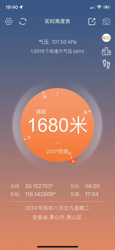
Mobile app interface of a real-time altimeter showing 1680 meters altitude with compass and GPS data
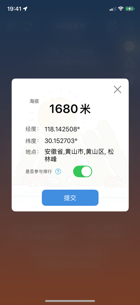
Mobile app interface showing 1680 meters altitude and GPS coordinates for outdoor hiking
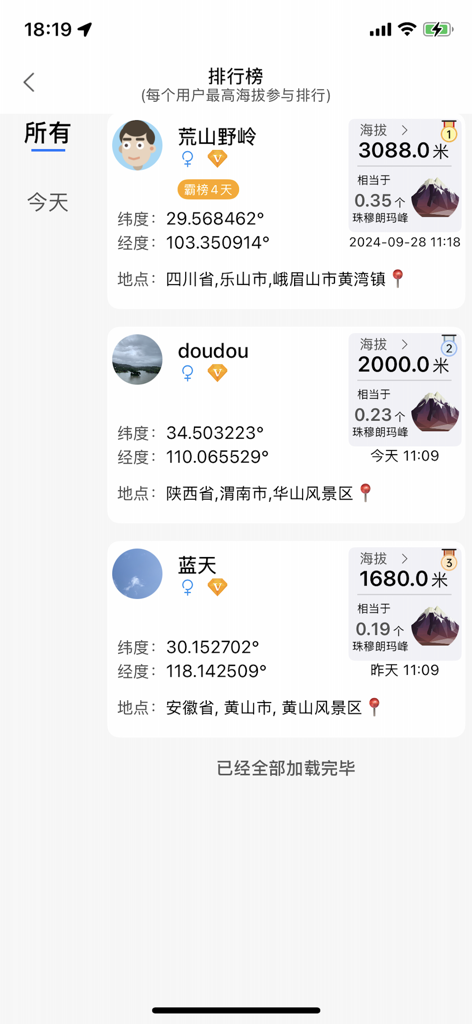
Leaderboard view of the Real-time Altimeter app ranking users by their highest recorded altitude with GPS coordinates and locations.
Mobile app screen showing GPS coordinates, barometric pressure, and altitude watermark styles for photos.
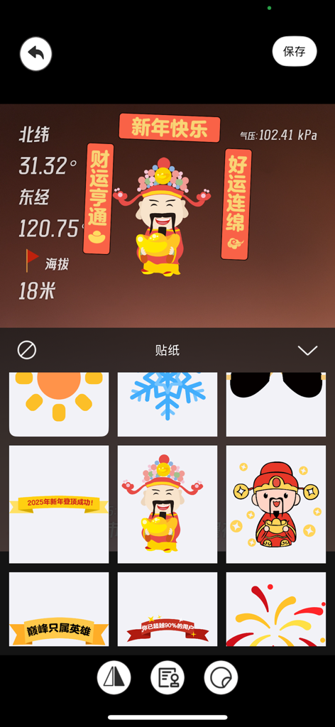
A mobile app interface showing altitude and GPS coordinates with a selection of festive stickers for photo watermarking.
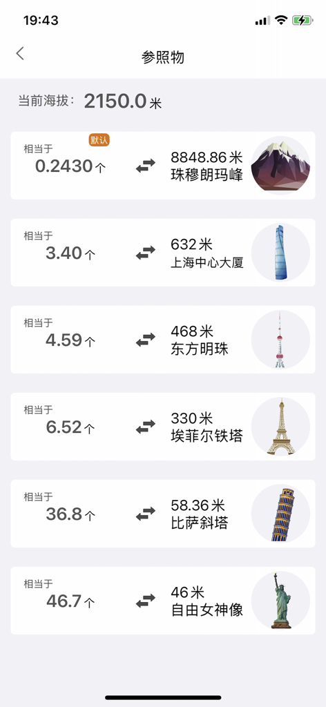
A mobile app interface comparing current altitude to heights of famous global landmarks.
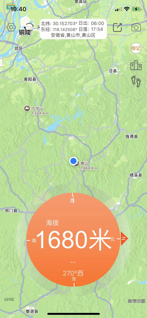
A mobile app interface showing a topographic map with a real-time altitude reading of 1680 meters and GPS coordinates.
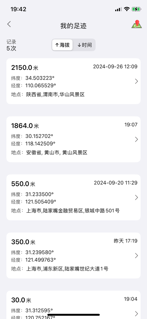
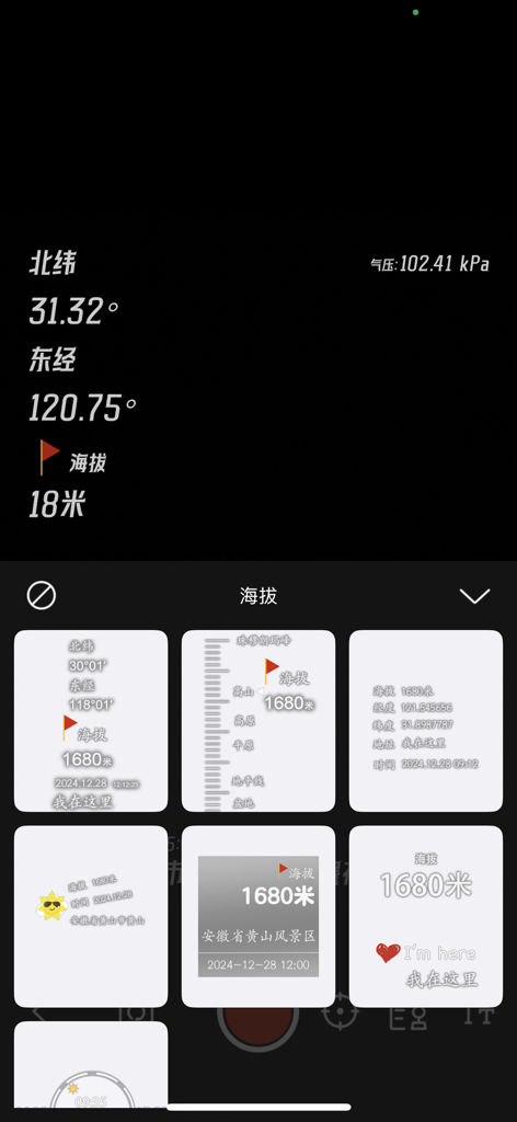
A mobile app interface displaying a list of recorded altitude measurements with GPS coordinates and timestamps.
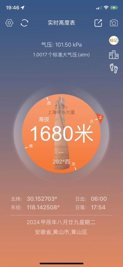
Main interface of the Real-time Altimeter app showing 1680 meters altitude, GPS coordinates, and compass orientation.
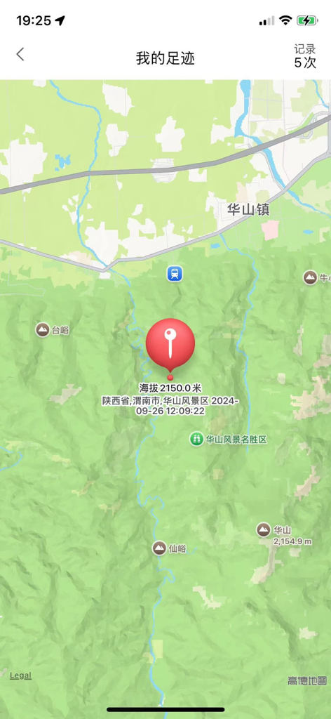
Map interface of the altimeter app showing a location pin with altitude data and tracking footprints
Description
Download
More Like This
Top-ranked apps in the same category

Uber - Request a ride
Uber Technologies, Inc.

Airbnb
Airbnb, Inc.

铁路12306
ACADEMY OF RAILWAY SCIENCES CO., ltd.

Booking.com: Hotels & Travel
Booking.com B.V.

Grab: Taxi Ride, Food Delivery
GRABTAXI HOLDINGS PTE. LTD.

Trip.com: Book Flights, Hotels
Trip.com Travel Singapore Pte. Ltd.

DiDi China: Ride Hailing
Didi Chuxing (Beijing) Network Platform Technology Co., Ltd

去哪儿旅行-订酒店机票火车票
Beijing Qunar Information Technology Company Limit

Bolt: Request a Ride
BOLT TECHNOLOGY OU
This page is not an official page of the app or its developer, but an independent editorial publication created for informational and commentary purposes. Unless expressly stated otherwise, neither the app nor its developer is affiliated with, endorsed by, sponsored by, authorized by, or otherwise officially connected with MWM, Apple, Google Play, the app publisher, or the app's developer, and nothing on this page implies that the app was developed using MWM's services. Any trademarks, logos, screenshots, and other content remain the property of their respective owners.